Tuesday, August 27, 2019

Joshua Tree National Park Night Sky (Arch Rock and Sky's the Limit), August 23-24, 2019

Weekend trip to Joshua Tree last weekend. I drove up on Friday afternoon, and managed to catch enough traffic to not get to the town of Joshua Tree until around 4:30pm. Because it was getting late, I popped into the NPS visitor center there, to confirm that my plan for getting to Arch Rock would work. I knew the White Tanks campground was closed for the season, but I wanted to make sure it was still okay to visit Arch Rock.

After some level of difficulty in conveying my question to the ranger (which, to be honest, seems to happen a lot when they assume you know less than you do), I got confirmation that access was allowed.
I went last year in early June. At the time, White Tanks campground was open. When that's the case, you park in the campground and walk not even 1/4 of a mile to the arch. As I went after "day" parking is allowed, I just parked on the main park road to the south entrance (Pinto Basin Road) and walked in from there. Maybe a 1/2 mile or so walk, each way.
But now I was told to park in the White Tanks backcountry board parking lot, and hike from there. As my Trails Illustrated map for Joshua Tree showed only the California Riding and Hiking trail passing this spot, and no trail from there to Arch Rock, I asked the ranger if there was an actual trail to the arch, or if it was a cross-country route. I swear, she looked at me like I was an idiot and said you had to cross the road. Well, okay, then. So off I went.

I figured, worst case scenario, I walked south on Pinto Basin Road, and enter via the gated (to cars) entry. Well, turns out at the trailhead at the south end of the parking area, there was a brand-spanking new sign for Arch Rock. Didn't give the mileage, but I knew it couldn't be far.
Interestingly enough, the map on the backcountry board did NOT show a trail going to Arch Rock, just as my Trails Illustrated map did not show that trail. But I followed the sign. In about 1/10 of a mile, it hit some wooden fencing and another sign, directing that Arch Rock was across the road.

Across the road was more wooden fencing and more brand-spanking new signs. One of these indicated .37 miles to Arch Rock Nature Trail.
So I made the short walk and confirmed that this would be no problem after dark. Took a few shots, spoke with a couple and their young child who were there (but no other cars were in the White Tank backcountry board lot, so obviously they parked elsewhere), scouted around for angles for later. Eventually decided, no, the same spot as last year was the best. Took a few pictures, before about three other hikers arrived.

Since I was really there for some Milky Way shots, I left when the others arrived, and walked back to my car. Once there, I ate a granola bar, drank some water and Gatorade, and took my evening medication. Still no cars in the lot, so, again, these other guys were also parking elsewhere.
Waited a bit longer, letting it get darker, then walked back to the arch. Still didn't need a headlamp to get back.
I had seen some flashlights in the distance, but obviously they continued further east, so I had the arch to myself. Took many pictures, again. Partly, that's because so many caught planes passing through the field of view, and that was even after waiting when visible planes were spotted.

The early shots were taken with just with the twilight sky providing the arch lighting, but also took some with a white light, bouncing it off the rocks behind me to get a softer light. I liked some of those, too. Took more pictures than I can recall.

I started walking towards the car somewhere around 9:30pm, but stopped to shoot some pictures with rocks or Joshua tree in the foreground. While I did this, I saw many lights and heard many voices coming from the ostensibly closed campground.

After taking another ten shots ore so, I resumed my walk.

Once back at my car, I ruined the dark adapted eyes of several people who appeared to be just waiting in the parking lot, possibly to photograph, or possibly to telescope. I intended to drive out on just my daytime running lights, but goofed. Of course, under these conditions, even the DRL are going to destroy your night vision, at least for a while.
On the way out, I stopped at the Joshua Tree National Park entry sign and took a number of pictures, there. The sign was illuminated by the distant lights of Twentynine Palms. No supplemental lights required or used. That's the picture at the top of this post.

The next day, I took a couple of hikes in the morning (to be blogged soon, I hope), then returned to my motel room. Home for Friday and Saturday nights was the Motel 6, in Twentynine Palms. About the third or fourth time I've stayed there. Very conveniently located if you're going to be at Arch Rock or Sky's the Limit, late at night.
Saturday night was, in fact, a Sky's the Limit night. They have public star parties there most Saturdays. And since 1) it had been a while since I had done any telescope work under a dark sky, and; 2) I was going to volunteer for the Night Sky Festival, in September, I figured it would be a good idea to try to get my bearings under a dark sky.

Set up my 150mm refractor and showed Jupiter, Saturn, M7 (Ptolemy's cluster), M57 (the Ring Nebula), the Double Cluster, M31 (Andromeda Galaxy), M17 (Swan Nebula), and M22 and M13 (globular clusters). Oh, and Albireo, briefly. But the truth is, with a trickling-in set of visitors, I went back to Jupiter and Saturn plenty of times.
Not bad seeing, although 6" is really too small for some of the objects I looked at. Still, it was fun to be under dark skies, again.

The star party started to wind down around 10pm, so I started putting stuff away shortly after that. One of the later ones. By the time I got my telescope back in the car, there were only a few people left, and they were regulars. So I snapped a few quick shots of the dome and sidewalk area, and called it a night.

Monday, August 19, 2019

Antelope Valley California Poppy Reserve and Saddleback Butte State Park, April 5, 2019

During the spring "superbloom," I made multiple trips into the desert. Two posts ago I wrote up my early March visit to Santa Rosa and San Jacinto Mountains National Monument, and the Living Desert Museum, both in or near Palm Desert. Also in early March, I visited Joshua Tree National Park. (In fact, given the dates, I'm thinking I may have one of them off a week in the posts, which is what happens when you wait too long to post!)
Then, in late March, I visited the Antelope Valley California Poppy State Reserve. On that trip, I was a little pre-peak. So I came back again a few weeks later. That's what I'm posting here.

I combined a quick return to the Poppy Reserve with a short trip to Saddleback Butte State Park. Saddleback Butte is always pretty empty, even during a superbloom. You don't get the same density as you do elsewhere, but the flowers can be nice and the variation in terrain is a nice change from the Antelope Valley California Poppy Reserve.

In contrast to the emptiness of Saddleback Butte, the Poppy Reserve was pretty zoo-like, even with a relatively early arrival. Of course, even then, once you get some distance from the visitor center, the lower-altitude trails that go around the rises are still somewhat empty. Also, I was more or less at peak, so the crowds could be mostly ignored, once I got away from the parking area.
Unfortunately, the areas closer to the parking lot literally get trampled. There seemed to be dozens of areas like this, where stupid people who can't just take a picture of nature but need to insert themselves right into the bloom, trampled areas along the trail for their selfie moments. The park placed little placards on the ground at these trample areas, telling people this was not a trail and to stay on the trail. Obviously, not entirely effective.
But, again, once you got further from the parking lot, the area opened up some, although there were still some trampled areas. Even worse is that you could see where previous years' trampling had occurred by the patches of flower-free zones adjacent to places with thick blooms. The damage from soil compaction in areas where people "selfie" lasts for years, even if you think you're only going where other people have already gone.
After my relatively short walk along the trails of the Poppy Reserve, I then drove east, to Saddleback Butte State Park. My last visit there had been back in January, for the total lunar eclipse.

Saddleback Butte was once known as Joshua Tree State Park, but people confused it with what was then Joshua Tree National Monument, which is not very near, geographically. The Joshua Tree here are also generally smaller than what you'll find in the park. But, especially in the northern portion of Saddleback Butte State Park, the Joshua tree are plentiful.
There are relatively few California Poppies in this park, but there is often in springtime, a good variety of other wildflowers. Fiddlenecks were common, and provided a nice foreground to the snow-capped San Gabriel Mountains, to the south and southeast. Mount Baldy himself is slightly east of south from here.
Shortly after having arrived, an F-18 flew quickly overhead. Edwards Air Force Base is not too far away, though I don't know if Saddleback Butte is on their regular route. I don't recall seeing such flyovers on previous visits, and I wasn't ready for that one. But I did switch my lens out and prepare for a later flyby, which I did catch. Not the best angle, but still, pretty close.

Fremont Pincushion were also scattered about, as were desert dandelion, desert marigold, desert daisy, dune primrose, and coreopsis.

Other than the Joshua tree forest, most (if not all) of these shots are from the trail from the campground towards Saddleback Butte, near the southern end of the park.

Didn't actually climb the butte, this time. Having already walked 4 miles or so in the Poppy Reserve, I was content to explore the dune and alluvial fan areas along the slope of the butte, and the nature trail up near the visitor center.
The visitor center was closed, alas. Looks pretty tiny, anyway, but I was hoping to get some information there, and I've never managed to visit when the visitor center was open. Still haven't!
My original ambition for this trip was to also visit the nearby Antelope Valley Indian Museum. It's also state run, and very close to Saddleback Butte. But, despite many trips to Saddleback Butte, I still have not managed the Indian museum.
And, here, again, I wasn't feeling enough motivation to want to squeeze in another park, so this will still need to wait for another day.


Wednesday, August 14, 2019

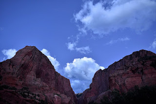
Nighttime in Kolob Canyons, July 26, 2019

On Friday, July 26, I started off on a quick weekend trip up to southern Utah. Unfortunately, I worked the previous several nights (and days, of course), so I had to pack that morning. Packing and getting on the road took longer than I had hoped. I was already catching Las Vegas-bound traffic. But it turned out to be even worse after I passed north of Las Vegas.
There's a long-term construction project going on in the Virgin River Gorge. Several bridges were undercut in downpours last year, so they have not been safe for full traffic loads. Until at least early 2020, traffic through the gorge will be limited to less than 10 feet in width (not a factor for me obviously) and a single lane along varying sections. The result is some serious delays in both directions on many days. Not sure if the suggested detour would actually save time, though I might consider it if the alternative were peak-time travel on I-15.
By the time I got to my motel room in Hurricane, Utah, my original plan of doing some afternoon hiking in Cedar Breaks was not practical. Might have been able to try something short in Zion's main canyon, but that would also have had very little light.
Besides, part of my original plan was to end the day of hiking with some night photography in Kolob Canyons. I kind of wanted to do THAT on the way up to Arches and Capitol Reef, back at the end of April. But on that trip, it was cold and probably cloudy, and I knew I could always return in the summer for the same shots, but at a more reasonable hour, and warmer temperatures.
Hey, look, there's my car. :D

The first few shots in this post were as twilight began. You can even see a few stars in those first few shots. It was somewhat cloudy, and I was far from sure I'd be able to get any shots that night But it wound up clearing, and I did have fun I also got bitten by various bugs, unfortunately. But, still, a good trip.
These were all from the parking lot at the hairpint turn, about halfway up the five mile drive in the Kolob Canyons section of Zion. There's an unpopularized cross-country route for a short hike up a canyon there. I'll have to try that some time, when I'm here in the daylight.

The next day, I visited Cedar Breaks for the wildflowers, then headed back down to Las Vegas. The southbound drive was faster than the northbound drive, but this was Saturday. I suspect the Sunday traffic is worse, both ways.

Monday, August 5, 2019

Around Palm Desert, March 3 2019

I keep saying it, but my cats are making blogging a whole lot harder. I should upload some pictures so you can see the culprits. Got a pair of toddler-cats. They were somewhere around 3-5 months old when we got them back in November. Of course, all cats like to walk on keyboards, and that makes blogging impossible But these guys were also in the "chew everything" mode, so I've lost several USB plugs to them. They just chew right through the wire. At least two were for my Fitbit. Three or so were USB-C type plug, which would let me connect my phone to my computer to directly download photos from there. My phone has the shots I shoot with it, but also some from my dslr, when I choose to use either Nikon's Wireless Mobile Utility (WMU) or Nikon's Snapbridge. It turns out some Nikon cameras use one, and some the other, and the things you can do with each app varies. That makes it harder to post about those hikes, too.
They've also chewed through the USB cords for my portable hard drives, and almost (but, thankfully, no quite) through the power cord that powers one of my tv streaming devices. BTW, this makes me think that "stick" streaming device inventors must own kittens that chew, a lot!

Also, for some reason, the computer at the car dealer I get my oil changed stopped letting me properly logging on to my blogspot account. Anyway, many stupid barriers, and that's before personal time constraints get in the way.
At any rate, I started blogging this back in June, but, even then, the hike was old: From back in early March, even before the desert superbloom ran its course. I took advantage of the first full weekend of the month to visit The Living Desert Museum/Zoo, in Palm Desert. They have a non-summer trail that loops near Eisenhower Peak, a 1952 foot tall (get it?) mountain, adjacent to the developed zoo area. It's about a five mile hike, which I have done only twice.
I also hiked the 2.5 mile Randall Henderson loop trail, a the visitor center for Santa Rosa and San Jacinto Mountains National Monument. At this point, I have no good recollection of which shots were where, except that the chuckwalla was definitely on the Eisenhower trail. The notch-leafed phacelia was also on that trail.

I had hiked this trail before, and wrote it up, here. I would have wagered I'd hiked it more than once before but only one turns up in a quick google search.
It's an enjoyable hike, to be sure. Nice views. This time, however, the trail to examine the San Andreas Fault was closed, due to water damage from heavy rains the previous month.
Meanwhile, it was my first visit to Santa Rosa and San Jacinto Mountains National Monument. The trail they put me on had a fair number of wildflowers, but it was not superbloom-status. Pretty, but not outstanding. Still, it was a change of pace, for me. New trail, never walked, before. The variety of plants was different than what I had seen before. Glad I went, but not likely to take this trail, again.

During this time, there were some serious blooms down along I-10, but I did not know public trails in that area. Other areas suggested they were being overrun so I didn't go there. So I didn't manage the most complete sampling of this year's superbloom. Not nearly as much hiking as I had hoped for, either. Still trying to get back in my hiking groove, even as I type this.