If you think you're going to need a vacation to recover from your vacation, I've got just the ticket: Next weekend (Saturday, June 5 and Sunday, June 6) is a fee-free weekend in the National Park Service lands. It's not quite as nice as last month's National Park Week, but it's still a chance to save a small amount of money on a trip to one of our local national parks. For example, if I head out to Joshua Tree on Saturday, it'll save me $15, which would cover just over 5 gallons of gasoline. If I stick with just the northern end of the park, that'll pay for about 1/2 of the fuel costs for my trip.
Head to Death Valley, Sequoia/Kings Canyon, Yosemite, or the Grand Canyon and the fee-free weekend will save you $20. Not a huge incentive to visit your national parks, but it's a good a deal as you can get!
Sunday, May 30, 2010
Saturday, May 29, 2010
Hike 64: Inspiration Point
 Hiked Friday, May 28. Four days since my last hike, which makes this one of my longer layoffs so far this the year. I kept having little midday tasks or thinking I had little midday tasks that made getting away for a hike difficult. And I knew I wouldn't be able to hike on Saturday, so even though I had a noonish dentist appointment, I decided to try to fit in a hike to Inspiration Point.
Didn't get to the trailhead (Altadena, top of Lake Avenue, at Alta Loma) until about 2:30pm. Fortunately, the days are long and the hike is short enough that I figured I had plenty of time even with the late start.
My last time up this trail was way back on January 17, as Hike #9 for the year. I don't think I ever wrote it up.
One of the nice things about this hike is that the end sort of sneaks up on you. The pavilions are hidden most of the way, until you round a bend maybe 1/3 of a mile from the destination. Then you're happily confronted with the sight you see in the picture at the top of this post. That gives you a nice kick of adrenaline to finish the last little climb.
 When you get up to the pavilion, you'll see these sight tubes, pointing out various things that, when it's clear, you can see from Inspiration Point. I get a kick out of the one for Inspiration Point. :D
Big changes since January. My January hike was in cool weather. It was overcast and drizzled a bit on my way down. Because of the clouds, I didn't have much of a view. But I could see enough on the otherside to see that the Station Fire had left a large part of the watershed behind Inspiration Point as a wasteland.
 Now, at the end of May, there are plenty of signs of life. The trees and larger bushes are still dead, but there are some grasses and smaller bushes that have grown in, softening the appearance of the area north of Inspiration Point. This view is to the northwest.
 Meanwhile, the shot below looks to northeast, towards Mount Wilson.
It was also clearer. Despite the haze, Santa Catalina Island was easy in the distance, rising above Palos Verdes. Downtown was also brighter, because the evening sun in the summer is north of the civic center. Rather than being visible only in silhouette, downtown appears brighter (but still distant).
 Something else I didn't notice last time was that the circular foundation of Echo Mountain's water tank is also easy from near the top.
Similarly, when it's clear, you can see part of the pavilion from down near Echo Mountain.
Meanwhile, the flowers in bloom had changed somewhat. Sage, which has been blooming for several months, is still in heavy bloom. Mustard, too. Photos of some of the other flowers I saw are at the end of this post.
 On the return trip, I diverted about 1/10th of a mile to see the remains of the "White City" on Echo Mountain. I've hiked here a number of times, but it's still a nice diversion. Surprisingly (to me), even though I got back there sometime around 6pm, I had the place pretty much to myself. So I took a few shots of the rail platform and stairs leading up to the hotel. Then I headed down the last 2.5 miles or so to Lake Avenue.
On the way down, I passed probably 20 people heading up. That's still fewer than I expected on a nice evening like Friday.
The signpost at Inspiration Point say it's 4.7 miles to Lake Avenue. Adding the short diversion to Echo Mountain on the way down, I figure that makes it at least 9.5 miles roundtrip.
Some wildflowers I spotted along the way:
 Unknown purple flowers, which I saw on the lower part of the trail, where there was an exposed drainage running into the Sam Merrill, and near the top, with similar conditions.
 The pictures below include (in order): Globe Gilia, larkspur, miniature lupine (with overexposed dime for perspective), purple clarkia, and yellow monkey flower.


Tuesday, May 25, 2010
Hike 63: Hacienda Hills
 I've been looking over the access and trail maps for the Puente Hills Landfill Native Habitat Preservation Authority the last few weeks, checking to see if there are any more trails I haven't been on, yet. Near as I could figure, the "Puma trail" out of the Seventh Avenue access point is the last major segment I hadn't been on, yet. So, on this day (Monday, May 24), when I knew I had limited time, and with the weather relatively cool, I finally did it.
To get to the trailhead, I took the Pomona Freeway (CA-60) to Seventh Avenue, then went south until I reached the small parking lot for the hiking trail, just south of Orange Grove. My route went up the Ahwingna trail for .8 mile, then on the Native Oak trail for 1 mile, then left at the Puma Trail. From there, it was on to the Schabarum Trail for .5 miles south, then north/east from the top of the Ahwingna trail. To add a little more distance to my hike, I then went back up the Native Oak trail for just about a mile, then took then turned northeast for about .3 miles, to the west end of Orange Grove Avenue. I walked back to my car along Orange Grove. Total mileage was a bit over 5 miles.
As I've mentioned before, this is not an especially scenic route, but it is nice, and it is a place to get away from the pavement in a relatively short period of time. If I lived on the other side of the 605, I'd probably hike out here more often.
 Despite the coolish weather, reptiles were still active. Shortly after I started up the Native Oak trail, I came across a snake, laying across nearly the entire trail. Given the relatively narrow head of this snake, and the relative narrowness of its body for the length, I'd wager this was a gopher snake.
 Not much further up the trail, I came across a good-sized (6-8 inches) lizard. [edit--a check on line allowed me to identify him as a coast whiptail. He looked similar to, but much smaller and darker than, a similar lizard I saw at the base of Bailey Canyon, ten days earlier].
 Flowers are still blooming on this trail, although the thistle has largely gone from purple spiny to puffy and white. The false daisy were common, as were the mustard. [edit--I just got this CD called "Plants of the San Gabriel Mountains: Foothills and Canyons." What I thought was a false daisy, they have photographs of the same plant listed as "cliff aster." So I learned something new already!]
 After finishing the circuit described above, I headed down towards Orange Grove Avenue. I passed the remains of an old oil well, as well as several water tanks.
 At the bottom of the hill, sprinklers worked to keep the urban interface green and fire resistant. Beavertail were in full bloom.
Given the coolish temperatures forecast for the next few days, it's possible I'll make one more hike in the area before returning to the San Gabriel Mountains.
Sunday, May 23, 2010
Hike 62: Big Dalton Canyon
 Hiked Saturday, May 22. ~5 miles.
This was my third trip into Big Dalton Canyon. Last time, I stopped at Glendora City Hall on the return drive and picked up the "official" map of city trails in the Glendora Wilderness Park, so I could get a better handle of the trails here. However, I knew the trail map was going to be an iffy proposition. More on that, later.
 I reached Big Dalton Canyon by taking the 210 freeway, exiting at Grand Ave, and heading north to Sierra Madre Road. A right turn at Sierra Madre Road, then another three miles or so east to Glendora Mountain Road (passing Glendora Road along the way). I made a left on Glendora Mountain Road and drove about 1/4 mile north to Big Dalton Road. I drove this nice, winding road to near the gate that marks the end of public access roadway in the canyon.
I still wanted to take Glendora Wilderness Trail, but I still don't know if the trail actually exists (it is marked as "Under Construction" in the city map). According to this map, I should be able to take the Pavil Canyon Trail (marked "easy" in the map) no more than .3 mile up canyon to a junction with the Glendora Wilderness trail.
 However, as with last time, I reached a 6-8 foot, steep rock barrier. If I really wanted to, yes, I could have scrambled up and around the barrier. But this did not seem possible to be part of an "easy" trail, and there was no signed junction with Glendora Wilderness trail reached, so I turned around.
 When I got back to the junction with the Keiser Trail, I turned left. This is marked as "Easy-Moderate" on the map, and .5 miles in length. However, I never saw where this trail should have ended. Indeed, even the lower portions of this trail were extremely overgrown. Blooming mustard, with bees buzzing all around, made pushing through those sections very unnerving. Other portions were overgrown with seasonal grasses, and those seed stickers were uncomfortable.
 The trail I followed climbed up a side canyon, then followed a contour above Big Dalton Canyon to the southwest, in the direction the water flows down the canyon. I determined that at some point (with no sign indicating this), I must have gotten on to the Coulter Pine Trail. After what seemed like well over 1/2 mile, I reached a fork in the trail. The lower fork was probably a connection to the Dunn Canyon Trail, although there was no sign indicating this. The slightly better-defined trail continued along the contour downstream, above Big Dalton Canyon. After another 1/2 to 3/4 of a mile, the trail turned from heading southwest to heading northwest. At the same time, the trail was also recently maintained: nice, wide, and weed-free. It had the appearance of recently being weed-wacked, which was a nice change of pace from the overgrown feeling of earlier in this trail.
 Eventually, I popped out in a small grove of Coulter Pines, which finally made clear to me why this trail was called the Coulter Pine Trail (There weren't any other pines passed along the way).
The map described this trail as "moderate-strenuous," and 1.4 miles in length. There definitely were some areas with a fair climb, but the thing that really made this trail strenuous was the overgrown nature of the trail.
From here, I walked down canyon, looking to pick up the Big Dalton Canyon Trail. I crossed a footbridge and caught the Big Dalton, heading down-canyon, again. Where it hits the Upper and Lower Mystic Canyon trailheads, I turned back to the road and crossed over to the Wren Meacham Trail. The map says it's 1 mile in length.
The Wren-Meacham trail started out easily enough, but I soon discovered why it had the "strenuous" designation. While I initially assumed it would simply parallel the drainage and run along the debris basin, in fact, the Wren-Meacham soon heads STEEPLY up the south face of Big Dalton Canyon. I find it very hard to believe that either mountain bikers or equestrians can safely descend the top end of this trail. Also, it, like portions of the Keiser/Coulter Pine trail, was extremely overgrown.
 It wasn't very pleasant to hike, either. Again, there were areas where blooming mustards buzzed with bee activity, but I still had to push aside the plants to proceed. Thistle kept scratching my legs, and I again had to stop repeatedly to try to remove those grass seed stickers from my socks. I really hated this trail. I think the LAPD folks would call it a "Baker Sam Trail." I think the NATO folks would call it a "Bravo-Sierra Trail." It was just miserable. Probably long, sticker-proof pants would have helped, but I still think it's crazy to list a trail on a map and then allow it to become so overgrown.
Wren-Meacham ends in an equestrian center. The map told me I had just gone one mile from the start of this trail, although it sure felt like more. Walking around the equestrian center and eventually getting back to Glendora Mountain Road (GMR), I did not see where the Glendora Mountain Road Trail is. It does not seem to be immediately adjacent to the road. It may be that at some point it crosses GMR, then heads up behind the fire facilities I saw to the west of GMR.
In any event, I decided to walk along the shoulder of GMR, and soon came to the trail head sign for "Poop-Out Trail." Initially, I thought "Poop-Out Trail" meant this is the bail-out route you took if you started up Upper Mystic Canyon trail, but were too tired to continue.
 Nope. "Poop-Out" means this trail will absolutely kick your fanny. Although it's only 3/4 of a mile in length, it is even steeper than the Wren-Meacham trail. Some of the earlier portions feel like you're heading up 30 or 40 degree inclines. Fortunately, the ground mostly has good traction, and the "trail" is plenty wide. So, despite the incline (which I am NOT exaggerating!), it was a lot more fun than either the Wren-Meacham or overgrown portions of the Keiser/Coulter Pine trails.
 It was also relatively scenic, with thick blooms of bush sunflower, penstamon, cliff aster, and many other flowers.
Poop-Out trail ends when it intersects with Lower Monroe Motorway, a wide dirt road that continues on into the San Gabriel Mountains. I took about two miles of this road on an earlier hike. See hike 13, here.
Today, I turned right around and took the Upper Mystic Canyon trail back into Big Dalton Canyon. The Upper Mystic Canyon trail intersects Lower Monroe Motorway just feet away from where the Poop-Out trail reached the Motorway.
The map lists Upper Mystic as strenuous and 1.0 miles in length. It may also be strenuous, but it's far easier than Wren-Meacham, that's for sure.
 At the bottom, I was back on the Big Dalton Canyon trail, which I then took upstream, as far as it was defined. It's supposed to be 1 mile and easy. So, as with the Pavil Canyon trail, when it stopped being "easy," I turned around. Just before the "end," there were some nice sections of old oaks, which cut an impressive silhouette against the sky.
Given the mileages for the trail segments I know I walked (Pavil Canyon: .6 miles RT; Keiser: .5, although I did not walk all of it; Coulter Pine: 1.4 miles; Wren-Meacham: 1.0 miles; Poop-Out: .7 miles; Big Dalton: 1.0 miles), and that I doubled back on portions of the Big Dalton Canyon trail, and had to walk bits to get between the Coulter Pine and the Big Dalton Trail (very little) and the Wren-Meacham and Poop-Out (more--probably .4 or .5 miles), I'm estimating 5.5 miles total.
The horrible conditions of portions of the Keiser, Coulter Pine and Wren-Meacham trails slowed me down a great deal. But, despite all that, I still enjoyed my half-day of hiking.
Overall, the Glendora Parks map I picked up was only marginally useful. It provides an overview, but does not indicate altitudes. The ratings of "easy," "moderate," and "strenuous" aren't very helpful, and I have my doubts about the mileage indicated for the trails, and whether some of the trails even exist. Still, a bad day of hiking beats a good day of work, at least most of the time.
Other sights from the hike, in order, below:
1. A little cluster of blue flowers with the unfortunate name of "blue dicks."
2. Something that looks like monkey flowers, but are red instead of yellow/orange.
3. Cliff aster, with bee, buzzing around and getting ready to land.
[I've got many other pictures of the same flower, which I thought was a false daisy. However this new CD I just got, "Plants of the San Gabriel Mountains: Foothills and Canyons," identifies it as a cliff aster.]
4. Crop of the previous picture, zeroing in on the bee.
5. A red flower hummingbirds seem to enjoy.


Friday, May 21, 2010
Hike 10: Camp Hollywoodland to Mt Lee
 I hiked this back in January, but never did a writeup. However, I saw that Modern Hiker wrote this up recently, so that finally got me off the dime to write it up myself. Actually, it made it easier, because now I can just link to his post and stick in some of my own pictures!
The trailhead is at the top of Canyon Drive, which is a bit west of Vermont. I had a heck of a time finding Canyon and wound up driving by it several times. Once you do find it, you just drive as far as you can, then find someplace to park. If it's not too crowded, you can get relatively close to the gate. Otherwise, it's a bit of a walk.
 Bronson Caves ("The Batcave") is accessible via a short detour--rather than heading "up canyon," in the direction of the road you just drove in on, cross the small bridge across a stream (it was a stream in January--it may be dry in the summer), pass through the gate that blocks this road, and walk about 1/4 mile until you see a large clearing on your left. The caves (actually, tunnels) are on the right side of this opening. If you pass through the tunnel (or walk around the mountain into which the tunnels were blasted), you can get a pretty good view of the Hollywood sign from here. Modern Hiker suggests being on the lookout for snakes in the cave. When I went, in January, you had to beware of the water that almost covered the tunnel floor.
 The hike to the Hollywood sign is mostly along a dirt road. The description I had sent me off the road, but if I were to do it again, I'd just stay on the road. My way was probably longer and definitely slower than sticking on the road.
As is described on the linked post, this is a crowded hike. But nobody walks to the Hollywood sign with the hope of being alone. Nonetheless, there were times when you could be alone with your thoughts.
 It's been so long, I don't remember if I had to take a detour to get the best views of the front of the sign. It's possible I had to walk past where you would turn up the paved hill and continued along the dirt road to get a view of the front of the sign.
 Meanwhile, the trail to the top does loop around the back of Mt. Lee. On the last stretch, you've got a pretty good view of Burbank, Glendale, and Forest Lawn Cemetery.
 From the top, you're looking at the sign from the back. Hollywood Reservoir is to your right. The Griffith Observatory is to your left. Beyond Griffith Observatory is Downtown L.A. Of course, the odds are pretty good that the haze will make Downtown a little tough to see (top picture in this post).
Modern Hiker gives a distance of about 6.5 miles roundtrip. Sounds about right. He also notes that there's not a lot of shade on this hike. Right, again. In the winter time, you're shaded on the final stretch up the paved road because it's on the north side of Mt. Lee. And if you're out early or late, the hills will shade parts of your hike. Otherwise, you're pretty exposed the whole way. On the bright side, it's a relatively level walk, except for the last bit, up the paved road to near the summit.
Hike 61: Timber Mountain
 Hiked Thursday, May 20. Timber Mountain is the shortest "high peak" out of Icehouse Canyon. From the 210 Freeway, take the Baseline Exit, head west, then make a quick right on to Padua. North a few miles and you hit Mt. Baldy Road. Follow Mt. Baldy Road north, through the town of Mt. Baldy. The Icehouse Canyon trailhead is difficult to miss. In fact, the road going up Mt. Baldy is such that you're more likely to turn accidentally right into the Icehouse Canyon trailhead than you are to miss it.
There's a large parking lot and pit toilets at the trailhead, but I did not see any running water. Leashed dogs are allowed on the trail. A wilderness permit is required (free, from the visitor's center in Mt. Baldy Village).
Because of my late start that day, I did not hit the trial until almost noon. As a result, most hikers were ahead of me, and I would estimate I passed 20-30 people heading down as I headed up. Many were in groups of 4-6 and were "mature." On the return trip, I passed about ten people heading up, nearly all during the last mile or so. On a weekday! So I'm sure the lot fills up on weekends.
The trailhead is at 4,900 feet, and the whole trip is uphill. I took it very slowly on the way up, because past experience tells me that, at altitude, if I let my heart rate get too high, I'll get a headache. As a result, it took me about three hours to get to Timber Mountain. The return took about 2 hours of walking time.
The first mile of walking is along a roaring stream. Because of the steepness of the terrain, the water is rushing quickly down. However, there are some larger pools that look like pretty good trout habitat. Didn't see anyone fishing, however. I don't know if this means fishermen know about this area and know there aren't any fish here, or if fishermen don't know about this area and so there are lots of fish here. :D
 Like many other river bottoms in the San Gabriel Mountains, there are both occupied cabins and unoccupied ruins that used to be cabins along the lower stretch of the trail.
 There are also tall piles of rocks that have fallen from the cliffs around you.
After one mile, there's a fork in the trail. The Chapman Trail peals off steeply to the left, while the main Icehouse Canyon trail continues straight ahead. By the way, there are metal stakes pounded in the ground every mile, so you know when you've walked one mile, two miles, or three miles. Curiously, there's also one stake with a "5" on it, between Icehouse Saddle and the 3 mile stake. I don't know where it's measuring from.
 Just before mile 2, you pass a sign welcoming you to the Cucamonga Wilderness Area. Shortly thereafter is the "2" stake. And shortly after that, on the opposite side of the canyon, is an impressive (in late spring) cascade, dropping through several steps on the way down to the canyon floor.
About 3/4 of a mile later, the Chapman trail rejoins the Icehouse Canyon trail. Six-tenths of a mile later, you reach Icehouse Saddle.
There are three choices at this saddle. One trail heads south, then southwest, to Kelly's Camp (1 mile) then on to Ontario Peak (8,693 ft, 2.5 miles). There's also a variation that heads from Kelly's Camp to Bighorn Peak (8,441). Another trail heads east, then south, to Cucamonga Peak (8,859, 2.3 miles). Because both of these trails run along the north end of the respective peaks, there's snow and ice between Icehouse Saddle and those destinations. I'm pretty sure that's Bighorn Peak on the left of this shot, with Ontario Peak behind it and to the right.
I took the third trail choice, which heads mostly north. After .7 miles, there's a spur that heads .2 miles east, to Timber Mountain (8,303). If you ignore the spur, you'd have another 2 miles to Telegraph Peak (8,985), and another 1.2 miles beyond that to Thunder Mountain (8,587).
Because of their higher altitude, I decided Timber Mountain would be the destination today.
 In this shot, taken from the trail heading towards Timber Mountain, I'm looking back to the south. I'm pretty sure Bighorn Peak is the rounded, snow-covered mountain to the left, while the mountain behind Bighorn and a little to the right is Ontario Peak.
The top of Timber Peak is a rounded summit, with plenty of trees. There's a wooden sign that looks like someone wrote "Timber" on with a crayon.
 Behind that sign is a metal stake driven into the heart of a large tree. This stake has "Chapman MT" written on the top, and contains several small notebooks that are the summit registry. (Timber Mountain used to be known as Chapman Mountain).
 On my return trip, I headed a bit north on the trail to Telegraph Peak. It looks like those two miles would be pretty tough, because, although the trail more or less follows the ridge, you still yield about 400 feet from Timber Mountain to the low point on the ridge. Then you need to gain about 1,100 feet to get back up to the taller Telegraph Peak.
I also explored around Icehouse Saddle a bit. As of yesterday, the path for the trail to Kelly's was not obvious. There's enough ice and snow on the ground that few people are hiking there, so the trail is not yet well-defined. I expect in a few weeks, that will change.
 By the time I made my way back to near the trailhead, the sunlight was getting softer. I saw some nice backlit scenes along the way, although not all of them photgraphed as I perceived them.
 The building clouds mixed with the lighting to give some interesting effects.
Tuesday, May 18, 2010
Hike 60: Powder Canyon trailhead
 Hiked Tuesday, May 18. 6.5 miles.
Today's hike was from the Powder Canyon trailhead in the Puente Hills Landfill Native Habitat Preservation Authority (PHLNHPA) land near Schabarum Park in La Habra Heights. To get to the trailhead, I took the Pomona Freeway (CA-60) to the Fullerton Road exit, took Fullerton Road south about 3 miles (approximate). Just after the signal at Pathfinder Road (where the Schabarum trail extension crosses Fullerton Road), you need to make a right turn at the next corner to stay on Fullerton Road (if you go straight, the road turns into Harbor).
You pass the familiar green trailhead sign adjacent to Fullerton Road within 1/4 mile of turning. That trailhead (Black Walnut trail) has limited street-adjacent parking. However, if you go on another 1/10th of a mile, there's a dirt road on your right, again adorned by the a Native Habitat Preservation Authority trailhead sign. Turn right on the dirt road and follow it about 1/4 mile to a relatively large parking area. There's an oval equestrian warm-up ring right near the parking area, as well as a portapotty and a wooden sign with a map of the area.
Printing out a copy of the map is a good idea, because, with the exception of some areas of the Schabarum trail, trail junctions are mostly unsigned. Maps for all of the PHLNHPA are available at this address: http://www.habitatauthority.org/trailaccess.shtml
If you have the map, you can trace my route by following this trail route summary: I took the Powder Canyon trail west, turned left on to the Purple Sage trail to the end, came back on the Schabarum trail, skirted Schabarum Park, walked past the Schabarum Park equestrian area, headed south back down Powder Canyon, then hung a sharp left to return via the Black Walnut trail. I connected back to the Powder Canyon trail using the Nogales trail. Mileage on the PHLNHPA for this route would be 6.24 miles. However, I made two wrong turns along the way, so my total distance covered was approxmiately 6.5 miles for the day.
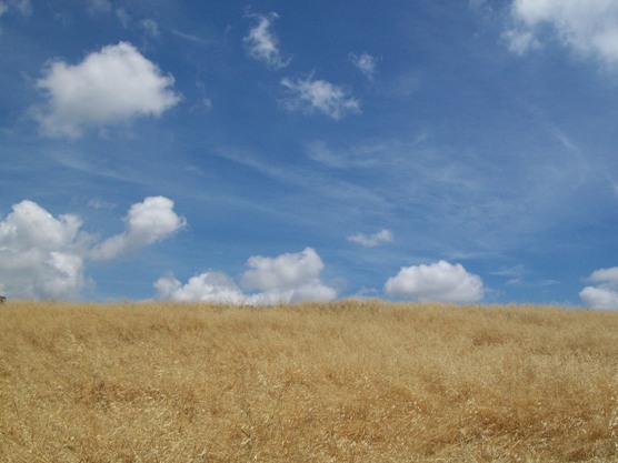 The seasonal grasses have aleady dried out, as illustrated by this picture from the hills to the east of Schabarum Park. However, many seasonal bushes and herbs are still in bloom. I came across several new-to-me flowers in bloom that I will need to identify.
 I think these five-petaled, purple and white flowers were my first new species of the day. They were growing in Powder Canyon, right near the start of the trail.
 Not much further along were a large number of these plants, with tall stalks peppered with yellow flowers.
 Other plants I have seen before, even if I don't know all of their names. One I did recognize was the devil's trumpet, which I had seen on my hike in Arroyo San Miguel. Shortly after passing the plants above, the Powder Canyon trail goes under a canopy of black walnut and oak trees. That's the picture at the top of this post.
Not long after going under the trees, the trail begins to climb. I passed the unsigned junction for the Black Walnut trail (on the right), then another unsigned junction for a short dirt road that goes (also to the right) to the base of an electrical transmission tower on a hill. Next came the unsigned junction for the Purple Sage trail, which required a sharp left turn. After I came around a bend, I could see a water tank, which confirmed I was on the right track (because the trail map showed a water tank near the trail).
 Right after I saw the water tower, I also saw a couple of large purple sage bushes, which further confirmed I was on the right track.
After passing the water tank, the trail continues to the west.
 Fields of yellow mustard grew on either side of the road as I approached a cluster of radio antennas on a hilltop. I consulted the map several times at this spot, to be sure I stayed on the correct side of the hill as I passed the hill both as I went west, on the Purple Sage trail, and again when I came back east along the Schabarum trail.
 Monkey flower grew thick in several spots, but especially as I made it past the towers a second time, along the Schabarum trail.
 I also passed a mixture of purple "flag" flowers and a yellow globe flower of unknown species. The purple flowers have been blooming in the Puente Hills for several months. The yellow flowers (arranged in a globe at the top of a small plant) were new to me.
Other sites I passed along the way:
 Another field of mustard.
 A skinny little garter snake. I've seen several the past few weeks, but they are usually just a striped blur as they cross the trail and disappear into the grass. This guy was all stretched out straight on the trail, and appeared to have some difficulty gaining traction to get out of my path, so I was able to get a few pictures of him. Probably about 18 inches long, but only about 1 inch in diameter when he was stretched out, far skinnier than the rattlers I have seen.
 I've seen these guys before, too. They may be some sort of datura, but I'm not sure.
After today, I have walked nearly all of the official trails in the Puente Hills Landfill Native Habitat Preservation Authority. There are only a few trails from the Hacienda trailhead I need to cover. The next time there's a cool day, I'll probably do them. On warmer days, I think I've waited long enough that I should be able to do most of the trails in the Mt. Baldy area, although actually reaching the summits may still be a few weeks off.