Anyone sitting around tonight trying to think of what to do on Saturday? Anyone sitting around tonight thinking, "I want to eat a burrito on Saturday"? If so, I have a deal for you. OK, *I* don't have a deal for you; Chipotle Mexican Grill has a deal for you: Half off on a pack of six or more burritos, and you get a free day pass to a California State Park. I kid you not.
So, go on: Eat. Then hike. Not necessarily on the same day!
Burrito offer is good only on Saturday, June 30. The day pass can presumably be used at your leisure.
Thursday, June 28, 2012
Tuesday, June 26, 2012
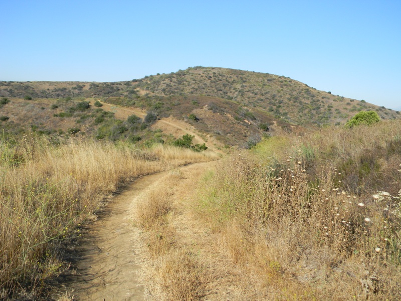
Hike 2012.038 -- Cahuenga Peak, Griffith Park


[My initial guess was going to be a "Sister Cities" event, but Los Angeles doesn't have a sister city in Australia or Columbia, so unless someone messed up with the flags, it was something else.]

Looking to the west, I could see a solitary tree, silhouetted against the glare of the eastern horizon. I later learned this tree marked the summit of Burbank Peak. It seems like more of a shoulder than a peak, but I don't get to name things.

As I made the final push, coming from the northeast, I passed a bloom of monkeyflower.
Then I was there.
Great views back to Mt Lee, with Mt Hollywood and Griffith Observatory beyond. Hazy Burbank and Glendale to the north. Hazier North Hollywood to the west. Universal Studios was down there. No view of the ocean today, either. As with my last few hikes in Griffith Park, visibility was poor.
What I could still see was the lone tree, which I eventually decided to visit.
It's a quick 3/4 mile, with a fair descent in altitude to the tree.
An old ammunition case was labeled "Tree Mail," and there were several notebooks inside. All the entries were from the last few days, however, so I figured there was no point in leaving a message.
Took some more pictures, then returned the way I came.
No real idea on the total mileage for the day. I'll call it 6 miles, though it could be more.
Saturday, June 23, 2012
Hike 2012.037 -- Crags Road Trail, Malibu Creek State Park
 Hiked Tuesday, June 19. With business again taking me to Van Nuys, I elected to return to Malibu Creek State Park. I also decided to use one of my day passes from the California State Parks Foundation to enter the park-proper, with the intent of getting park map. I'm not sure if they have a free version of the map, but I wound up buying a trail map for two dollars.
I then pulled into the first lot on the left.
 To get to the park, I took U.S. 101 (Ventura Freeway) west, about 19 miles past I-405 (the San Diego Freeway), to Las Virgenes Road. As last time, I exited there and headed south about three miles. However, this time, rather than turning at Mulholland Highway, I continued straight for a short distance, and turned right, into the park.
 Once there, with my map, I studied the trails. I saw several good candidates that were actually outside the park. But I didn't want to hike from there after having used a park pass, so I decided to just hike Crags Road.
 From the lot I was in, a trail from the southwest side of the lot heads south, past the second lot which, had I known better, I should have parked in. That lot is just before a sign that says, "Overnight Campers, Only." This added between 2/10ths and 1/4 of a mile to my roundtrip distance.
The actual "backcountry" trail leaves from the southwest corner of this lower lot. (Dogs are not permitted in "backcountry" trails). It's a somewhat steep incline towards a concrete section where Crags Road crosses Las Virgenes Creek. A number of kids swam in the pool of water just below this concrete section.
 From there, it's 2/10ths of a mile to where the Grasslands Trail intersects with Crags Road, and another 1/10th of a mile to where the High and Low Roads split. I've never actually taken the low road, though perhaps next time, I will. Instead, I've taken the High Road, which stays above the north bank of Malibu Creek as it arcs around the visitor's center. Meadows, trees, and crags are laid out before you, across the river. Very scenic.
 Meanwhile, to your right are more rolling hills and big 'ole trees scatter among them. After another 1/2 mile, the High Road rejoins Crags. Then the road climbs the steepest section of road between here and there. Near the top, a small trail leads off to the left, as a "backdoor" to Century Lake. You can also reach Century Lake by proceeding another 1/10th of a mile, and following the sign on a hairpin turn back towards where you came.
 It's a very scenic pond, which I visited on my return leg. Instead, I continued forward, wanting to get to see Malibou Lake. Unfortunately, I made the mistake of thinking that Crags Road would take me to a nice viewpoint. In reality, the road to the dam ends in a fenced deadend, and the other section that leaves the park turns to pavement and residences 1/2 mile before you reach the lake.
 In retrospect, I should either have driven to the road or taken the Cage Creek trail north to the Lookout Trail, then turned left and headed towards the Reagan Ranch. That's a likely future hike.
Instead, on this day, I first took the 3/10ths of a mile spur to Malibou Dam, then having returned to Crags Road, took that the 3/10ths of a mile to the park's gate, then turned around.
 Shortly after turning around, I ran into a couple walking the other way, asking about "the lake." I assumed they meant Malibou Lake, and told them what I ran into, and where I figured they would have to go to reach the lake.
However, about an hour later, as I approached Century Lake, it occurred to me that maybe they were really looking for Century, and had simply missed it and walked WAY past where they should have gone.
 Along my return trip, I passed Bulldog Motorway and Lost Cabin Trail, but took neither. I also passed the M*A*S*H site again. But having just been there three days previously, I did not pause.
I also passed the Cage Creek and Cistern Trails, as well as the Low Road. Many more alternatives, for future consideration.
As noted earlier, I did stop briefly at Century Lake. By then, the sun was down. But it looked very peaceful. No doubt it would look less peaceful if it was filled with folks trying to escape the heat with a swim. I guess, in that respect, coming late was a good idea.
 For the day, I walked 7.5 miles, with only a couple of short inclines along the way. These are generally child-friendly hikes, if the kids are so inclined. But it does get hot, so you don't want to go without enough to drink, and you don't want to necessarily go the whole distance with younger kids, particularly given that there aren't any restrooms once you pass the visitor's center. Maybe just to Century Lake.
Didn't get back to my car until about 8pm. It was nice having another twilight hike. It's been a while since I've done one of those.
Friday, June 22, 2012
Hike 2012.036 -- North Ridge Trail, Chino Hills State Park
 Hiked Monday, June 18. Although I didn't know it at the time, this was my first of three consecu-tive days of hiking.
The jury waiting room has wi-fi, so here I sit, blogging, trying to catch up on my hike write-ups.
Chino Hills State Park is located in northern Orange County, not far from either Los Angeles County or San Bernardino County. It's got rolling hills, not too different from the Puente Hills. Except it's bigger, has a lower density of development around it, and has fewer high tension power lines. Unfortunately, the park is officially open only Friday through Monday.
 There are several access points from county or municipal parks or residential areas, so you can walk into the park when it's not officially open, and I did not get the feeling that they enforce the park's closure with citations. However, not wanting to be the test case, I chose to try to visit only when it's open.
To get to the trail head, I took Imperial Highway east from I-5 (the Santa Ana Freeway). I made a left (north) turn at Harbor Blvd (about 9 miles east of I-5), went a block, then made a right on Lambert Road. From there, it's about three miles to CA-57 (the Orange Freeway). About two more miles later, Lambert Road changes name to Carbon Canyon Blvd. About a mile after that, you'll reach the "Discovery Center" for Chino Hills State Park, on your right. It's right after passing Carbon Canyon Regional (County) Park.
 There are undoubted-ly faster ways to various sections of the park, but because my work is down near I-5 and Imperial Highway, I decided that was the quickest way for me to get from work to the park.
The last time I was in the area, the Discovery Center was still under construction, and there was no trail access from the west.
 On the day I visited this week, the place was still sparkling new. Apparently, most of the exhibits still have not been installed, so the Discovery Center is basically a shell. The ranger there seemed enthusiastic and well-informed, though.
I picked up a map of the park. Because my previous hiking in the park was from a residential access point, I didn't get a map that time. I had to rely on what I found on-line.
 On that hike, I made a big loop, bagging both San Juan Hill and Gilman Peak. I had hoped to bag Gilman on this day, too, but I did not have enough time. I didn't hit the trail until about 4:45pm, which meant only a little over an hour out and a little under an hour back (to make sure I got back to the parking lot by 7pm, when the park closes and the lot is locked).
[Posted the five shots I was going to use to illustrate this hike, but my post is way longer. Guess I'll need to add more. These are not going to be in the order I took them]
 The ranger estimated four miles to Gilman Peak, and I figure I only got about 1/2 way there. I'm thinking I was looking at the hill that the trail makes a little jog around before meeting an incoming spur from the north. So I'm calling it four miles, roundtrip.
 I ran into a mountain biker just before I turned around. He parked in Carbon Canyon Park, where you can keep your car parked until 9pm. If I head back here again later in the week (or next week), I may do that. With two extra hours, I could make it to Gilman Peak and back. And, it being near the summer solstice, the daylight will let me use nearly all of those two hours.
Parking in Carbon Canyon Park is $3 on weekdays and $5 on weekends. Parking at the Discovery Center is $5, although, since I had the California Parks Foundation passes, it was "free" for me.
 The trail begins at the east end of the Discovery Center parking lot. You walk across the lot, towards a yellow gate. From there the trail continues as a dirt road for about 80 yards. There, it splits. The right branch becomes the Telegraph Canyon trail, which goes (duh) along the bottom of Telegraph Canyon, clear over to the park headquarters. The left branch climbs a sweeping arc along the north face of a hill, and is the North Ridge Trail.
As I climbed, I could look back at the parking area and Carbon Canyon Park, to the west. To the north, I saw several trails, though I'm not sure if they are "official" trails. Some of that area is part of Chino Hills ?State Park, while other parts are not. The Olinda Trail I mentioned in one of my linked posts above would have been just a bit to the west, within those northern hills.
 It took over a mile, I would estimate, before I got any good views over to the south, where I could overlook Telegraph Canyon. I also saw a huge development of some sort on the mesa on the opposite side of Telegraph Canyon that may be the water plant. Looks from the map that this is what is there, anyway.
The walk was kind of warm today, and I think warm weather is pretty typical this far inland. It was starting to cool, but it wasn't cool, yet. Given the steepness, it probably wouldn't be great for younger kids. They'd probably enjoy the Telegraph Canyon trail more.
[Wow, nice wi-fi here in the juror waiting room. My pictures uploaded way faster than with my useless DSL at home. For the amount I'm paying for DSL, I'm giving serious consideration to dumping that for wireless 4g wi-fi.]
Anyway, I turned around after about two miles and returned the way I came. Made it back to the car about 20 till 7pm.
Wednesday, June 20, 2012
Hike 2012.035 -- Cistern Trail, Lookout Trail, Crags Road, and Cage Creek Trails Loop to MASH site
 Hiked Saturday, June 16. Extremely detailed distance and altitude information is available here. The route I followed is described here.
The trail head is on the south side of Mullholland Highway, 1.8 miles west of Las Virgines Road. Mulholland is roughly 3 miles south of U.S. 101 (the Ventura Freeway). The Las Virgines exit is 14.5 miles west of the San Diego Freeway (I-405).
 Once you turn on to Mulholland Highway, note your odometer reading. There is no obvious signpost at the Cistern trail head. There's only shoulder parking (on the south side of the road), and there may or may not be any cars there. Also, if there are cars following you, making a U-turn here (right after a right curve) is not a good idea. Pull over and let them pass you before you get here, or be ready to pass the trailhead and turn around further on down the road.
 Several of the blogs I read regularly have visited this area recently, and got me to thinking about a return visit. I probably wouldn't have come back here, except 1) I already had to come out to Van Nuys for some work-related stuff, and 2) My wife mentioned the hike, and I was under the impression she might like to walk out to the M*A*S*H location, again.
 Our previous visit to the M*A*S*H location was, it is hard to believe, nearly two years ago. Then, we took the Grasslands Trail south to Crags Road, then headed west to the M*A*S*H location. (On a bit of a digression, it's funny, but I religiously typed the location as "M*A*S*H" rather than MASH in my original post, which meant when I searched my own blog for "MASH" yesterday, my own write-up was actually on the second page of my own blog's search results. Funny. I'll have to add the alternate spelling somewhere in my post tags, I guess).
 Although the ending 1.1 miles are identical either way, these two routes provide very different experiences. The Grasslands Trail appears to be much more popular, and provides plenty of, well, rolling hills of grasslands and impressive live oaks rising above those hills.
By contrast, the Cistern Trail has more of a coastal scrub feel to it. The ground cover is largely sage rather than grass. The higher perspective also makes those crags to the south look a lot more rugged and impressive. On the other hand, because of the starting point, there's a comparatively substantial, ~400 feet of gross altitude change in getting from Mulholland Highway to Crags Road Trail.
 The Cistern trail begins with a short but somewhat steep climb up a hill, behind a wooden powerline poll. Once at the top, there's a concrete foundation and a burst of matilija poppies.
You then head south, along the ridge, with plenty of nice views of those crags in front of you. After just 1/4 mile, you hit the Lookout Trail. I turned left here, because it seemed more direct. After just 1/2 mile of switchbacks, I was at Crags Road. The sign there told me it was .7 miles back up to Mulholland Highway. Along the way, I enjoyed several clear views of little Century Lake, tucked beneath those peaks. Three days after this hike, I eventually did visit the lake, but, on this hike, I simply headed west on Crags Road.
 Crags Road is wide and, if it were open, would be passable by two-wheel drive passenger vehicles, at least until the bridge over Malibu Creek. From your junction with the Lookout Trail, you'll pass another unsigned trail, also coming in from your right as you head east. That's Cage Creek trail. I didn't know that at the time I passed it, but I ended up returning that way, then checking a map when I got home.
When you finally cross Malibu Creek, the road becomes a trail. Plenty of oaks and walnut here, so there's lots of shade. That's welcome because, despite the "Malibu" in the name, this park gets very warm in the summer.
In total, it's supposed to be 1.1 miles along Crags Road to get to the M*A*S*H set. The first thing you see is a painted army ambulance, which wasn't there two years ago.
 Beyond that are the rusted, burned frames of a jeep and another army ambulance. A tool shed to the right contains some interpretive information about the set. Signs are also scattered around, and a replica of the directional signpost from the middle of the 4077 provides no aid to navigation, unless you're seeking memories.
There are also a number of picnic benches to eat your lunch here, though they afford no shade.
A short trail to the rise to the south of the camp is where the helicopter pad used to be. It's smaller than you would expect.
Climb up a bit higher (or stand on a chair or something) and look to the east. The mountains before you were the ones the helicopters came zipping in front of in the opening credits to the tv series. The vegetation has grown somewhat in the past 30 years or so, however, so the view is less expansive than it used to be. But compare the shot I took with a screen grab of a YouTube clip from the tv series.
 After I had my fill of MASH memories, I headed on back. As noted above, I took the trail just before the Lookout Trail. It had a crossed out picture of a bike there, indicating no bikes. It was a narrow trail, but it seemed like it would give me more shade on the way up. And, especially during the early part, it did. It made its way up a narrow canyon (no creek on this day), with plenty of large trees to give me shade.
I paused at a flower bush to try to get a picture of a butterfly. While doing that, a hummingbird visited a plant not too far away. My shutter speed was way to slow to "freeze" the hummingbird. Instead, the wings are an invisible blur, so it looks like the hummingbird is just a wingless body, suspended in space.
 A bit higher, Cage Creek trail intersected with the Lookout trail. It went both left and right here, but I knew right was the way home. More interesting flowers here, including what looked like a fuzzy lupine.
Eventually, I was back at the junction with Cistern trail, which I headed on up and returned to my car.
A short, 3.6 miles roundtrip. 400 feet of altitude loss and gain. Nice views of Malibu Creek.
 This hike, though shorter by about 3/4 of a mile roundtrip versus hiking to the MASH site from inside the park, is more strenuous because of the climb. But if you can handle the climb, it's quick, and it's free. By contrast, it's $12 to park inside Malibu Creek State Park.
On the other hand, if you join the California State Parks Foundation as with an introductory membership, for $25 you get 7 day passes to state parks (two visits to Malibu Creek State Park would just about pay for itself) and a one-year subscription to Sunset magazine. (edit--as of 2014, they only give four day passes to state parks for basic membership).
 I've joined them a couple of times, but this might have been the first year I've actually used any of the day passes. I've used two already. One for Malibu Creek (which I came back to on Tuesday), and one for Chino Hills (which I visited on Monday).
Incidentally, today (Wednesday), I hiked Cahuenga Peak in Griffith Park. I'm trying to get as much hiking in now as possible, since when I start my part-time job (on top of my current full-time job), I won't be having nearly as much time for hiking.


Friday, June 15, 2012
Hike 2012.034 -- Mountain Station to Skunk Cabbage Junction
 Hiked Sunday, June 10. Directions to the trail head were included in my previous hike from Mountain Station.
I just wanted a day spent in the mountains. Also, my desire to "get my money's worth" from my summer seasonal pass for the Palm Springs Aerial Tramway attracted me once more to this island in the sky.
My wife and I made the drive across the desert, and the ride up the tram. Then she spent the afternoon reading and relaxing in and around Mountain Station while I went off to figure out how far I could get out and back in five hours.
 The nice thing about this particular island in the sky is that it's a big "island." The flora is not all that different in appearance to what you get as you climb up Ice House Canyon and around either Mt. Baldy or the Three Ts. However, unlike those mountains, which rise steeply and narrowly, and so have only narrow rings of timber (much of which burned or have been killed by disease), the forests around Mt. San Jacinto roll over many a hill. I haven't quantified this, but the forested high country between 7 and 10 thousand feet just feels very broad out here. It has a more Sierra feel, although, even in June, it feels like the Sierra of August. Or maybe a little bit like Nevada's Great Basin National Park, though even drier than that. Still, there are numerous narrow, trickling creeks that meander along meadows or between draws.
 Not a whole lot of wildflowers, yet. Either they're still later in the summer or there just aren't going to be very many this year.
From Mountain Station, I wound down the concrete switchbacks that descend the back side of the development and made my way into the woods.
It's about 1/4 of a mile to the west to reach the ranger station where one must acquire a state wilderness permit. They're free, but required if you're going beyond the short nature trails immediately around the tram station.
After chatting with the ranger in there for about five minutes, I settled on Saddle Junction as my destination for the day. I actually wound up turning around 1/2 mile short of Saddle Junction, at Skunk Cabbage Junction. There and back was about 10 miles roundtrip.
 The Willow Creek Trail branches off from the "Low Trail" just 1/4 mile or so west of the ranger station. (The Low Trail is the one you'd follow on your way to Mt. San Jacinto). You cross a wooden segment of bridge across tiny Long Valley Creek. From there, it's a brisk 600 foot gain in just a mile or so, until you enter Hidden Divide Natural Preserve. Several sections of exposed granite look like they could have been glaciated (don't know if they were--they just look like it to my untrained eye). Occasional large boulders could also be glacial erratics, though it's also possible they just got eroded off of the towering granite cliffs around you here, and rolled down to they are today.
 Just before you enter Hillman Preserve, the High Trail comes in from the right. One could link the High Trail, the Low Trail, and the short mile you just walked on the Willow Creek Trail into a roughly four-mile loop.
From the pass at Hillman Preserve, it's then about a 600 foot descent to a small creek that is not labeled on the map.
Along that segment, you have some wonderful views to the south, looking over granite outcroppings and rolling forests. There's then a slight ascent on your way to the junction with the trail to Laws Camp. The sign pointing down the trail that heads south from here just says "LAWS."
 However, continuing east, it's about 1/2 mile to the crossing of Willow Creek, and another mile to yet another trail junction. The sign at this junction says "Skunk Cabbage Junction." It's another half mile straight ahead to Saddle Junction. Alternatively, 6/10ths of a mile south from here would take you into Tahquitz Valley. However, it was now 2:30pm, and I told my wife I'd be back around 5:30pm. Given the amount of altitude I felt like I had given up from Hillman Preserve, I was thinking the return hike might take even longer than the hike out.
I thus spent just five or ten minutes in the midst of Skunk Cabbage meadow. On the day I was there, I didn't see any skunk cabbage. I did see a lot of ferns just starting their growth after the snow melted off them about a month ago.
 Turns out the return went faster than I thought it would. I was back at the base of the tram station by about 4:15pm.
I then slowly made my way up the switchbacks. Along the way, squirrels tried to make themselves obvious, hoping to get a handout that many signs along the path said they should not be offered.
Once back in the station, and with no wife in sight, I walked on up to the third level, through the restaurant, and out the door on the west side of the station. From there, I was in the shade, with some benches I could sit in while I called and texted my wife to let her know I was back.
 With the text sent, continued up the steps to Grubb's View. This is a bit higher than the view you get from the restaurant, and high enough to provide a nearly unimpeded, 360 degree view of the desert to your east and the high country to your west. Mount San Jacinto rises to the northwest. Divide Peak, topped by tower of granite, is just south of west.
As I made my way around Grubb's View, I read the many little informative signs posted around the perimeter fence. One of the signs claimed that, on a clear day, you could see 170 miles to the northeast, all the way to Mt. Charleston. That's the 10K+ mountain that's a bit northwest of Las Vegas. My last week in Las Vegas (before I moved from there to southern California, back in the summer of 2002), I finally summited that peak. That was a tough one.
 Nothing so tough for me today. Just ten miles, maybe 850 feet of gross altitude gain. No idea what Mt. Charleston's supposed to look like from Mountain Station. I saw mountains in the distance, and more mountains beyond that. But the air was not that transparent, and I serious doubt I was seeing even half that distance. I wish they had a shot of Mt. Charleston from there, so I would know if what I saw was Mt. Charleston or not.
 While waiting up near Grubb's View, I saw the tram begin it's descent, and fired off several shots down the valley. It really is a steep and impressive escarpment between Mountain Station and Valley Station.
As with my last hike from Mountain Station, the degree of difficulty is mainly a function of altitude. If you handle altitude well, the hike is easy. If not, it'll be a killer. For me, I was feeling less in shape this week than a few weeks ago. I moved slowly, but still enjoyed the work out, Definitely worth a visit.
 Shortly after I finished my shots of the tram, my wife popped out towards Grubb's Peak. We caught up for a while, and I spent a few minutes down in the visitor center museum, which has a number of taxidermy examples of local fauna, and an interactive kiosk with information about the area. Then we got on board the next tram and returned back to the Los Angeles area.
 The aerial tram provides a quick and easy access to a Sierra-like (or Sierra-light?) experience. Anything from a short, less than 2 mile nature loop to an 11 mile hike to Mt. San Jacinto, or even longer loops and one-way trails through the state park and surrounding national forest lands make this a great (albeit potentially costly) excursion for hikers of any ability, provided you can handle the 8,500 foot altitude at the top of Mountain Station.