Friday, August 5, 2011

Eaton Canyon Tragedy

One of the interesting thing about blogger (blogspot) is that it provides you with some feedback on where traffic coming to your site originated, and which posts have been viewed recently.

I was mystified as to why I got a small number of hits coming from an laweekly blog, so I tracked it back and figured it out. On the story they posted about a fatal fall at Eaton Canyon last on Sunday, they used a picture I had of the waterfall in the story (properly credited, of course).

Since nearly all of my posts are just hike reports, I was debating as to if I would post blog about the fall (as well as the extraordinary number of fatalities this year in Yosemite). I guess the link pushed me to post about the Eaton Canyon fatality.

I've been to Eaton Canyon many, many times, but I'ver never tried to get to this second waterfall. Apparently, it's frequently visited, but it sounds more precarious than getting to the falls in Rubio Canyon, Switzers', or the other local waterfalls I've been to. Or it could just be that the volume of hikers is much greater. Regardless, I'm pretty scared of heights (or, more properly, I'm pretty scared of falling), so if I did make my way towards that second falls and it got hairy, I'd turn around.

That's actually one of the advantages of hiking alone. Peer pressure can be a tremendous influence, both for good or bad. Sort of like the thing your mother probably used to say ("If everyone else was jumping off a cliff, would you also jump off a cliff?"), if you're in a group and everyone else is walking in front of you, it's easy to dismiss your qualms about falling as irrational. Obviously, around Eaton Canyon, they're not. Don't be afraid to turn around. Don't let the sight of other people going somewhere cause you to ignore your own reservations. If you choose to hike off-trail or where large drops are a threat, stay absolutely focused on the task at hand. Consider your route up carefully, and know that it's usually harder to climb back down than it is to climb up. Stay alert, and focus on the task at hand. Don't be afraid to turn around (yes, I know I wrote that one already: I'm just reiterating). And always remember that it's unlikely that anything you're going to see in Eaton Canyon is worth risking your life to see.

Tuesday, August 2, 2011

Hike 2011.050 -- Hematite Lake, Land Between the Lakes National Recreation Area

Hiked Sunday, July 31. First hike in the LBL, which I imagine I will become quite familiar with over the coming months.

My first foray into Land Between the Lakes was only partially successful. I should probably splurge for the expensive "recreation map" pf the area, because the trails and trailheads do not appear to be very well signed. I walked around Hematite Lake without once seeing a sign saying that this was, in fact the Hematite Lake trail. Also, this trail should have more or less intersected with the trail that goes around Honker Lake /Bay, but the likely junction was not signed in any way.

Land Between the Lakes National Recreation Area lies between Kentucky and Barkley Lakes. The former lies behind Kentucky Dam, on the Tennessee River. The latter lies behind Barkley Dam, on the Cumberland River. Both lakes generally stretch north to south, and Kentucky Highway 80 more or less bisects the area from east to west. Within the Land Between the Lakes, "The Trace" is a two-lane road that runs north to south, between I-24 and US 79.

To get to Hematite Lake, I took KY-80 to The Trace, then took The Trace north about 6.8 miles, to Mulberry Flat Road. It was signed as going to Energy Lake. There weren't any signs for Hematite Lake there.

[Edit--The KY-80 bridge across Kentucky Lake was taken out by a renegade NASA barge a few months ago, so accessing LBL from the west requires a detour to either north or south side of the LBL. (Update -- The bridge has long since been replaced, so ignore. But I'm leaving it here for historical reference)]

I headed east on Mulberry Flat Road for 4.1 miles, to Silver Trail road. There, a sign indicated 1 mile to the left to Hematite Lake.

I initially wanted to take the Honker Lake trail, but saw no signs pointing the way. I think perhaps I needed to follow the sign to The Nature Station, and park there, or outside of that gate. Failing that, I settled on Hematite Lake. I actually walked some around an historic furnace area, but, for simplicity's sake, I'll just describe the Hematite Lake segment.

This trail starts on the far southeast end of Hematite Lake. A trail map is linked here.

The lake gets its name from the former town (since relocated) and the presence of hematite in the soil. The high iron content made the site an important forge location "back in the day."

On the east end, a low earthen impound dam with an earthen and concrete spillway at the southeast end hold back Hematite Lake. Concrete steps allow crossing of the spillway even if the water is flowing, or if the soil here is sodden. If you were to walk the trail in a clockwise direction, you'd cross here, then walk across the clearly mowed top of the dam.


I actually walked the trail in a counter-clockwise direction. In that direction, the lake starts out shallow and weed-choked, but deeper, open water is visible just fifty yards or so out.

However, the trail soon heads a bit away from the lake shore. Here, the tree canopy is thick. This makes it a relatively cool hike to take when the temperatures are high, but it also obscures your view for much of the way. About a half-mile in, a short spur trail takes you towards the lake, again. However, from the viewing area at the end of the spur, trees still largely obscure the view.

There's also a short detour around a wetlands area near the northwest end of the lake. It adds maybe 1/5 of a mile to the hike (hard to say).

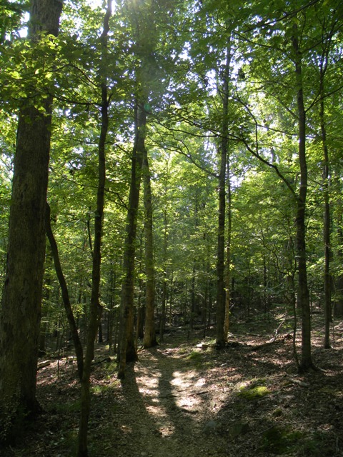
Once you get to the west end of the lake, the trail spends some time on a boardwalk. This is obviously a wetlands area, and often saturated with water. Water lilies grow thick in this sheltered area. Some were in flower as I walked by.

Atop the boardwalk, I saw the muddy footprints of a raccoon.

A bridge carried you over a section of lake near what is presumably the inflow for the lake. Another spur trail (seemed to be 1/5 mile each way, at least) headed out to a point. This provided a better view of the water lilies. You could also look back and see the bridge. It wasn't quite Giverny, but it was nice.

Once back on the trail, the boardwalk continues until you are ready to start heading back east. Then, it's more walking under a forest canopy. You also pass an old pier. One could walk on it, but it looked pretty rickety to me.

Finally, after about a mile of more or less straight walking to the west, you reach the earthen dam and make the final northward jaunt back to the trailhead.

Wednesday, July 27, 2011

Hike 2011.049 -- Petroglyph National Monument, NM

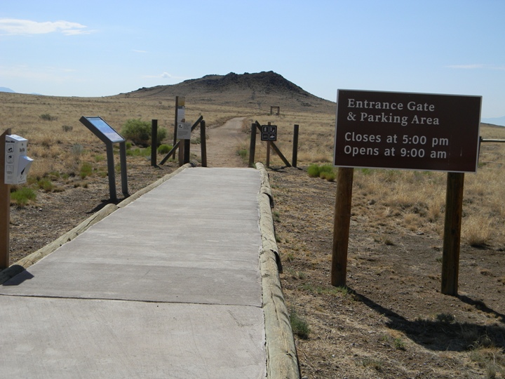
Hiked Monday, July 25. July 25 was a long day. I woke up in Albuquerque, hiked around Petroglyph National Monument, then drove all the way to Oklahoma City. Didn't get there until around 11pm local time. And it was still not far enough to easily reach my final destination the next night. From Albuquerque, Petroglyph National Monument is just to the northwest. Off of I-40, several portions of the national monument (including the visitor center) are located off of exit #154 (Unser Blvd). Head north 3 miles to Western Trail, then turn left into the visitor center. On the way to the visitor center, you pass the Rinconada trailhead, which is about a mile south of the VC. After my quick visit to the VC to get oriented and pick up some materials, I headed back to Rincondada for a short hike. This trailhead, like seemingly all of the ones in the monument, are open during daylight hours, only. That's to discourage vandalism. From the parking area, the trail heads into a broad canyon, with lava rocks pretty much covering the hills around the canyon. On those lava rocks were carved many historic petroglyphs, and many more recent scribblings. Not being trained, I can't necessarily tell one from the other. For example, on this picture, the face looks suspiciously like Mr. Bill, to me. I suspect most are not visible from the trail, but you're not supposed to walk on the lava rocks. From the trail, the visibility of petroglyphs depends on the angle the light strikes the rock. The same rock can appear barren or covered in markings, depending on the angle of the sun. Most rocks appear bare. One thing I saw a LOT of on my hike was millipedes. They were everywhere. Not sure if the rain the previous night is what brought them out, or if they're always that way. Other wildlife I saw were mostly lizards. I also saw a road runner, which was probably eating the lizards. He's right in the middle of this picture, though his plumage definitely helps him blend in to the rocks and grass! Ironically, not five minutes after I saw a roadrunner, I saw a drawing that looked like a roadrunner. I like to think that there's some strange spiritual connection between the person who carved the roadrunner, hundreds of years ago, and the roadrunners that still live in this canyon. Of course, it could be it's a non-ancient scribbling, and the drawing is of this actual roadrunner. :D This loop has an official distance of 2.2 miles. After I finished this loop, I headed to the Volcanoes section, which you would access by taking exit 149 north off of I-40 and driving about five miles north on Paseo del Volcan. Although the map shows the road as unpaved, it is actually paved until it reaches a small parking lot. It's on your right, shortly after you pass a sign for a shooting range (pointing to the left). A small parking lot and vault toilets are at the trailhead. During your drive towards the parking lot, you'll see the three volcanoes that this area is named for, off and to your right. They actually stand out better from a distance, when you are looking up, than they do when you're closer to their level and to the west. Looking west from your parking lot, the trail begins heading straight towards the southern-most volcano. Meanwhile, once you start on your trail and look to the north, here's what the other two volcanoes look like: Nonethe-less, even from here, it is clear that the, the northern-most volcano is the tallest. My plan was to take the 2 mile loop that goes around the southern two cones, then climb up the third one. It's distance is about two miles. That means total mileage for the NM monuments was 4.2 miles. From the west side of any of the three volcanoes (or even from the saddle between them), you have a view overlooking Albuquerque, with the Sandia Mountains in the background. Here, we're looking towards that saddle, with the Sandia Mountains in the background and some hikers on the saddle, heading north. Meanwhile, as you approach the northern volcano, here's what you'll see:And from the top of that volcano, here's the view looking back to the south: Although the picture somewhat flattens depth, it accurate presents that the two southern volcanoes practically disappear once you climb up the third one.

Hike 2011.048 -- Sunset Crater Volcano and Wupatki National Monuments, AZ

(Pictured: Lomaki Pueblo, Wupaki National Monument). Hiked on Sunday, July 24. This one's a bit of a cheat, since, even though I hiked pretty much all of the trails in both monuments, I don't think it was a cumulative three miles. If I had a bit more time, there are a number of longer trails on adjacent Forest Service lands that I could have walked to up my mileage, but I needed to get to Albuquerque that evening. Also, I walked an extra mile+ on Monday, so I'm going to carry the debit from Sunday into Monday. Boy, that line is going to cause some confusion! (Pictured: Along Lava Flow Trail, Sunset Crater Volcano National Monument). Both Sunset Crater Volcano and Wupatki are located north of I-40, near Flagstaff, AZ. From I-40, take U.S. 89 north for 12 miles, then turn on to the Wupataki Loop Road. The loop road is 35 miles long, and passes through the two aforementioned national monuments. It then links up with U.S. 89, 15 miles north of where you started the loop. That makes it (duh) 62 miles of driving off of I-40, mostly at 45 mph or less. In other words, it's a 90 minute detour, even before you get out of the car. Take a few short hikes (with lots of pictures), and this is easily a 4-hour detour, which was somewhat longer than I intended. From U.S. 89, the entrance station is two miles down the Loop Road. A $5 entry fee (or free, with one of the various federal lands passes, or a Flagstaff-area park pass) gets you into both Wupatki and Sunset Crater Volcano National Monuments. The Sunset Crater visitor center is located just inside the entrance station. Shortly after the VC, the first trail (Lenox Crater Trail) is on the left. The parking area is on the right, overlooking an ancient pahoehoe (yes, that's a word) lava flow. The actual trail is short but steep, right up to the top of Lenox Crater. Trees line the trail and give you broken shade pretty much all the way up. It also shields your view to the north and east. From the top, the only clear views are about 120 degrees, from east of south to southwest. A clearly delineated dark area of ancient flows runs first south, then to the southwest. The San Francisco Peaks are in the distance. I returned the way I came, having covered all of about 1/4 mile. Steep and short. Next up (on your right) is the Lava Flow trail, an easy one mile loop that takes you nearer to base of Sunset Crater. Although a rather clear use trail heads up the mountain, the site is considered sacred and not open to general public use. Some of the local indigenous peoples have permission to conduct religious activities on the crater, but that's it. The next point of interest on the loop is a Cinder Hills overlook. No hike there. Just a little spur road that lets you look over and towards Sunset Crater volcano from the opposite end. Continuing along the loop eventually brings you to Wupatki National Monument. Shortly after entering, there's a two mile spur road to the Wukoki Pueblo. A short trail leads from the parking area to the ruins, which sit atop a rock outcropping. In fact, the rock outcropping is integrated into the structure, providing both a foundation and several walls for the pueblo. Meanwhile the walls of the pueblo are constructed of small boulders (sheets of the local limestone and sandstone, reddish in color, like much of the Southwest). Near twilight, the rocks light up a brilliant shade of orange. However, since I was there mid-day, the rocks were more subdued in color. Returning to the main road, the visitor's center is just north of the Wukoki spur. At the visitor's center, they'll check to make sure you have your receipt for the park before allowing you to pass through to the Wupatki Pueblo. A 1/2 mile loop runs around those ruins. Returning to the loop road, I passed the Citadel and Nalakihu Pueblos without stopping, and stopped at the trail for the Box Canyon dwellings and Lomaki Pueblo. Walking up the trail, then taking the spur to the two dwellings on either side of Box Canyon, then continuing on to Lomaki Pueblo, then returning, is about 1 mile. The Box Canyon dwellings are interesting because there is one on each side of the wash. Presumably, the residents of each planted their crops in the wash and prayed for rain (but not so much rain that it would wash away their crops). This was basically dry-land farming, relying on rainfall, with very small check dams to create small, seasonal puddles in the wash. They were really living on the edge from year to year, with frequent needs to walk ten miles or more to the nearest reliable surface water, and only small woven baskets or heavy ceremics to transport and store the water. Most of both Sunset Crater Volcano and Wupatki are closed to the public, either to preserve the sanctity of the mountain or to reduce visitor impacts on archeological resources. Even from the road, you can see some ruins that are not officially accessible. There are no doubt many, many, many more ruins within and along the other washes and rocky outcroppings hidden from such roadside viewing.

Sunday, July 24, 2011

Coming Attractions

Too late to work on going through pictures and writing a real post, and not sure about tomorrow, either. Depends on how far I try to get.

Yesterday, the stress finally got to me and I decided I was better off leaving than just worrying about moving for another night. Left around 4pm, with the goal of Needles, CA (near the Arizona border). The rationale was that this would let me get to Sunset Crater and Wupaki National Monuments (near Flagstaff), walk the hikes, and still get to Albuquerque at a reasonable hour the next day. Getting to ABQ tonight means hiking around Petroglyph National Monument (just west of town), then hopefully getting to near Oklahoma City tomorrow (with a stop at the Cadillac Ranch, in Amarillo).

From there, it's a long day's drive to Murray, Kentucky. Also, I'm hoping to have time to stop at Little Rock Central High School National Historic Site.

If things start looking too ambitious, I can scale this back and give myself another day, or just not stop every where I want to stop. I'll play it a bit by ear.

Anyway, think of this as a "coming attractions" preview for my next few posts!

Thursday, July 21, 2011

Hike 2011.047 -- Echo Mountain. Also, Lost Dog Found in Altadena

First thing I saw when I got to the trailhead this morning was this picture:

I was happy to discover it was a "Found" dog rather than a lost dog. So if by chance (an extremely small chance, I know) any of you know someone in Altadena (near Lake and Loma Alta) who has lost a very cute dog, point them to this poster!

Meanwhile, my time remaining before I need to drive off into the sunrise, and a (temporary) new Kentucky home is rapidly running out. Today was hike 47 for the year, hiked July 21.

It doesn't look like I'll have time for any long hikes. Likely, there won't be time for any more hikes, or if there is, just little 2-3 hour things nearby. If not for some car and computer issues I've been dealing with, I might even already be on the road.

Echo Mountain is a common morning or evening exercise hike for hundreds of folks in the area. It's an old favorite, so I figured I'd do that today.

Moderately strong marine layer in the morning, although the air above the cloud deck was actually pretty clear.

Plenty of scarlet larkspur, as well as Indian pink. No good photos of them, though.

Short, 2 or 2 1/2 hours, roundtrip. After I got back, I made a short detour up to the old mine entrance that's in the ravine north of the Sam Merrill trailhead. I also got a picture of a setting gibbous moon (and a large raptor, carving circles below the moon).

Monday, July 18, 2011

Hike 2011.046 -- Mt. Williamson from Islip Saddle

(View from summit, looking west). Hiked Sunday, July 17. I actually had another hike planned, but it appears the road to Buckhorn Camp is closed, and I was not sure if I could walk in. Probably could have, but it wasn't signed so I figured on passing for today. Might try accessing Cooper Canyon Falls from the Eagle's Roost picnic area next. Definitely running out of hiking opportunities, so it will have to be soon.

(View from summit, looking southwest). After passing on Buckhorn, I was thinking maybe Mt. Williamson. Nice hike because I figured I could not miss the trailhead. It's right where the old CA-39 intersected with the Angeles Crest Highway.

To get to the trailhead, take the 210 Freeway to the Angeles Crest Highway exit and head right (north). I did not precisely measure the distance, but I think the mileage markers were in the 50s by the time I got there. Figure on roughly 60 minutes of driving once you leave the freeway, and have a highway map to mark your progress.

Incidentally, there were two spots where the highway is one-lane, with a traffic light.

(View from summit, looking towards Mojave Desert). Pulled into the lot (on the left side of the road, opposite the CA-39 stub that intersects with the ACH), hung my Adventure Pass, and studied the map. I was a little confused, because there are two trails heading out of the northwest side of this lot. On the map, the one on the left is labeled as the Pacific Crest Trail, and you would follow that for 1.6 miles (according to my Tom Harrison map) before the trail to Mt. Williamson splits off, to your right. Meanwhile, the right trail on my map was labeled as being the South Fork trail, which heads down towards the Mojave Desert 5.2 miles to South Fork Camp. From there, it would be 2.2 miles further to Devil's Chair, in Devil's Punchbown County Park.

However, on the ground, there are currently (July 17, 2011) no mileage, destina-tion, or trail name signs on either of these two trails at Islip Saddle. What's more, the right trail (South Fork Trail) currently has several PCT shields at the trailhead, indicating THAT is the PCT (pictured above). Thing is, this detour is no longer the "official" PCT route. With the exception a a very brief detour near Mt. Pacifico, the PCT has returned to its former route through the Angeles National Forest. Of course, most through-hikers probably already know this, but I can still imagine a number of hikers taking an unnecessary detour as a result of this, and many day hikers wanting to go to Mt. Williamson being misled by the shields.

(View from summit, looking south). Quite a lot of prologue, but I think it's important to let you know that, while your map may accurately show you as taking the PCT towards Mt. Williamson, the shields on the ground will suggest the PCT is actually heading someplace else.

Once on the "real" PCT, heading north from the ACH, the path is pretty steep. As you begin your climb (and for much of the first 1.6 miles of this hike), you can look back towards your car, and see Mt. Islip, rising directly to your south. Incidentally, from Islip Saddle, had you crossed the highway and started up the trail on that side, you could have gone up to Windy Gap, then on to Mt. Islip or any of the peaks surrounding Crystal Lake.

However, today, I was heading towards Mt. Williamson. Starting at 6670, you're at 7900 feet above sea level just 1.6 miles later, when you're supposed to leave the PCT and take a spur trail to the right (north), to Mt. Williamson.

This spur is unsigned, however, so it could be easy to miss. The good news is that it is at a crest, so when your trail is not longer climbing (and, again, as of July 17, 2011, there are small PCT shield decals on plastic stakes facing either side as the ridgeline intersects the PCT here), it's time to make your right turn and pick your way through the manzanita bushes on your way to Mt. Williamson.

(Approach to Mt. Williamson summit). Several paths of equally apparent-correctness make their way up the steepest portion of the climb to the higher ridge line. From there, you trend northwardly 1/2 mile to the unmarked summit of Mt. Williamson. There are several false summits (meaning, "slight bumps in the ridge line) along the way. Near as I can tell, the "official" summit should be the last one, before the trail drops noticeably downward, and with a pretty open view in most directions. Some sections of this final run take a bit of care to negotiate.

Mt. Williamson, at 8214, is a bit under 1,600 feet above the trail head altitude. Good views in most directions, although other tall peaks in the San Gabriel "high country" partially obstruct some directions. For example, in the picture at the top of this post, only a sliver of the ridge line that includes Mt. Wilson is visible between a break in the foreground mountains.

This picture here is a close-up view through that notch. It's close enough that you can make out the antenna and observatory domes.

Once at the summit, I noticed a clear use trail making its way down this summit and up the next (lower) rise. With a bit of time, I decided to head down this steep and gravelly section, losing about two hundred feet elevation, in the process. Then I headed back up the next rise (another 100 feet or so altitude gain). There actually isn't much of a peak to this next rise, and I continued from the crest an additional 200 yards or so. From there, I could see the trail continuing down, then back up over NEXT little rise. But, with time running short (I needed to get my car started down the mountain by 3pm), I had to turn around then. Back along the flat portion, then down the 100 feet I just gained, then back up the north face of Mt. Williamson. The picture above was on my way back, looking at that north face.

On my return back up the north face of Mt. Williamson, I looked back and saw several large, and numerous small, metallic objects reflecting the sun back at me from the ravine to my north. Those are the remains of a plane crash from back in the 1960s. The pieces were more visible in real-life than they appear in this picture. In the picture, the largest piece (about 1/3 from the left, near center) appears as a white rock rather than the metallic reflection it actually was. The smaller pieces are nearly invisible in this shot, but are scattered below and to the right of the large piece.

An extremely faint use trail also makes its way to those remains, but I chose to let the dead rest in peace.