
Hiked Monday, June 10. This was the last hike I took, and the last of a little splurge of hiking I managed to fit in: The third consecutive day of hiking, and the fifth in the preceding eight days. Obviously, I'm not posting my hikes in order of completion, and I still have a number of hikes to write-up for the year.

I've been to Switzer's only once before. Ironically, it was almost exactly two years before my last trip. Yet, despite the similar time of year, the dryness of this year has left Switzer's a shadow of what Is aw the last time I was here.

Getting to the trailhead is pretty straightforward. From the Foothill Freeway (I-210), exit north on the Angeles Crest Highway (CA-2). Less than a mile after Clear Creek Junction (where the Angeles Forest Highway comes in from Palmdale), there's a signed turnoff for the Switzer's day use area. It's a pretty little picnic area that undoubtedly gets hammered on the weekends. However, thanks to Adventure Pass, on weekday afternoons/evenings, the place is pretty empty. I doubt I passed more than a dozen hikers on the way to the falls (ignoring the less-than dozen non-hikers I saw within 1/4 or the parking lot, including a pretty large group of what I would assume to be film students doing a project.

The tricky part for this hike is that there's a sign pointing you to Switzer's Falls right near the parking lot. Yet it gives no distance, nor any further direction about how to get to the falls.

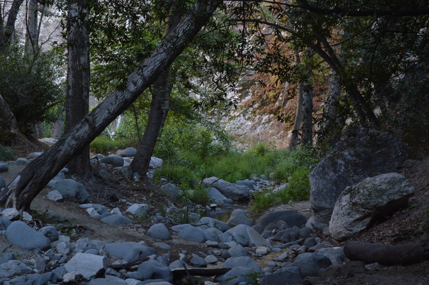
From the parking lot, you cross a service bridge, placing yourself on the south side of the water. Head downstream. Cross to the other side when you are forced to, then go back and forth as often as the trail demands it. There are two signs along the trail as it parallels the river. Each directs you (at different points) to cross to the right side of the river. Other than that, it's pretty straightforward.

After the second crossing to the right, your trail climbs steeply out of the canyon. You'll hear the water to your left, especially when you pass near one of several steep falls that you can not see much of because of vegetation and topography.
At a trail junction (that, because of a continuing Station Fire closure order is not really a junction, since the other way is closed), turn left, back down towards the creek. It's a short, steep descent of maybe 1/3 mile. Then, head back upstream another 1/2 mile or so.

The lower waterfall is, of course, had to miss.
Should you choose to go around that waterfall, there's a way to the right. It requires a modest amount of dexterity, and the ability not to let the (non-fatal) drop off psyche you out. Alternatively, if you get nervous around drop-offs, don't go past the lower falls; it's not worth it.

From there, you can make you way up about another 1/5 of a mile, to a second, taller waterfall. However, on this trip, the water was so low (and stinky) that I elected not to get my feet wet to try for a better angle.

I spent only a few minutes at the upper falls before turning around. Nonetheless, because of the late start, the sun was approaching the horizon on the return trip. As with all of my hikes this week, this meant a soft, warm light for some of my later pics. It really shows that on the mountain top, covered in yucca stalks picture at the top of this post.

I also got some soft light as I shot around a small cascade, when I was nearly back to the trailhead.
Roundtrip is supposed to be about four miles. It seems a lot tougher than either Eaton Canyon or Sturtevant Falls, however. Not sure why.


No comments:
Post a Comment