Friday, February 25, 2011

Hike 2011.012 -- Chantry Flats Truck Trail

Hiked Friday, February 25. Chantry Flats Truck Trail (11W20) is the designation on Google Maps. It's the road that starts out gated but paved, leaving from Chantry Flats. It's what you walk up as you head towards the Upper Winter Creek trail. Figured I'd sneak a shortish hike in before the Big Snow. :D

Forecasts are for snow line to drop as low as 1,000 overnight. Not sure if it'll happen, but if it does, it'll bring snow to a lot of places that don't normally see it. Heck, even Chantry would get a pretty good dusting.

I also figured on Chantry to get one more use out of my Adventure Pass. It expires on Monday, which is a shame. I was hoping to hike in the Santa Ana Mountains soon (Cleveland National Forest), but if the Big Snow really happens, I'm not sure how things would be on my proposed hikes on Monday.

As I drove up to Chantry Flat, a light drizzle began to fall. The road was wet in spots, so I knew they got at least a brief bit of rain here. But when I got out of the car (about 10:15am), the rain had stopped and the sun even popped in and out of view.

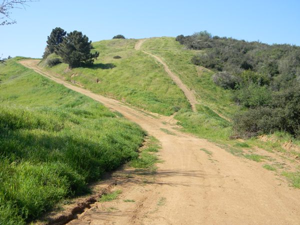
In hiking up the truck trail, it turns out if you hike past the Upper Winter Creek turnoff, the pavement continues for about 1/2 mile more. When you reach the Chantry heliport, the pavement ends, but the road continues. You alternatively get some nice views either across Santa Anita Canyon (east), across and down over Upper Winter Creek Trail (north), or over the San Gabriel Valley (south).


To the west, forest-covered hills pretty much block your view. It's a surprisingly thick forest canopy, however.

Around here, a drizzle began. I was happy that I decided to wear my jacket. That meant I could keep heading up, knowing that, if it really started raining, I could still get back to the car without getting too soaking wet.

I walked this truck trail almost to the official end (11:50am). I could see the end (judging by the weird antenna or reflector that I saw, and the apiary, radio towers and water tank I saw in real life and also in the Google Map zoomed-in view of where the truck trail officially ends. For a few seconds, a hawk sat on the edge of the weird reflecting thing.

Elsewhere I got a sot of a pigeon sitting in a tree. Yeah, big deal. But that, and the picture of a Spanish broom bloom, were a chance to try out some of the capabilities of a new camera that I bought by transforming batteries and printer paper purchases and Discover Card charges into about 3/4 of the purchase cost of a Nikon Coolpix L110 (long story). Short verdict on the camera is that the 30% pixel increase over my previous camera, and possibly superior lenses do produce sharper pictures. I'm not totally pleased with its focusing capabilities, however.

Several use trails continue from there, of course. But by the time I got to near the end, the constant drizzle increased to a moderate rain, and I figured I had better start heading back before the moderate rain turned heavy.


My jacket kept the top half of me dry. Feet were dry. But my pants got a little wet. My camera lens also got wet, so I couldn't take decent pictures on the way back. On close-ups, the camera actually tried to focus on the water droplets on the front lens rather than the flower. I guess it really can take some good macro shots, if I ever have the need.

Total hiking time was two hours and twenty minutes. My estimate is I covered between 5 1/4 and 5 3/4 miles. Net gain of about 1,600 feet. Gross gain was probably several hundred feet more.

Chantry Flats is accessed by taking Santa Anita Avenue north, into the mountains. From the 210 Freeway, you can exit and Santa Anita and drive on up.

Traffic was still a little heavy in the morning, and I spent a lot of time at traffic lights. That gave me time to check a lot of gas station prices. That was depressing. . . .

Thursday, February 24, 2011

Hike 2011.011 -- Marshall Canyon

Hiked Thursday, February 24. Marshall Canyon is north of Pomona or San Dimas or La Verne. From the 210 Freeway, exit at Fruit Avenue, head north for a few hundred yards, then turn left at Baseline Road. From there, it's about 1000 yards to Esperanza Drive, where you will make a right. Take Esperanza Drive about two miles north. It will turn to the left and change into Golden Hills Road. Once you're heading west, be on the look out for Stephens Ranch Road. Make a right there.

Lower Brandt Park will be on your left, with basketball courts and a restroom. I think these are the last public toilets out this way, because Marshall Canyon Park is pretty much undeveloped.

If you continue past Lower Brandt Park, you'll soon have Marshall Canyon golf course on either side of you. There are a number of golf cart crossings here, so keep an eye out for them.

After you're past the golf course, Stephens Ranch Road curves to the right. Stay on the mainroad, and do not turn through any gates. At the top of the hill (before you start driving down the other side), there'll be a large dirt parking lot on your right. It's signed as the equestrian assembly area.

Park there. On the east side of the lot, you'll see several signs for Marshall Canyon trail. It goes both upstream and downstream from here.

I headed to the left, where the trail soon crosses the paved Stephens Ranch Road and parallels the road for a bit on the north side of the pavement. Eventually, the trail (a very broad dirt road) bears to the left and heads for the hills.

Since I had no particular destination, I wandered a number of the trails and dirt roads in the area. I discovered that this trail was like a lot of LA County Parks trails--the sign for a singled named trail (in this case, Marshall Canyon Trail) often had signs with arrows pointing in three different directions. In other words, the single named trail referred to a trail system, with no differentiation between the various spur trails that lead to the main trail, which forms a large loop (about 5.5 miles, as I understand it) through the area.

Not all intersections are signed. At some intersections that are signed, arrows will direct you in 3 or even four different directions. So either give yourself plenty of time to explore the alternatives or just accept that you'll be backtracking some and may miss your correct turn a time or two before you get back to your car.

Because I both got a late start and had plans for later in the afternoon, I only planned to walk about three miles. In practice, because of "wrong" turns (through, really, how can it be a wrong turn if you have no destination?), I ended up walking about four miles.

At any high point on the trail, you'll have a good view south, overlooking San Dimas, La Verne, Claremont, etc. The San Gabriel Mountains will be to your north. In lower areas, near the canyon bottoms, you'll be in a thick oak forest. In more exposed areas, you'll be in chaparral-sagebrush country.

There are a lot of water tanks up this way, and a number of pipes running through the area. There are also a lot of birds and rodents, so bird watchers might find this place a particularly good hike.

A more systematic writeup of this area is available on Dan's Hiking Blog.

Monday, February 21, 2011

Santa Anita

No hike today. I had several little things planned today, beginning with getting my "free" beer mug from Santa Anita. Then it was going to be "free" paper from Staples. Then I was going to use a very inexpensive Metrolink ticket to get me to some amusement for less than half of the regular price.

The first part went fine. I parked on Huntington Drive and walked to the track (about one mile, round-trip), then snapped a few pictures. It's a very scenic backdrop. Dead center, over the big screen, is Santa Anita Canyon. The road cut that cuts diagonally across the hill is the road to Chantry Flats.

To the east, you can see Monrovia Canyon, and the dam in Sawpit Canyon. Further east of that is Baldy. To the west of Santa Anita Canyon, you can see the ridge-running firebreak that would take you towards Mt. Harvard, on your way to Mt. Wilson.

On the way to Staples, my car died. I had just started accelerat-ing from a stop light, when I noticed I was losing velocity. Pressing the gas pedal had no effect. Then I figured out my rpms had dropped to zero, so my engine wasn't running, any more. I flipped on my blinker and coasted safely to the curb. Fortunately, there wasn't much traffic so the coasting part worked. If I had run out of coast, then I would have needed to push my car to the side of the road, and that wouldn't have been any fun.

Several hours later, I got the bad news on the repair: Faulty fuel pump. Ouch!

Personally, I was rooting for the cheapest possible explanation: clogged fuel filter. Nope.

However, I'm counting myself fortunate the failure occurred on a four-lane surface street with a 35 mph speed limit, versus a ten-lane divided highway with a 70 mph speed limit.

Of course, this means no hiking tomorrow. Maybe Wednesday?

Friday, February 18, 2011

Hike 2011.010 -- Colby and Colby-Dalton Trails

Hiked Friday, February 18. Not knowing how long I'd have before the rain would start falling, I picked a relatively nearby and short hike for today.

The trail head for the Colby Trail is at the north end of Loraine Avenue in Glendora. From the 210 freeway, exit on Grand and head north about three miles, to Sierra Madre Avenue. Hang a right. After about a mile, you'll pass Live Oak Avenue. A little bit after Live Oak, Sierra Madre's two lanes turn into one, with the right lane becoming a right turn, only lane at Loraine. Stay in the left lane and make a left at Loraine. After a short block, your one-lane road gets narrower, and there's a line of palm trees in between the north-bound and south-bound lanes. You'll see the trailhead at the end of the road. There's room for about four cars right near the end of Loraine.

Your trail begins as a wide trail that could be driven by a four-wheel drive vehicle. It's also pretty steep as it climbs towards Glendora Mountain Road. But despite your proximity to homes and roads, parts of the trail give you a brief illusion of isolation, as you make your way under a canopy of live oak.

About 1/4 mile up, there's a signed split, with the "Berm Trail" indicated on your right, and an unsigned trail going to the left, between stone walls. Either would lead you to grassy meadows that overlook Glendora and give you expansive, 180 degree views to the south. Even on this overcast day, I could see Downtown LA to the southwest, and the Santa Ana Mountains, to the southeast.

If you instead continue on the Colby Trail, you'll pass a few more signed spurs that give you the option of overseeing the debris and settling basins just east of the trailhead.

Finally, as you rise to within sight of Glendora Mountain Road, you reach your last signed junction. This sign indicates you've got 260 yards to GMR, and that you've gone 2/3 of a mile from the Colby trialhead. It also tells you that if you take the Colby-Dalton trail down, it's just under 1/2 mile to that trailhead.

I went up to GMR, snapped a few pictures, then headed down the Colby-Dalton Trail. This one is also quite steep. It emerges from the forest along side the debris basin for Little Dalton Reservoir. The Colby-Dalton Trail continues to the south from here, passing just west of the dam. As you head over the crest, you can see the dam spillway to your left. Just ahead of that is the USFS fire station, also on your left. You're now walking on asphalt.

Pass the open gate and continue straight and you'll soon reach this lower section of GMR. At the corner of GMR is a small sign, obvious if you're standing right next to it but not obvious if you were driving or even if you were standing on the other side of the road. This sign says "Colby-Dalton Trail, so it appears the official trailhead for this trail is at the corner of GMR and the fire station drive.

I crossed GMR here and passed between the two equestrian rings, where the signed start of the Wren-Meacham trail is located. Because my only other experience on the Wren-Meacham was so miserable, I had no desire to continue this way. I just wanted to know that I could make the link if I ever decided I wanted to.

At this point, I turned around, returned on up the Colby-Dalton trail. Note that, if you were walking the Colby-Dalton Trail from the bottom, I think you'd probably want to park in the equestrian area. You might also choose to park on GMR near the entrance to the fire station, although I'm not sure about parking regulations there. You would then walk (or, if riding a bike, ride) past the fire station, and go through the open but unsigned gate to stay on the Colby-Dalton trail. To continue on the Colby-Dalton, bear to the right as you approach the dam. Walk over the rise, then back down, then, when the well-worn trail splits off from the dirt road, bear to the left there and begin your ascent of the Colby-Dalton trail.

Of course, if you were mountain biking, you might choose to bear left near the dam and ride on the pavement to a point much higher up, then reconnect to the Colby trail when you were much closer to the top. You'd then return return down via the dirt trail of Colby-Dalton.

After I got back up to the Colby-Colby-Dalton junction, I turned back down the Colby trail, then took several detours to explore the spurs that head off of the Colby trail. This was partly out of curiosity and partly to accumulate my minimum three miles to let me call it a hike.

When I got back to my car, I decided to continue my exploration by turning left when I reached Sierra Madre Avenue, then turning right on North Valley Center Avenue (the point where Sierra Madre dead ends). I took North Valley Center south until it dead ends into Compromise Line Road, and made a left there. After a few hundred yards, this ran into Route 66. I made a left at that light, then a quick right on to Lone Hill Avenue. The 210 Freeway was just 1/2 mile or so from there.

Thursday, February 17, 2011

Free National Parks Days in 2011

Last year, I managed to visit Joshua Tree National Park about five times without having to pay an entrance fee. Several visits were to parts of the park that don't ever charge a fee (Black Rock Canyon trailhead, for example). The others were on fee-free days.

So, as my Adventure Pass winds down through its last two weeks of eligibility, I got to thinking again about the same question I ask every year: Adventure Pass, or America the Beautiful Pass? Part of my calculation is whether I plan to visit one other fee areas beyond the local national forests, and how many of those other trips will cost me an additional entry fee. The answer to that question depends in part on if there will be any fee-free days coming up.

Well, I finally got around to looking for 2011 fee-free dates. Here they are:

April 16-24 (National Park Week)
June 21 (first day of summer)
September 24 (Public Lands Day)
November 11-13 (Veteran's Day weekend)

Here's a link to the NPS website that has the dates.

In the past, free national park days have also been fee-free days for national forest, BLM, COE, and other federal agencies that charge day use fees. So now I have a few more weeks to kick around the idea of which recreation pass or passes I ought to consider buying after my Adventure Pass expires at the end of the month.

Monday, February 14, 2011

Hike 2011.009 -- Glendora Ridge Motorway

Hiked Monday, February 14. About five miles roundtrip.

I started this hike off of Glendora Mountain Road. From the 210 Freeway, take Grand Avenue exit and head north. Today, between construction and traffic, this segment was annoyingly slow. (Google Maps suggests I should be getting off at Lone Hill Avenue, but I've never tried that way).

After exiting on Grand and heading north, passing Route 66, Foothill Blvd, and several other lights, Grand reaches a stop light at Sierra Madre Avenue. That's about 2 1/2 miles north of the 210. Make a right at Sierra Madre. It's another 2 1/2 miles east until you reach Glendora Mountain Road. Along the way, you will have passed AND NOT TURNED at Glendora Avenue). Glendora Mountain Road (GMR) is about 50 yards or so before Sierra Madre Avenue deadends into Mountain Lane, but there is no stop sign on Sierra Madre when you reach GMR.

Turn left on GMR ahd head north. You'll pass Big Dalton Canyon Road, which offers several hiking alternatives for another day. Shortly after that, you'll also pass the road-side parking area for the Poop Out Trail. Another 1/2 mile or so and you'll pass the parking area for Lower Monroe Truck Trail. After that hairpin turn and a number of other winding parts you'll pass the end of the Colby Trail. (I still haven't come across the START of that trail, but I suppose I could easily find it if I wanted to).

Shortly after you pass mile marker 9.77 (the mileage numbers gets smaller as you head up GMR), you'll find a parking area on your right and a gated dirt road on your left. Park on the right, and hang your Adventure Pass on your car's rear view mirror.

There were no signs indicating the name of this road. It should take you to the southwest, so if you start out heading to the north, you're on the wrong road.

There were a number of live oak lining this road. After about 1/4 mile, there was a nice peek-over, back towards GMR and my car. After that, most of the other views for the first mile or so are back to the north, over San Gabriel and Morris dams and reservoirs. Later, there are nice views to the west (towards Mt. Wilson) and south, over Glendora, Azusa, etc.

It's also nearly all on a wide dirt road, although there was an eroded point near the start with about an eight-foot gap. The entire path is still passable by horse, foot, or bicycle, but no longer by motor vehicle. I suppose they'll fix that in the spring, though.

At several places, use paths diverge from the dirt road to give you the option of walking or riding over summits. Today, I stayed on the main road, just trying to get past where I got to on my walk from the other side (the Garcia Trail), from last month.

It being the winter growing season, annual grasses were thick and green. A few annual flowers were popping up, too.

My best guess is that I took this road about 2 1/2 miles, until I passed the high point I stopped at a few weeks ago. I initially planned to go all the way to Azusa Peak, but standing on the road and seeing the several hundred feet of altitude I would have to give away to get there deterred me. Besides, I was supposed to get back early. My wife and I celebrated a Valentine's Day lunch at Zen Buffet. Yeah, it's more fun for me than for her, but at least I didn't forget!

Not sure when I'll be able to get my next hike in. I have other plans tomorrow, plus I need to get my last bit of studying in for a civil service exam on Wednesday morning. The first day of docent training is also tomorrow, so I'm not sure if I can still squeeze this in. I also have another job application that's due on Thursday, and a few more due in March I should probably get started on. Might not be able to go hiking again for another week.

Friday, February 11, 2011

Puente Hills Landfill Native Habitat Preservation Authority

Story in today's Whittier Daily News about native habitat restoration in the Puente Hills. I'm pretty sure they're talking about the area around Arroyo Pescadero, which I hiked last year. Then, stumps and cuts of the eucalyptus still dominated the landscape. Judging by the pictures, a lot of the area still looks pretty barren. However, the landscaping and sprinkler installation should continue to bring this area to a more naturalistic-appearing state.

I may have to return to this area later in the spring.

Thursday, February 10, 2011

Hike 2011.008 -- Chino Hills State Park

Hiked Thursday, February 10.

Rim Crest Trailhead is at the top of Rimcrest Drive, in far northern Yorba Linda. From the 57 freeway, I took the Imperial Highway exit and headed east. After 3.3 miles, I took a left at Bastanchury Rd. 2.7 miles later, I made a left on Fairmont Blvd. .8 miles later, I made a left on Rimcrest Drive, and took that to where the Rimcrest turns into Blue Gum. A half-dozen cars were parked on the right side of the road, just before the turn. A sign indicated parking was permitted, except from 7pm - 8am. That's no problem in the winter, but in the summer, avoiding a ticket would require you to make sure to clear out well before dark. Parking on the left side of the road (as viewed looking up the hill) is by permit, only. The side streets also appeared to be parking by permit, only.

At the turn in the road, a curb cut allows easy walking or biking access, as well as emergency vehicle access to Chino Hills State Park. Just up the trail, there's a gate and two bulletin boards with various notices posted. There's also a small container with a small number of Chino Hills State Park flyers.

A mileage sign at the bulletin board indicates that the South Ridge Trail runs perpendic-ular to your entry into the park. Turn right to head towards San Juan Hill (2.8 miles) and the park HQ (5.5 miles). Turn left to head towards lower Telegraph Canyon (1.3 miles). Also, a small, hikers-only trail is straight ahead. Three-tenths of a mile would take you to Telegraph Canyon. That's the way I returned, at the end of the day.

In the morning, I turned right. This trail gains altitude rather quickly, although this entire park is mostly rolling hills. For example, the entry station is just under 1,000 feet above sea level. The high point in the park, San Juan Hill, tops out at 1785 feet, meaning the net gain is just 280 feet per mile. All but the last 1/10 mile or so is on a dirt road or double track. Most intersections are signed with a wooden stake giving the name of the intersecting trail. Along the trail, there were also stakes at one mile intervals, giving the name of the trail and the number of miles from there to the park headquarters. However, a number of the stakes were burned in fires about 18 months ago, obliterating the trail names and making the mileages difficult to read.

Incidentally, the map that's available at the park and on-line also has most of the trail names indicated, and places the number of miles from the hq on the map. That gives you a fair indication of your distance covered, at least if you're heading east-west. For north-south travel, you've sort of on your own.

Chino Hills looks somewhat like the Puente Hills. I expect the climate here must be a little more under a marine influence than Puente Hills. The hills also seem more rounded, with fewer oaks. However, most of where I hiked in the Puente Hills is on north-facing slopes, while the Chino Hills canyons seem more east-west. A small trickle ran along the bottom of Telegraph Canyon, and water seeped on a few other areas. However, despite being more moderate in climate, it seemed dryer than Puente Hills. The recent fires may have helped reduce the larger shrubs and trees and dried out the area, however.

High-tensions wires and pressurized natural gas pipes cut across the park. Nonetheless, the there are some pleasant views along the way. This February day, dried annual grasses stood tall, while green grasses grew lower to the ground. Wildflowers were still pretty sparse, although I did see a number of lupine out near Gilman Peak. There were also some nice views of Mt. San Antonio (Baldy) and his friends, to the north. Mt. Wilson and friends were further to the west. To the southwest was the Pacific Ocean, with Santa Catalina Island showing nicely today. I also got a relatively close-up view of the Santa Ana Mountains, to the east, Mt. San Jacinto, to the east-northeast, and Mt. San Bernardino and San Gorgonio, to the northeast.

There was a large cement monument on the top of San Juan Hill, with the year 1896. That's two years before the famed Battle of San Juan Hill, so the naming of this place was not an homage to the heroics of Teddy Roosevelt.

After crossing over San Juan Hill, I continued on the South Ridge Trail a bit further, giving away altitude as I descended towards Telegraph Canyon. I made a sharp left turn at mile marker 2 and briefly joined the Telegraph Canyon Trail, which I followed to Four Corners (about 1,300 feet). I guess it gets that name because of all the trails that converge there. In addition to the convergence, there's a couple of benches, a portapotty, and (on this day) a fire engine.

Just a bit further west, I reached the signed turnoff for the North Ridge Trail. I walked up the ridge, passed the McDermont junction, and continued another 2 1/4 mile to Gilman Peak (1685).

Along the way, I passed a fenced area with a sign warning of explosives and hazardous materials to the north.

After passing over Gilman Peak, I continued down Gilman Trail, which ends at Telegraph Canyon. I headed west about 1/2 mile, with rolling hills and a tiny stream running along the bottom, to the west. On the left, I saw a small clearing with a "No Bicycles" sign, but no name. Nonetheless, I was confident (and correct) that this was the Easy Street Trail that would take me back to Rimcrest. Three-tenths of a mile later, I was back at the trailhead. My car was still there, unticketed. Yay. :D

This was about six hours after I started my walk. During this time, I would estimate I covered about eight miles, perhaps a bit more. That's a pretty slow pace for me. Yes, I'm still feeling the after-effects of my illness. Even at low altitude and with relatively modest altitude gains, and with many stops for pictures, this was dog-slow for me, but about all I was up for today.

Wednesday, February 9, 2011

LA Zoo

Since I haven't had any new hikes to post in quite some time, I thought I'd post some shots from the LA Zoo. These were taken back in September.

The picture of the sea lion floating upside down against a window kept popping up on my slide show.

The meerkats were also looking cute, although I guess it would be a better picture without the chainlink fence behind them.

This was the first time I saw the ocelots doing anything other than sleeping in a corner. I don't know if this meant they were finally getting used to their cage or if they were just feeling frisky that day.

I'm still not feeling 100 percent, but I absolutely need to get some walking in tomorrow. I've printed out the maps and directions to get to Chino Hills State Park tomorrow. I'm planning to hike from the Rim Crest Trailhead to San Juan Hill. David Lockertz on his Nobody Hikes in L.A. blog, which I follow, recently posted about this one. So tomorrow I'll either report success or a ticketed/towed car!