Friday, March 31, 2023

Golden Bee Mine, Joshua Tree National Park, CA

Hiked March 18, 2023. Thought I'd take a run out through southern Joshua Tree, in case wildflowers were blooming. Also hoped for a clear night sky, so I could do some astronomy. Alas, the second part was completely clouded out.

Because the intial plan was for astronomy later, I poked around Alltrails and looked for shortish trails I could take during the day, hopefully short enough that I wouldn't get too worn out to want to head out again, after dark.

Golden Bee showed to be about five miles round trip, which is pretty managable, even if I did some short wildflower walks earlier. Yet, in real life, the five miles still made me tired enough and took long enough that, by the time I finished and got into Yucca Valley, I was not entirely disappointed when the clouds moved in and made astronomy impossible.

Alltrails has the hike as starting from the Cholla Patch parking area. Figured I'd park there, on the assumption there'd probably be portapotties and what not there. There were no portapotties, but there were a lot of cars. Despite the congestion, when I got there (early afternoon), there were plenty of parking spaces vacant, despite the many cars parked along the road outside of the parking area.

From the parking area, you're supposed to walk east along the road about 1/2 mile before turning to the south. So even though I could have "cut the corner," I figured I'd follow the path as shown on the app, at least on the way out.

About fifty yards after making the turn, I could see that I was on an intermittent old jeep trail, obvious in parts, but less obvious in others, especially when it crossed some washes. But the general direction was clear, so I only needed to check the app when I felt I was off the path. Moved pretty quickly, except at the wash crossings. As I approached the hills in the distance, road cut scars on the hill clarified my destination.

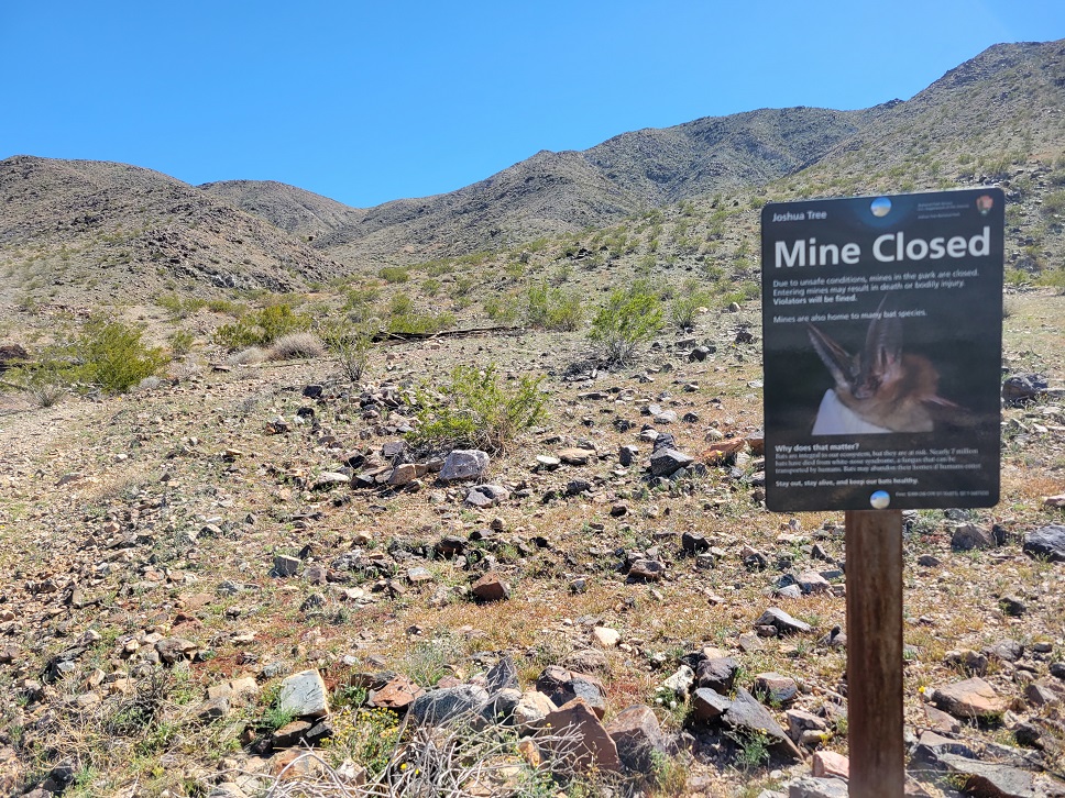
As I started up the actual hill, the "Mine Closed" sign was there, indicating to me both that I was on the right path and that even if I was inclined to enter the mines (which I'm not!), I shouldn't, on account of white nose disease.

Evidence of past mining became more frequent as I climbed, although some "ruins" were just completely collapsed wooden structures. Scattered cans, barrels, cables, and other errata were also visible.

At a place where the ravine split, the app indicated I should go to the left. More climbing and more significant structures were revealed. Not sure if there would also have been things to the right.

There are certainly larger and more expansive mine ruins elsewhere in the park, but this one promised to be emptier, despite the crowded start. The mine is not part of the "official" hikes listed in park publications, and there's no signage regarding it at the start. And, indeed, I passed only one person returning as I walked towards the mine, and passed none on my return. This, despite the overflowing parking lot at the Cholla patch.

Somewhere upon reaching "the end," I checked my app, and it said I had walked just under 2 1/2 miles. Unfortunately, because of the crowded parking lot, I felt rushed to get into my car, then get my car out of the lot. So, as is frequently the case, in my haste, I forgot to shut off the app recording. As a result, I don't have an actual measured distance for the total hike, and the recording has a good distance of me driving towards Yucca Valley.

I did cut the corner a little bit near the end, because I could obviously see the parking area and knew I did not need to walk the longer route to get back to my car. So probably only about 4.5 miles total walking for me. Probably another 1/4 mile if I had returned the way I went.

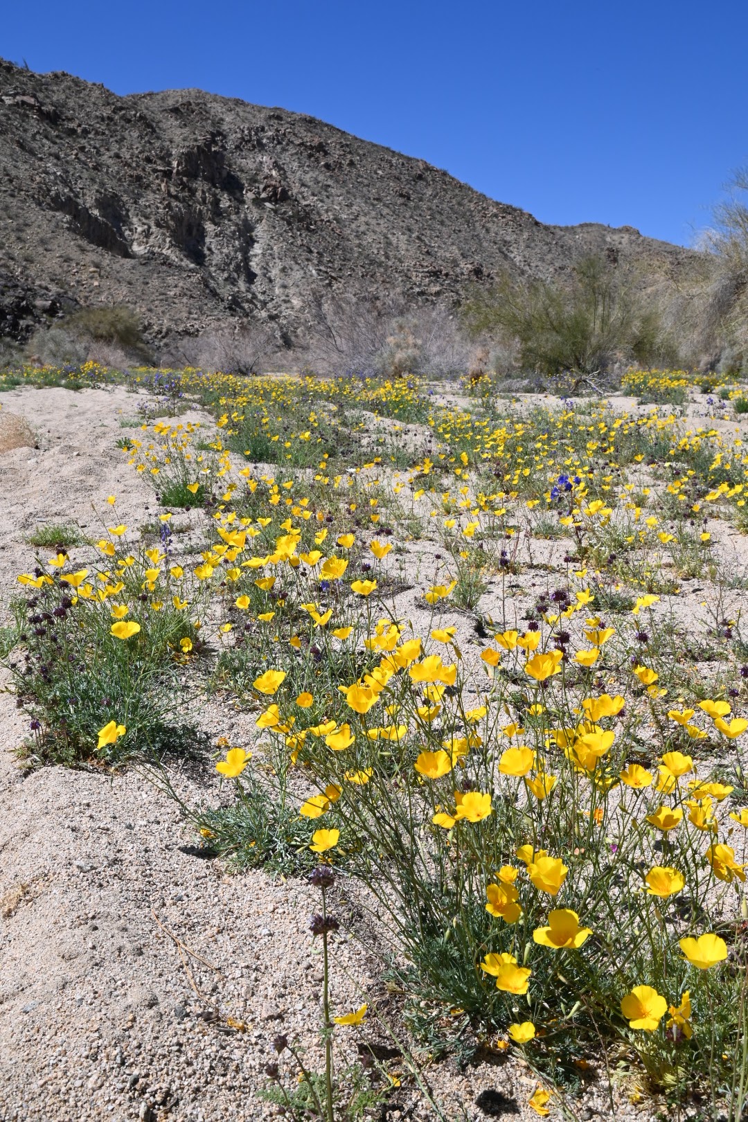
There were scattered wildflowers along the way, especially in the washes. Nothing "superbloom" in density, but lots of individual specimens. I took quite a lot of pictures with my dslr, but the Snapbridge app kept crashing on my phone, so I couldn't transfer those flower shots from my dslr to my phone for processing. So my post here is just cell phone shots, that were just resized quicker for posting.

I posted this hike over a week ago on my personal facebook page, noting that I didn't know what was mined here. A friend informed me that it was gold, which makes sense, given the name. The other part of the name was also relevant: He said the water tank was, "back then," infested by bees. Not surprising, because bees in the desert are always looking for water. Hence, Golden Bee.

He also told me the bees were killed by the addition of cyanide to the water. Of course, once he told me it was a gold mine, I had already considered the question of, "I wonder if the soil here is contaminated by cyanide?" I'm not a chemist or a miner, but I do know that cyanide is used to leach gold apart from crushed ore that comes from a mine.

In any event, a nice hike, and I had no intent to eat the dirt or drink water from the likely-cyanide-laced soil around the mine, so I assume I'm safe. It was nice to see someplace I hadn't been to before, despite my many visits to Joshua Tree. Glad I visited.

Since this is not an "official" trail, it's not as easy to follow as those "real" trails. But, with the app, it was an easy hike, though with some steeper areas up gravelly slopes near the end, and some uneven parts as you enter and exit the many washes you cross along the way. Without the app, just heading in the general direction, you could likely find the evidence or road cuts to take you to the mine. But the app definitely makes it easier.

Monday, March 27, 2023

North Palm Springs and South Joshua Tree

From Saturday, March 18, 2023. Not really much in the way of actually hiking, but part of a longer excursion.

I saw the field of desert dandelion from I-10, as I passed through North Palm Springs. My fitbit just went off, telling me I needed to walk, which was fortuitous timing. I exited at Indian Canyon Road, hit the Pilot/Flying J there, bought some food for lunch and dinner, used the restroom, then headed back out on to Garnet Avenue (basically the frontage road to I-10, here). Drove west maybe a 1/2 mile, until I found a clear area to park. Walked maybe 200 yards back east, shooting as I went, then returned to my car. I loved the desert dandelion, the windmills, and, of course, Mt. San Jacinto, beyond.

Then I continued on my planned route, to the south entrance of Joshua Tree National Park. Just inside the park is the Bajada trail, which I had visited during a previous "superbloom," and it was impressive. Figured it might be too early this year, but worth checking out.

Well, turned out it was either too early, or it's just not going to bloom much there, this year. A few bushes of lupine made a nice photograph, and there were scattered desert poppies and yellow cups along the road. But not really worth a stop, at least on this day.

Further up on Cottonwood Springs Road (the road heading into Joshua Tree), the flowers got thicker, and spread beyond just the road runoff area. Desert poppies, yellow cups, and desert bluebells were the most common.

I'd say from roughly 3 miles to roughly a mile before the Cottonwood visitor center, the flowers were thick enough to be calling for you to stop. I stopped at a turnout and walked maybe 1/4 mile along one of the washes. Many to choose from, but obviously you should park at an actual pullout, so you don't run over the wildflowers you came to see, or have your car partially protruding into the road.

Later, I went on to the Cottonwood visitor center, figuring they'd want me to show my pass and be counted. But they just waved me along, so I left, without asking any questions. I was pretty sure I had already seen the densest flower blooms in the park at the time.

I drove on to the Cholla Patch, as my Alltrails app had suggested a short hike from there to a mining ruin. That'll be the topic of my next post, an actual hike. Should post that later this week.

Thursday, March 23, 2023

Ice Box Canyon, Red Rock Canyon National Conservation Area, NV

Hiked March 12, 2023. It's not news to anyone out west that it's been a wet year, and with several heavy snows at much lower altitudes than typical. A week before I got here, Red Rock was covered in snow. By the time I got here, the lower altitude snow was long gone. But the snow at higher altitudes was still melting, and that fed the waterfalls very nicely.

I've hiked this canyon before, and once, during active rain, when the water was flowing even higher than on this day.

Still, it was great hiking weather, a bit cool, but not cold, and, as mentioned, the water was running strong. With continued rain, I expect at least a decent flow on into April. Unlikiely I'll make this particular hike, again, but I wasn't able to visit Lost Canyon falls this trip, so likely I'll want to hit that by the end of the month. Maybe also Oak Creek, another short hike to a small falls.

On a somewhat related note, my America the Beautiful pass expires this month, and I always like getting in as many hikes as possible before it does. Yes, I'll buy a new one later in the year. But, who knows? Might be able to put that off into May, if I manage to schedule only not-federal fee area hikes in April.

Of course, because the recent rains have been so persistent, I wasn't the only one who had this idea of visiting Red Rock's waterfalls. The preferred parking area for Ice Box Canyon was full when I drove by that afternoon, so I had to continue on the one-way loop. But, no problem, I figured. I got the idea that I could just start from the Pine Canyon trailhead, then take "Dale's Trail" up to intersect with the Ice Box Canyon trail.

On the plus side, yes, this will work. On the minus side, I forgot how up-and-down Dale's trail is. Although probably less than two miles from Pine Creek trailhead to the junction with Ice Box, it took me about ninety minutes to get there. And since I started late (entered just before 3pm), I knew I was going to be pressing things to try to get to the waterfall, then back to my car, and out the gate by 7pm (when, in March, the loop road officially closes).

I mean, Dale's trail scenic enough. But I had forgotten how up-and-down this trail was, and it sure felt longer than I thought it would be. Also, even once on Ice Box, the high water meant there were lots of stream crossings, and detours up canyon side trails to try to get around the natural barriers in the creekbed. So, despite this being at least the 4th or 5th time up this trail, I wasn't moving very quickly, even once I was on the trail.

I think it was about 5:30pm by the time I got to the waterfall, which meant getting back to the car and out by 7pm was going to be tough. It would have been easy if I was parked at the Ice Box trailhead, but I already knew it would take me nearly 90 minutes just to get from Dale's trail back to Pine Creek (maybe a little less, since it's a net downhill hike on the return). So I walked rather swiftly. And, it being somewhat downhill, and over familiar ground, the return down Ice Box Canyon was definitely quicker than the way out.

I then decided I could move quicker along the paved road (despite it being longer) than along Dale's trail, so I went that way. After all, two miles on pavement, downhill, that's less than 40 minutes. So I wound up getting back to my car about 6:57pm, and reached the exit in my car at 7:01pm. No ranger handing out tickets, and the gate was open.

I don't know how strict they are at ticketing, but, so far, and I've never been more than a few minutes late out the gate. Do things change if you're 15 or 20 minutes late? Don't know, but prefer not to find out the hard way!

So about five miles of hiking for the day. As noted, great day for hiking, and very scenic with the water flowing.