Tuesday, February 26, 2013

Hike 2013.011 -- Rubio Canyon


Hiked Sunday, February 24. Well, I'm still WAY behind on my hike write-ups, and it doesn't look like I'll be catching up any time soon. So I'm going to drastically shorten the length of my posts, at least for the next week or so.

Took a short hike in the mid-morning, before having to head off for work. I chose the trailhead near Rubio Canyon and Loma Alta Drives, in Altadena. Most of this hike is covered in this previous write-up.

Using this trailhead rather than the one at Pleasantridge Drive adds about 1/2 mile roundtrip and probably 120 vertical feet to the hike. Given the short length of this hike, I wanted the extra distance.


Given the slew of recent rains, I was thinking the front range falls might be looking pretty nice this weekend. Sorry to say, I was somewhat disappointed.

Ribbon Rock and Moss Grotto lived up to their names, with a rather thin ribbon of water making its way down the two lowest major falls of Rubio Canyon. Nonetheless, I decided to push on, to the overview of Thalehaha Falls. Water there was very unimpressive. I won't even bother posting a picture of that one.


One point to note is that the erosion on the route up towards Thalehaha and beyond is significant. I think the least damaging route to Thalehaha overlook is to loop around the large willow that was once in the middle of the canyon. Pass on its right and loop 270 degrees around, approaching the gravelly cliff from that angle. Head up towards the fountain grass, staying high as you across the clayish-grassy area.

I briefly continued pass the overlook before deciding that I was causing too much erosion for what wasn't going to be much of a view. Leontine Falls only gets about half of the water that runs down Ribbon Rock and Moss Grotto. Given how little was making it over them, continuing seemed stupid.


So I turned around, heading back towards my car. Just before getting back to the Camp Huntington Road (the paved road that connects with Loma Alta), my eye was caught by the golden petals of wallflower. I snapped a number of pictures of the 4-6 plants that were growing right near where the trail that heads east, out of Rubio Canyon, begins. I followed that trail about 1/4 mile, just high enough to get some shots back towards downtown Los Angeles. Then I returned back to the canyon, then back to my car.

I'm calling it three miles for the day. Might have been less, but given the steepness of the sections I walked, the exertion was definitely tougher than three level miles.

Saturday, February 23, 2013

Hiked 2013.009 -- Liberty Bell Arch Hike, Lake Mead National Recreation Area, Arizona

(Picture 1: Liberty Bell Arch from above and to the south).

Hiked Sunday, February 17. Got a relatively early start. From the beginning, the goal was to hike this trail this weekend. I came across it, not in one of the books I recently bought, but, via a bit of random Internet searching.

Looked very doable, a nice payoff, and something different from my previous hikes in Nevada.

(Picture 2: Informational Kiosk).

To get to the trailhead, take U.S. 93/95 south. When US 95 splits off, stay on US 93. This is the "new" way into Arizona. Previously, all traffic on this highway had to slow for the bottleneck at Hoover Dam. Now, the main road is a two-lane divided highway, while the dam is a turnoff from the highway. I may explore that area next time I'm in town, depending on the temperatures we're seeing then.

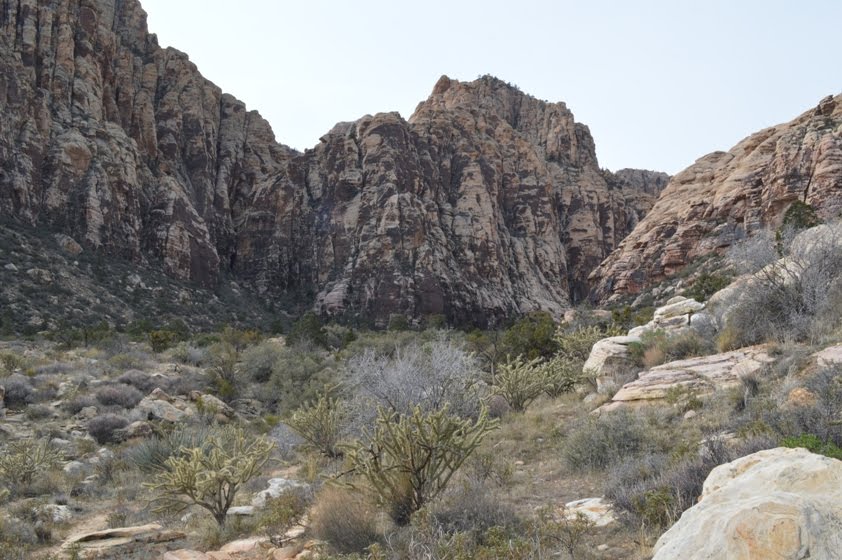
(Picture 3: Wash after crossing under highway).

The freeway from Las Vegas and Henderson flies to the southeast, at least up until Boulder City. There, the freeway and divided highway end, and the road becomes a business route through town. When you reach historic Boulder City, you'll also reach the only semi-tricky spot on the road: To stay on US 93 through town, you need to make a 90 degree left turn at a light. Yeah, I'm pretty sure you're actually heading north for a while. But that's what they've done.

(Picture 4: The wash gets briefly narrower).

I'm still not sure how the Visitor Center thing works. There's one in Boulder City, at 601 Nevada and another one further down off of US 93, as you're making a rapid descent towards the lake. I thought the sign at the lower one said they were closed, and I should go to the one at 601 Nevada Way. However, when I went there, that facility was dark. Maybe the ranger was taking a lunch break? Don't know, but it was an annoying delay, costing me at least 20 minutes to divert, discover it was closed, then get back to where I was.

(Picture 5: Some remnants of a mining operation).

After passing through Boulder City and a brief period with 25 and 35 mph speed limits, the highway becomes divided again as it heads down the aforementioned hill. The lake shimmers blue, contrasting with the red rocks of the desert.

The new bypass bridge, named after a former Nevada governor and a professional football player who gave up the easy money to volunteer to serve in Afghanistan, has high guardrails to deter peeking at the dam. If you take the earlier turnoff to Hoover Dam, there's a parking area where you can access the pedestrian walkway on the north side of the bridge, for a bird's eye view of the dam. I was too tired to do that.

(Picture 6: Liberty Bell Arch from near the mining remains).

After crossing the bridge, you're in Arizona. You're looking for the White Rock Canyon Trailhead. It's at the 4 mile marker. If you're coming from Nevada, you'll need to get into the left lane to access the left-turn lane into this parking area.

It's a pretty large parking area, but it was nearly full by the time I got back form my hike. However, when I started (around 9am, I think), I was only about the fourth car.

(Picture 7: Arch from the south and below).

At the south end of the lot is an informational kiosk with maps of the trails you can access. The vast majority of hikers head for the hot springs. At least they did when I hiked: I only saw four other hikers on my trail between the split and the end.

A slightly annoying thing about this trail head is that there are no directional markers. It's not a major issue, in the sense that there's a map on the kiosk side, and the trail clearly passes under the highway. Still, exactly which route are you to take? With a signed dirt road heading to the left and a signed historic bridge in front of you, you might be tempted to go someplace other than directly under the highway. Resist that temptation: Go under the highway.

(Picture 8: Different view, same arch).

Now what? Keep going down the wash. It's a wide wash with many worn paths. Moot point, since the wash eventually narrows and your path will become more obvious. Just head down the wash. Pay attention to the fact you are descending, which means your return hike will end with a climb. Also, if you're taking the Liberty Bell Arch Hike, there will be essentially no shade after you leave the slot canyon, in about 1/2 mile. This is not a good hike for the peak of summer. For mid-February, however, it was perfect.

(Picture 9: Looking downstream from the overlook).

After the wash narrows, you've got some zig-zagging between occasional high walls. If there were heavy rain upstream from you, you'd be in deep doo-doo. So, in addition to not doing this hike in the heat of summer, don't do it if there's a fair chance of rain someplace upstream from you.

(Picture 10: Waterfowl, flying upstream, above the Colorado).

After about 100 yards of sometimes tall walls around you, the walls fall away for a brief section. You want to look to the right side of the trail. On the day I was hiking, there were a couple of small cairns (rock piles) marking the divergence of the Liberty Bell Arch trail from the White Rocks Canyon trail.

(Picture 11: Liberty Bell Butte).

Up about fifteen feet, and you're walking along another wash bottom. After about 1/2 mile, I came to another fork in the trail. I chose the left one, though I was not sure if it was the correct choice. This route climbed quickly, eventually leaving me with a distant view of Liberty Bell Arch, but from the side. The opening was only visible by the light that shined on the wall to it's north.

(Picture 12: Desert Bighorn).

Closer to where I stood were the remains of an old mine.

My question here was how to get from where I was to where I wanted to be. Eventually, I did discern a faint trail that made its way down the steepish dropoff near where I stood to a much more obvious trail below. I zig-zagged my way down a canyon, giving away quite a bit of altitude as I made my way to the west. It was probably a mile of dropping down into the canyon and working my way west. Then it was up a rise and heading towards the arch.

(Picture 13: Another bighorn).

I actually walked by it pretty quickly, because I thought the trail was going to zig back towards the base. Instead, it continued around the ridge. So I went off-trail, and eventually decided to head up to the top of the butte that the arch was attached to.

(Picture 14: 3 Sheep).

Because it's a volcanic cap to the butte, it is actually easier to get to the top than a casual look would suggest. That doesn't mean you couldn't hurt yourself if you're not careful. And, depending on when you go, you might end up killing a lot of seasonal plants on your way up. In retrospect, I shouldn't have gone. But it's too late, now.

(Picture 15: Full frame shot of hikers and landscape. The next three are various crops of that same picture).

Nice views from there, or even from below. Interestingly, you can still look all the way back to US 93 and see where you came from.

After enjoying the sense of conquest for a few moments, I worked my way back down to the trail and followed it further west. It leads to a mesa that overlooks the Colorado River. WAY overlooks, as in what must be over 1000 feet. To get some idea of the distance down there, I've got a picture of large waterfowl flying upstream, taken with my telephoto lens zoomed to 210mm. Not sure what kind of birds they are, but I'd figure they must be at least three-feet long and with a 3-foot wingspan.

(Picture 16: Hikers).

Here, the Colorado is blue or green, clear, and definitely not red.

Upon the deep blue water were a number of kayaks being put in. That's what flushed the waterfowl into flying upstream. I could hear the sound of their wings slapping on the water as they lifted off.

I also saw what must have been HUGE fish down in the tailwater below. I mean practically kayak-length, swimming in large schools. Far below, yet many times longer than the waterfowl I mentioned above. I'm figuring 10 feet long, which seems impossible. I'd think the only freshwater fish that large are sturgeon, and I don't think there are supposed to be any of them here.

(Picture 17: Hikers).

Unfortunately, my longer telephoto was not handy, though, at this distance, the evidence would probably be marginal. After all, look at my waterfowl pictures from this distance. I'm assuming they're swans, but who can tell from this distance?

After retrieving my longer telephoto lens, but with the fish-like objects no longer visible, I shot some pictures of what were probably flocks of swans. It was an unusual, bird's eye view of them.

(Picture 18: Hikers).

I also shot plenty of pictures of the landscape around me. Directly to my south, there was a deep canyon that I would have to explore on a later trip. This is the one you'd head down if going to the hot springs.

(Picture 19: Lizard).

The return hike was not as difficult as I expected. Heading back up towards the mining remnants was pretty easy. From there, it was up the canyon, also easy.

Upon rounding a crest, I heard the sound of hoofs on rock. I looked up to see a couple of desert bighorn, eyeing me suspiciously. I clicked off a few shots with my 18-55mm.

(Picture 20: Sheep and Mountain).

They stuck around, still watching me. So I eased on down, and tried to be casual and non-threatening as I swapped out the 18-55 for my 55-210 telephoto. Looked up. They were still there. So I fired about a dozen shots off. They were still there. I debated if I should wait until the hikers somewhere behind me caught up, so I could point out the sheep. But I figured if I was still there, the appearance of two more hikers would likely cause them to leave. So I continued on my trail, which passed about fifty yards away from them.

The sheep continued eating, so I kept turning back and taking more pictures.

When I got to the other side of the ridge, I saw three more sheep, which I also photographed.

(Picture 21: Desert Moon).

Once past the sheep, I was on the very short side wash that soon runs into White Rock Canyon. In fact, you can start hearing the voices of folks heading towards the hot springs almost as soon as you get back on the side wash.

The slog up the main wash to the highway was a little slow going. Despite the short distance, walking on sand tires you out quicker than normal. Still, all done in about 3 1/2 hours for the six or so miles of walking.

(Picture 22: Gully).

OK, bunch of "throwaway shots," just to illustrate the hike. The last few shots on this blog are just a series: The original, uncropped shot, looking east from the overlook, then various crops, trying to decide how best to fit the hikers into the perspective of the landscape. I liked the original shot, but they're so small, you can only see them if you're looking for them. After that, I've got a lizard shot, another desert bighorn shot, a desert moon shot, and an unusually "green" gully, due to recent rains.

[Man, I used to like the way the pictures were embedded before; gotta figure out if I can use that old layout, still!]

Monday, February 18, 2013

Hike 2013.010 -- Teutonia Peak, Mojave National Preserve

(Picture 1: Teutonia Peak). Hiked Monday, February 18. Well, I've fallen so far behind in my hike write-ups, I guess I'll start working backwards. This is the hike I did today. I'd done it once before, about two and a half years ago.

Today, I was driving back from Las Vegas. My original plan was to hit both Teutonia Peak and Kelso Dunes. But my camera battery died on Teutonia Peak, so I just called it a day after this hike.

(Picture 2: Cima Dome from near I-15). Teutonia Peak lies atop Cima Dome, less than a mile from the center of that dome. Cima Dome is a huge shield of a dome, ten miles in diameter. It's so large that you can most easily view the dome from a distance. Picture 2 shows the view from just south of I-15. Teutonia Peak is atop this dome, less than a mile from the center. In contrast to the dome, peak sort of blends right in. It doesn't become obvious until you are much closer to the trail.

From I-15, head 12 miles south on Cima Road. A sign announcing your approach to the parking area for Teutonia Peak and a White Cross World War I Memorial appears just 1/4 mile before your destination. Because the White Cross gets top billing, you may not have time to read the whole sign, so I'm telling you now: When you see the White Cross sign, that's your indication to get ready to stop. If you're coming from the north, your parking area will be on your right.

(Picture 3: The White Cross). The White Cross memorial is accessed via a trailhead on the east side of Cima Road, opposite the Teutonia Peak trailhead. I didn't know for sure what this was, so I crossed Cima Road and walked a few steps up the granite slab there, then looked to the south. Less than 1/8 of a mile away was the White Cross, which I then concluded must have been the cross that was the subject of recent litigation. I snapped a picture of the cross in the distance (Picture 3). Then I turned around and snapped a picture of Teutonia Peak, standing above the thick Joshua Tree forest (Picture 1). Then crossed back over Cima Road to start my hike.

(Picture 4: Cholla cactus). Your trail begins mostly flat, making about 3/4 of a mile slowly climbing the dome, towards Teutonia Peak. This is the Joshua Tree forest, with a very few juniper mixed in. When you finally reach the outcropping that is Teutonia Peak, the climb gets steeper.

You make your way to a saddle in the long, narrow "mountain," then continue somewhat up the ridge line before dropping "behind" Teutonia Peak. From the west side, you can see Cima Dome again, closer, but still very shallow as it makes its way to an apex.

(Picture 5: Cholla Cactus and the summit of Teutonia Peak). Cholla and prickly pear cactus are common on the slopes of Teutonia Peak. I also saw a few barrel cactus. I especially like how cholla look when backlit against a low sun (See Picture 4).

Once over the saddle, you can view Cima Dome, again. Well, again, you're actually ON Cima Dome the entire hike, but the part that continues to rise is to your west, and visible once you crest the ridge (See Picture 5).

(Picture 6: East from Teutonia Peak). The views from atop Teutonia Peak are expansive. Tall mountains far to the north are visible, as are mountains closer to you, and the aforementioned Cima Dome. In this picture, you're looking to the east. Cima Road is the white line that cuts left to right.

As I mentioned, the camera battery died (about ten seconds after taking this picture), so I was necessarily done with picture taking for the day. I also decided to scrub my Kelso Dunes hike for the day. I'll do that one later.

So, three miles for the day, and about 700 vertical feet. Not bad, for a third consecutive day of hiking.

Not sure if the (blogspot) has changed the interface or if I just pushed a wrong button. Formatting is a little different. Sorry about that!

Tuesday, February 12, 2013

Hike 2013.004B -- Icebox Canyon, Red Rock Canyon National Conservation Area

(Picture 1: Icebox Canyon waterfall). Hiked Saturday, February 2.

After returning (not entirely by design) to my car from Lost Canyon, I immediately set out again for Icebox Canyon. That's the next canyon you encounter in the counterclockwise drive around the Scenic Drive.

BTW, that means Red Rock Canyon is a misnomer. It's not one canyon. It's a place where easily half-a-dozen different canyons open up out of the surrounding hills and on to a place that is undoubtedly stacked high with the alluvial materials from those many drainages. I guess, in a sense, standing in "Red Rock Canyon" means you're standing on top of the Spring Mountains, the La Madre Mountains, and the Sandstone Bluffs, all at the same time.

(Picture 2: Lost Canyon wash). In any event, rather than driving my car the mile or so further along the road, I just walked the connecting SMYC trail (no, I saw no indication of what SMYC stood for). If I had to guess, it's probably the initials of the guys who built the trail), to the southeast. It more or less parallels about one mile of the face of the bluffs that form the west boundary to what people normally think of as "Red Rock Canyon." These are not the steepest or most multi-colored sections of cliff, but they're still nice.

(Picture 3: Turtlehead and La Madre). As the trail makes this lateral, it does not stay level. First, it drops down into, and crosses, a wash. Parts of the wash are dry, but, in other areas, the water from Lost Canyon springs flows on by (See Picture 2).

(Picture 4: Cholla cactus). Later, the trail begins a bit of a climb. Before long, you can see over the intervening alluvial fan, and look upon Turtlehead Peak and the southernmost part of La Madre Peak, off in the northeast, on the other side of the scenic drive loop (See Picture 3).

Once past the outcroppings, the trail heads annoyingly close to the parking area for Icebox Canyon. That means it's a longer walk that it has to be, because you give away a lot of altitude that you'll just have to gain all over again when you get on to the actual Icebox Canyon Trail.

(Picture 5: Looking into Icebox Canyon). As you approach the Icebox Canyon Trail, Cholla cactus become somewhat plentiful. I love those cactus; they look so wonderful when they've got a little backlighting on them.

Finally, I reached the Icebox Canyon Trail. Icebox Canyon was now above and head of me. The rocks were covered in desert varnish. (see Picture 5).

(Picture 6: A millipede). That trail, like many I have en-countered in Red Rock, is difficult to follow, as many parallel and crossing paths are intertwined as you head into the canyon. I think the actual trail is supposed to hug the edge of the ravine, on your left.

(Picture 7: A tighter view into Icebox Canyon). In contrast to my walk along the connector trail, the flow of bodies along the Icebox Canyon trail was pretty constant. I also came across a short millipede (See Picture 6), which reminded me of the veritable swarm of them I saw in Petroglyph National Park last year.

Eventually, I reached a point where the dark stain of water seeps were on my right (See Picture 8). My impression is that many people turn around here, because, next, the trail drops into the ravine and makes a series of rocky hops, occasional scrambles, and poking of the way around obstructions in the canyon bottom to continue.

(Picture 8: Seep into Icebox Canyon). After another 1/4 mile or so, I could hear the sound of running water, dropping between the piles of rocks in along the canyon walls. Soon, I rose to see a sizable pool of water (See Picture 9). Passage directly up the canyon was blocked here, but a relatively easy class 3 path was possible behind a pine tree on the left. The tree provide fall protection as you scrambled up the rocks.

From there, you had to walk with a 10 or so foot drop off into the pool of water on your right. But the rock had somewhat level pathways, and was still pretty grippy for my lugged soles to navigate. It's not a big drop, but clearly many people stop their hike here.

(Picture 9: Pool before the falls). After the fifteen or so yards of exposed scuttling, I was back on a solid surface.

Another pool of water was here, and a narrow sluice of water zipped in from another pool, above (See Picture 1).

Climbing that little falls would not be too difficult, but the exposure and possibility of a wet fall into the pool, plus seeing that there would be no further advancement beyond that pool, convinced me to enjoy this falls from below.

(Picture 10: Dried redbud seed pods). It's a pretty sight, but the lack of direct light reduces the contrast between the water and the rocks, so I don't think the pictures do it justice.

I returned the way I came. Just below the falls was what looked like a western redbud tree, with seed pods still hanging on (See Picture 10). I bet this place would look beautiful in the early spring, when those redbuds are in bloom.

About 4.7 miles for this segment of hiking. Moderately strenuous, except for the last 100 yards or so. That part will take a little coordination and an ability to walk along a small dropoff. Probably not dog-friendly or child-friendly for that section.

Monday, February 4, 2013

Hike 2013.004A -- Lost Canyon, Red Rock Canyon National Conservation Area

(Picture 1: The trail-head that leaves from the "left" side of the parking area). Hiked Saturday, February 2. Yeah, it's been two weeks since my last hike. Pretty sad.

And, here I was, back in Red Rock Canyon National Conservation Area. Partially, it's because this is the quickest and easiest place for me to get to when I'm in Las Vegas. Also, I can use my America the Beautiful Pass, so it feels like I'm getting my money's worth.

On the other hand, it finally occurred to me that I could also use this pass to get into Lake Mead National Recreation Area, so I might try a hike in that park in a few weeks. In the days since this hike, I've researched a couple of possibilities in Lake Mead NRA, although I think at least the one I want to do next is, I think, outside of the fee area.

(Picture 2: The trail-head that leaves from the center of the parking lot, straight towards Lost Canyon). I've also been reading a Wilderness Press book with lots of hikes in a very broadly defined "Las Vegas and Southern Nevada," so I've got no shortage of places and ideas for future hikes.

However, on this Saturday, the plan was to try to link several hikes around Lost Canyon and Icebox Canyon into one moderately long hike. The roughly 3/4 of a mile I hiked in Lost Canyon was the first phase of the day's plan.

Today, I took the "official" way to Red Rock" U.S. 95 north, to Summerlin Parkway. Summerlin Parkway East, to the 215 Beltway. Beltway south, to Charleston Blvd. Charleston Blvd/NV-159 east, to Red Rock Canyon Scenic Drive. Once on the Scenic Drive, I drove it about 1/2 way around, to the signed Lost Creek trailhead. That's the first trailhead after you have turned off the Scenic Drive and right, on to the Rocky Gap Road that would take you to the Willow Springs picnic area.

(Picture 3: The Boardwalk by the Springs). In addition to the pit toilets here, there are two clear trails that lead away from the parking area. One heads from near the center of the lot and goes towards the southwest. The other heads from the "right" end of the lot (if you are facing the lot from the road) and heads to the west. In practice, both are two ends of a short loop. There are also numerous interconnections around this loop, though I failed to find the one that would have taken me to the northwest, and some petroglyphs and pictoglyphs.

(Picture 4: Close-up of the springs that the boardwalk passes over). I took the trail that leaves from the center of the lot, which heads straight for Lost Canyon. After about 100 yards, there's a branch to the left that heads towards Icebox Canyon. I took that route for Hike 2013.004B, right after I completed my loop and decided to just head off for Icebox.

Lost Canyon is quite obvious when you're this close to it. It's a narrow canyon between towering sandstone, which ends in an alcove, at the base of what will be a dry falls most of the time, but an actual waterfall on rare occasions. This was not one of those rare occasions.

En route to the seasonal waterfall, you pass right over a small spring. I believe this spring is perennial. A short boardwalk/bridge allows you to view the spring without trampling the vegetation.

(Picture 5: A wide view of the alcove from which Lost Canyon Falls ought to be flowing over). After arriving at the alcove, I spent a few moments to appreciate the size of the drop--probably 30 feet, right off the ledge. It could be an impressive sight. Not today, but sometimes.

On my return, I bore to the left at a fork in the trail. This took me more northwesterly, past the agave roasting pits. That's basically small caves, where I guess the ancestral Pueblans would have tossed the hearts of agave plants, packed what burning material they could around them, and prepared the agave for consumption.

(Picture 6: Close-up of the seep where Lost Canyon Waterfall ought to be). Shortly after the agave pits, there should have been a trail that continued to the northwest. It probably looked too much like a use trail for me to take, so I stayed on the main trail until it became obvious that it taking me right back to the parking lot. Oh, well.

So I walked past my car, then headed back out on the trail that left the center of the lot. This time, at the fork, I took the one heading to the left (South). This was the SMYC trail, which was sign, but the importance of those letters was not explained. It's a 1.1 mile link between Lost Canyon Trail and Icebox Canyon Trail. Between the connector and the actual Icebox Canyon Trail, and the short segment I took to get to this fork, I'm figuring about 4.75 miles total for Hike 2013.004B (which I'll blog about next). Just .7 or so miles for 2013.004A, which I completed once I was back at the parking lot.