Thursday, September 21, 2023

John's Camp, Joshua Tree National Park, CA -- Hiked September 3, 2023

I have some astronomy outreach events coming up, so I wanted to get some late-summer practice locating objects with my dob. So the plan was to drive up late, take a short hike, get back to the car, drive out to Ryan Mountain trailhead, set up my telescope as the sky got dark, and locate some objects.

I looked at my Trails Illustrated / National Geographic Society map for Joshua Tree, and noticed a short pair of trails it showed, leading to "John's Camp." Maybe 3-4 miles total, so that seemed like an idea.

One of the other times I had tried hiking a trail on this map that wasn't mentioned by the NPS was to the Contact Mine, just inside the north entrance to Joshua Tree National Park. That turned out to be a success, but also easy, since that trail was well-defined, and, a few short years later, now that hike is prominently mentioned in Park hiking lists.

I also used this approach to figure a cross-country route to Samuelson's Rocks, which I hiked a few years ago, but still haven't gotten around to blogging.

The hike to John's Camp (or Johns Camp; the apostrophe seems to be inconsistent in usage) was shown as starting from either of the first two roadside parking areas, if coming from the east, at Pinto Wye (I'm pretty shure this simply means the "Y" where the road goes one of three ways: Either north, towards Twentynine Palms, south, towards Cottonwood Springs, or west, towards Jumbo Rocks, and eventually, Yucca Valley).

I picked the first one, just because it was first, and also a little longer, which was fine, since the hike was going to be so short. Amusingly, there was some guy in a faux space suit, having his friend take photos of him among the desert flora. They left by the time I got organized around my car and ready to strike out.

Not much of a trail, here. I assume the goal would be to just head down tot he bottom of the wash, then head left (uphill; I was going to say "upstream," but there's only water in here duirng actual flooding events, I think!).

I ended up leaving the wash too soon, then taking a cross-country route, over a ridge. Should hae just been more patient, but I was unsure of my route, at the time. The scale of the Trails Illustrated map is too small to determine if you are supposed to go around or over fairly large rises.

By the time I got over that rise, I was ready to call it a day. I even started walking back, before deciding that the camp must be further upstream. So I continued, staying in the wash. The first indication that I was getting close to something was a rusted can, which had presumably washed down from the camp. The second indication was the large white "tailings" hill, to the right in the fifth picture of this post. I saved that photo in a larger file size, so you when you click on that one, it will be substantially larger than the other photos, and you'll be able to see the white mound.

I continued past that tailings, because I wasn't sure where the "main" archeological ruins would be. Where the wash split, I first headed to the left, through a narrows (sixth picture), and saw nothing immediately beyond. I then backtracked briefly to the main wash, and headed up that way. It quickly ended in large boulders, which I could work my way around if I wanted to, but seemed an unlikely barrier to need to get to the mine ruins. So I decided the tailing pile was the place to go, and headed back down the wash.

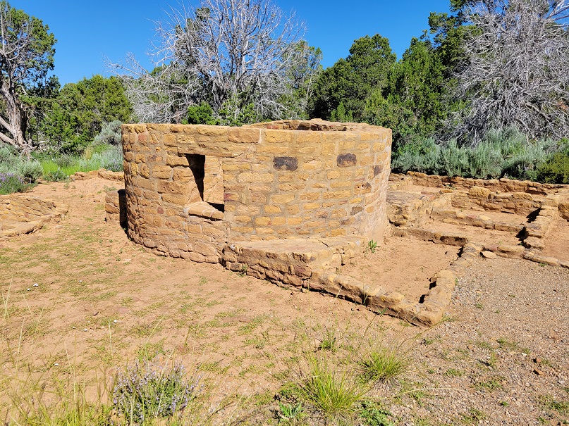
Evidence of mining was widespread here, but I did not see any mechanical implements or engraved rocks that I had seen in some on-line posts about this location; I don't know if that means they've ben removed, or if I did not find the main camp, or if erosion has significantly changed the remains. I didn't spend that much time wandering around the area, so there may have been more ruins, not too far away.

I saw some stone walls, some concrete-filled cans, a concrete slab, some unnatural-appearing slabs of rock, and a mine entrance. Not sure what the concrete cans were about; sort of looked like maybe they held up temporary sun shades to work the mine.

The ruins were not nearly as extensie as at the Contact Mine, nor at Golden Bee or some of the other mines in Joshua Tree I've visited. But, for what I wanted (a short hike to loosen up after the long drive out here, and before my evening astronomy), it was perfect.

Given my late start, it was already pretty dark by the time I got back to my car. In fact, this required some walking along the road, in the dark. I just step further off the road when I see oncoming traffic.

This night was just four days after full moon, and three days before Third Quarter. What this means is that the moon rises somewhat after sunset, but well before "mid" night. So, as planned, this meant I'd hae about 90-120 minutes of pretty dark skies to do my locating before a relatively large moon would rise to wash away the dimmer faint fuzzies of the night sky. Ideally, I'd have waited until the next week, but my first major dark sky outreach event of the "summer" was September 15, meaning if I didn't go this weekend and next weekend got clouded out, I'd have no opportunity to practice before the event.

Although, to be fair, I had done a very brief outreach event back in the spring with my 10" dob. But the sky's completely different five months later, as we're now nearly on the opposite side of the sun, and the things you can see at night are similarly changed.

In any event, my lesson from the short practice session was that, yes, I can find things. But, because of the telescope's design, objects near the horizon place the telescope's eyepiece really low to the ground, so probably not the best for public observing. So I've decided I'll take my C11 on this next outreach event, after all. The collimation (lens and mirror alignment) on the C11 is off and hard for me to get right, but it's not too serious an issue at low magnifications, so if I keep powers low, it'll be fine.

Sunday, September 17, 2023

Fremont Indian State Park, Utah, July 16, 2023

Fremont Indian State Park is just off of I-70, about 17 miles from where east of where the Interstate starts, at I-15. During construction of I-70, in the 1980s, archeological evidence of ancient habitation was uncovered. Following excavation, the village was large either re-intered, or removed. The petroglyphs (carved in rock) and pictographs (painted on rock), however, remained in the canyons.

In the case of that first photo, in fact, the painting is so large it is visible even if you are speeding along on I-70.

Some glyphs date relatively recently, to the Paiute who passed through the area in the between 1400 and the late 1800s, while some date back to the Fremont People, roughly a thousand years ago.

Many large panels are visible in the short, paved trail behind the visitor center. Some are up a bit in height, so binoculars or a telephoto lens is helpful. Indeed, one wonders if there were rocks closer to the cliffs, or if the original artists used ladders of some sort to paint so high.

Photos are also helpful because you can later crop and zoom in to see some sections of the panel in better detail. For example, the third and fourth photos of this post are crops of the second shot.

The interpretive signs nearby stated that the higher glyphs were written after the lower ones. But it is interesting to know that, by the time the more recent paintings and carvings were made, the oldest were well over 500 years old!

There are several shortish walks you can take, some more well-defined than others. There are also dirt roads, either travelable by passenger cars, or, in some cases, ATVs. That brings you to more rock art, so if you have the time, you can do some exploring and look for lesser-known displays.

There are also a few cave or alcove paintings, where a metal fence keeps you out, to protect the art. In one case, where the art is on the interior wall of an alcove, there's a parabolic mirror so you can see the inside wall of that alcove. You could also reach in with your camera and snap some shots, for a clearer photo of the art. Looks like I didn't include any pictures of that, though.

Finally, there are several areas were you can park along the road and scanned the high cliffs above. Again, a telephoto lens or binoculars are helpful. Can't always find all of the art referenced in the interpretive signs, though.

The park is pretty small, so unless you plan to take longer walks along ATV trails, you can see all of the major exhibits in a pretty easy day. In that respect, it's not necessary a destination so much as a place to make as a day trip from other areas nearby, or as an extended stop on a longer trip through the area. In my case, it was a long day trip from Cedar City. It's the same trip I looked at wildflowers and did some night sky photography in Cedar Breaks National Monument.

I had started thinking about a visit here as sort of a tie-in to my Mesa Verde trip, which occupied the last five posts of this blog. I also gave it serious thought as a possible destination to view the Annular Solar Exclipse of October 14, 2023. My initial hope was to combine that with a trip to Capital Reef, which I had only visited, briefly, once before. Of course, like here, Capitol Reef has a lot of roadside rock art.

But then my wife had limited vacation time available, so I thought maybe here, instead.

In fact, they are planning a "view" event here for the annular eclipse. But, by July, I had already made a commitment to the Night Sky Festival, and Joshua Tree National Park. Still, thought my wife might like to join in on a rock art hunt.

Wednesday, September 13, 2023

Mesa Verde to Navajo National Monument, Arizona, July 3, 2023

Mesa Verde National Park is in southwestern Colorado, not very close to any Interstate highways. But it's a relatively manageable two day drive from southern California to get there early enough for the 3pm tour of Cliff Palace. It would have been an easy two day drive, but construction in the Virgin River Gorge makes that drive unpredictable.

The return would also take two days. The first day was going to go all the way to the Las Vegas area. But, along the way, was Navajo National Monument.

From Cortez, we took U.S. 160 east. As we reached the far southwestern bit of Colorado, we could again see Shiprock, in New Mexico, off to the south. We probably got no closer than 25 miles away. I just pulled to the shoulder, walked across the highway, and snapped some shots. The first shot was relatively wide; the second, a long telephoto. This was probably about 12 miles from Four Corners.

We continued west, past Kayenta, and on to AZ 564. About 9 miles north on 564 takes you to Navajo National Monument.

From the visitor center, the main trails head right out the back. That's because this park, like many with archeological artifacts, is a sunrise to sunset park.

The short, 1.3 mile roundtrip trail to the overlook for the Betatakin ruins is paved or on wood planks, so it's semi-accessible. Probably too steep in parts to qualify as handicapped accessible, but pretty easy, with just a slight descent to the overlook. In the morning, the alcove with the dwellings is at least partially in shade. A telephoto lens or binoculars are highly recommended

Getting closer requires a guided tour with NPS personnel, but you'd have to get there at 7am, which would be really hard unless you're staying right there, so the tours generally do not fill.

There's a separate, overnight tour to a different ruin, Keet Seel. Obviously, I did neither tour.

Instead, once back near the visitor center, I headed down the Aspen trail. It's reported as .8 mile roundtrip, but with a 300 foot descent in that short distance. The trail is NOT paved, but with steps in sections. At the end is a pretty overlook into the canyon that contained Betatakin. And right below you is a relict forest of aspen and Douglas fir, a remnant of when the area had a cooler and wetter climate.

After completing the hike, I changed clothes behind my car (took off my long pants and shirt I wear for sun protection when I'm hiking, and put on shorts and a t-shirt for driving). I drove off, not noticing that my cell phone was sitting on my hood. My Prius hood slopes such that you can't see the top from the driver's seat. Phone flew off at about 55mph as I headed down 564. The phone, a Samsung S21, somehow managed to survive, so I was able to photograph the Navajo Taco I ate in Cameron Trading Post, an hour and a half later.

Saturday, September 9, 2023

Mesa Verde, Besides the Petroglyphs and the Cliff Dwellings, July 2-3, 2023

This is a non-exhaustive collection of photos, other than those I took on the Petroglyph Point hike, and on the Balcony House and Cliff Palace Tours. There are still lots of photos I'm not posting, and a good chunk of the park we didn't visit. In particular, Wetherill Mesa is closed due to road construction this year, and I did not hike the trails around the campground.

That first shot up there was the view from behind the visitor center, at the entrance to Mesa Verde National Park. One place to get info, although the inside can be crowded at opening time. The little walk around the visitor center was basically just me, though. Nice view of Lookout Point, a very prominent sight.

The second shot was of Shiprock, New Mexico, from atop Park Point, the highest spot in Mesa Verde National Park. That's a short 1/3 of a mile or so up a paved walkway, to a fire lookout. Shiprock, a volcanic plug, is about 45 miles away from Park Point. One of these days, I'd like to see it much closer.

The next five shots are from around the Far View Complex. Numerous dwellings, farm areas, and reservoirs from over a 300 year period preceding the cliff dwelling phase.

The Far View complex is a bit past the modern Far View Lodge, the only in-park motel, with accompanying restaurants and gift shops. Never stopped there, but I later learned it's not terribly expensive, and would save a bit of driving versus staying in Cortez, CO. But I have a bucketload of Wyndham Rewards points, so my wife and I stayed in the Days Inn in Cortez. It's only 14 minutes from there to the park entrance, but 45 minutes from there to the Far View Lodge. So you'd save about 90 minutes of driving a day if you stayed in the park's inn, but you'd have more limited food options.

At any rate, the turnout for Far View Complex (the ruins) was not super-well signed. It showed there was a road coming in, but I don't recall if a sign actually told you what that road was for, so I seem to recall blowing by it and having to make a U-turn to get to Far View. Short road, that ends in a small loop, with room for only a handful of cars around the tiny loop.

If you park there, Far View ruin is right there. A trail from there heads north, past a small tower, the remains of an ancient reservoir, and then Megalith House, which has a sort of metal barn built over the excavation site (it's a pit house, that mostly went below ground, for "free" insulation).

Another trail loops from there to Coyote Village, to the south. I took a less-than direct route there. Still, all told, maybe 1/2 mile of walking to visit all parts of the Far View Complex.

Finally, on the Mesa Top Loop, along with the stuff around Spruce Tree House, Balcony House, and Cliff Palace, there are numerous other overviews of various near and distant cliff dwellings. The most of impressive, to me, was Square House. And that's just because you can't see it from the road, but a short, paved walk takes you out, and, all of a sudden, you're practically right above Square House. I think it's the closest you can get to any of the cliff dwellings on Chapin Mesa (Chapin Mesa and Wetherill Mesa being the two main mesas of Mesa Verde with cliff dwellings in the alcoves beneath the rim).

So this and the previous two posts were from the recent Fourth of July weekend. But that's not all! One more post upcoming from that weekend, for Navajo National Monument, in northern Arizona. Then I'll still have Fremont Indian State Park, plus, for August, several hikes in the eastern Sierra, and Black Mountain in Sloan Canyon NCA in NV, and, for September, at least one hike in Joshua Tree National Park. Won't be able to get all those posted before I hope to have a few more hikes to blog about.

Monday, September 4, 2023

Cliff Palace, Mesa Verde National Park, CO, July 2, 2023

Similar to my last post, this little walk also required an $8 tour ticket, which meant logging in to recreation.gov at 7am MDT, two weeks before the hike date, and trying to snag my slots. Actually succeeded the first time, as opposed to Balcony House, where I originally could only get one slot and had to keep reloading, before eventually lucking into a second slot in the same tour time.

As noted in the previous post, tickets were hard to come by, in part, because the target date was over the Fourth of July weekend. This was also early season, and tours of these ruins were unavailable the previous year, due to construction on the mesa. As a result, there may have been some serious pent up demand. In checking on recreation.gov recently, getting slots in the next two weeks would have been pretty easy, especially if you avoided a Saturday.

Unlike Balcony House, you can actually see Cliff Palace from the start of this hike. You can see the earlier tours down there, and clearly see how far down you need to go. Also unlike Balcony House, there is no crawling involved, and far fewer stairs and ladders. The latter, especially, means less exposure (less of a chance of a serious fall), but also means that claustrophobia and acrophobia should be less of an issue. However, there is more walking among narrow gaps, which means a slower walker or climber in front of you will slow the whole group down. So practice patience, and if your schedule won't allow a few extra minutes going up or down, then don't go on that tour.

Our ranger walked us down into an alcove, then described the site largely from within the shade of an alcove. It was hot in July, but not super hot, on account of the altitude. It's mostly 6500-7500 feet among the cliff ruins.

Cliff Palace is significantly larger and taller than Balcony House, and better preserved. However, we weren't allowed to go deep into the ruin; we just stayed on the front end.

After speaking for several minutes in the alcove, the group was directed over to the far side of the ruin. I took a number of pictures along the way.

Once at the far end, and partially shaded by some pine trees, you could see several of the large kivas, and we learned more about how those worked, and why they were there. Took some pictures during the talk, and some after we dispersed.

Then, exit time. The way out obviously required about as much altitude gain as we had lost on the way in. So it's non-trivial climb, at a moderately high altitude. And, as with the way in, the walk way out was generally going to be singled file, along narrow rocky steps.

One neat thing is that you could see some tiny footholds chistled out of the rock, adjacent to the larger, modern steps. That's how the original inhabitants came and went. Kind of made you wonder how often they fell on the way into and out of their cliff-side homes.

Once back at the top, your car is still on a one-way loop. Near the end of the loop is the start of the hike to Balcony House, so if you're planning to do both tours during your stay, you'll know where both begin. Helpful to keep that in mind, that when you drive out there, Balcony House is at the end of the loop, so allow sufficient time to drive the full loop. You don't want to be late for your tour!

At the end of your loop, you're back near Spruce Tree House, again. So, again, that's your place for flush restrooms, food, drinks, and gifts.

Distance is again given as 1/4 of a mile. It's probably a bit more than that, but not particularly long. Not too strenuous, although the return climb may slow you down, because it's uphill. If you think you're going to be slow, you can check with the ranger about starting up earlier or later. ALternatively, if you're fast, don't plan to rush through the tour and walk up too early, because then you'll catch up to the stragglers from the previous tour, who waited until everyone else was gone before heading up.

Because it's so narrow, no one can pass you if you need to rest on the way up. By contrast, there are several wider spots on the return up and down to Balcony House, so if you need to rest, you can stand aside and let others pass.

In that respect, although Balcony House is considered more strenuous, other than the crawl and the length of the first ladder up, I don't think it's tougher than Cliff Palace, and friendlier for people who might need to rest on the way back up.