This is a non-exhaustive collection of photos, other than those I took on the Petroglyph Point hike, and on the Balcony House and Cliff Palace Tours. There are still lots of photos I'm not posting, and a good chunk of the park we didn't visit. In particular, Wetherill Mesa is closed due to road construction this year, and I did not hike the trails around the campground.
That first shot up there was the view from behind the visitor center, at the entrance to Mesa Verde National Park. One place to get info, although the inside can be crowded at opening time. The little walk around the visitor center was basically just me, though. Nice view of Lookout Point, a very prominent sight.
The second shot was of Shiprock, New Mexico, from atop Park Point, the highest spot in Mesa Verde National Park. That's a short 1/3 of a mile or so up a paved walkway, to a fire lookout. Shiprock, a volcanic plug, is about 45 miles away from Park Point. One of these days, I'd like to see it much closer.
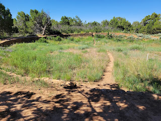
The next five shots are from around the Far View Complex. Numerous dwellings, farm areas, and reservoirs from over a 300 year period preceding the cliff dwelling phase.
The Far View complex is a bit past the modern Far View Lodge, the only in-park motel, with accompanying restaurants and gift shops. Never stopped there, but I later learned it's not terribly expensive, and would save a bit of driving versus staying in Cortez, CO. But I have a bucketload of Wyndham Rewards points, so my wife and I stayed in the Days Inn in Cortez. It's only 14 minutes from there to the park entrance, but 45 minutes from there to the Far View Lodge. So you'd save about 90 minutes of driving a day if you stayed in the park's inn, but you'd have more limited food options.
At any rate, the turnout for Far View Complex (the ruins) was not super-well signed. It showed there was a road coming in, but I don't recall if a sign actually told you what that road was for, so I seem to recall blowing by it and having to make a U-turn to get to Far View. Short road, that ends in a small loop, with room for only a handful of cars around the tiny loop.
If you park there, Far View ruin is right there. A trail from there heads north, past a small tower, the remains of an ancient reservoir, and then Megalith House, which has a sort of metal barn built over the excavation site (it's a pit house, that mostly went below ground, for "free" insulation).
Another trail loops from there to Coyote Village, to the south. I took a less-than direct route there. Still, all told, maybe 1/2 mile of walking to visit all parts of the Far View Complex.
Finally, on the Mesa Top Loop, along with the stuff around Spruce Tree House, Balcony House, and Cliff Palace, there are numerous other overviews of various near and distant cliff dwellings. The most of impressive, to me, was Square House. And that's just because you can't see it from the road, but a short, paved walk takes you out, and, all of a sudden, you're practically right above Square House. I think it's the closest you can get to any of the cliff dwellings on Chapin Mesa (Chapin Mesa and Wetherill Mesa being the two main mesas of Mesa Verde with cliff dwellings in the alcoves beneath the rim).
So this and the previous two posts were from the recent Fourth of July weekend. But that's not all! One more post upcoming from that weekend, for Navajo National Monument, in northern Arizona. Then I'll still have Fremont Indian State Park, plus, for August, several hikes in the eastern Sierra, and Black Mountain in Sloan Canyon NCA in NV, and, for September, at least one hike in Joshua Tree National Park. Won't be able to get all those posted before I hope to have a few more hikes to blog about.


No comments:
Post a Comment