Hiked Sunday, March 20. Still many hikes behind in blogging. And, fortunately, I finally had a decent weekend of hiking, this weekend. So I'm now four hikes behind; I'll be three behind after I finish this post.
I visited this park, twice, in 2010, during my first year of blogging. The first visit is linked here; the second one is linked here. I feel like I'd been here at least once additional time, yet I could not find a third post in a quick google search, so perhaps those were my only visits; if so I should visit, again.
My initial plan was to head for the ridgeline between the Sylmar side fo the mountains and the Placertia Canyon side. However, as is often the case, I got distracted.
As has been mentioned in past posts, Wilson Canyon Park (under the authority of the Santa Monica Mountains Conservancy), is located immediately adjacent to Olive View Medical Center, in Sylmar. Take Olive View Drive just east of the Hospital, and you'll see access points (there's probably an access point just west of the hospital, too).
The paved road to access Wilson Canyon Park is well-signed. However, parking there requires a $5 fee, and you sometimes feel like a sucker when you pay for something you could so easily not pay for. And you do not pay if you park on the street, and walk in.
I walked on up the driveway, and came across a dirt road that seemed to head directly north, where the paved road turned west. Well, with no particular destination, I took the dirt road.
No idea as I walked up where this trail would lead. I hoped it would continue on up to the ridge, as an alternative to the Pinetos trail. It does not, at least not as a trail. I get the feeling some do use it as a cross-country route straight up, but it would be very steep, and probably not the wisest way up.
Instead, the trail appears to lead to an old home site. There's brick walls or brick retaining walls, flat concrete pads, and the remains of a power box attached to a wooden power line pole. There were also red oleander in bloom, and burned skeletons of what might have been a few fruit trees or shade trees. I'd guess it very roughly as one mile up.
You could go a bit higher, but not easily.
Meanwhile, for the return, there were several options. I could return the way I came, or I could head down the canyon to my west. A well-defined trail headed down into that canyon.
At the bottom, it was wet, though I could not tell if this was a perennial source of water.
The trail then headed down canyon. But there was another spur, that headed east, again. It went up a narrow break in the ridge, then descended into a narrow ravine, into the next canyon over.
As I neared the ridge, the Canterbury bell became thick. Yellow flowers of wild mustard were also common. And there were a WHOLE bunch of large caterpillar, perhaps several variety.
The caterpillar seemed to be eating a plant that was not yet in flower, so I could not identify the plant.
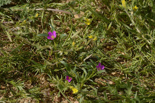
Overall, I had seen a nice collection of flowers: lots of blue dick, lots of filaree, lots of morning glory, some scattered lupine, and several concentrations of purple nightshade.
The way from this ravine back to the Los Pinetos trail was a pretty good walk, so I'd estimate another mile and a half, to that trail. Then probably 3/4 of a mile or more to get back to the car. Somewhere about four miles for the day, maybe five miles. I did not measure it well.
On my return, I passed by several large datura, or Jimson weed, near the parking area. I also passed the remains of a miniature golf course.
Walked between the parking lot and back on to Olive View Road. Then back to my car, and a drive home. Nice walk, lots of green, a fair amount of wild flowers. It was a good, easy walk. Enjoyed it, immensely.
Two Too Hot Hikes | White Mountains #1
-
For years we've travelled south to explore the Mojave. More times that I
can count, we've cruised south - and north again - along US-395 through the
Owens ...
10 hours ago


