Hiked Sunday, December 1. 4.5 miles. It seems like this must be a mistake, but, according to my blog, it's over three years since my last walk in the Oak Glen Preserve. It seems like I must have hiked more recently, but I have no blog entries to prove otherwise.
The good news is, in the past few years,
The Wildlands Conservan-cy has built several new trails in the area. It's now easy to assemble a hike of 4-5 miles or more without needing to retrace significant parts of your walk.
The trail-head is at Riley's at
Riley's at Los Rios Rancho, which is located at 39611 S. Oak Glen Road, Oak Glen (Yucaipa), CA 92399. From the West take the San Bernardino Freeway (I-10) east. Approximately five miles after passing the CA-210 interchange, exit on Yucaipa Blvd and head east (left). There are numerous restaurants along the next few miles of road, if you decide you're too hungry to continue.
After about 2 1/2 miles on Yucaipa Blvd, turn left on Oak Glen Road. Drive approximately 9 miles on Oak Glen Road, and look for Rileys at Los Rios Rancho, which will be on your right. The trailhead will be at the right end of the paved overflow parking lot that is to the right (as you enter) of the main lot.
The first thing I saw on my hike were some large birds, circling in the distance. Looking at the pictures, they look to me like white pelicans. After several orbits, they made their way east, above the mountains of Yucaipa Ridge, which is north of Oak Glen.
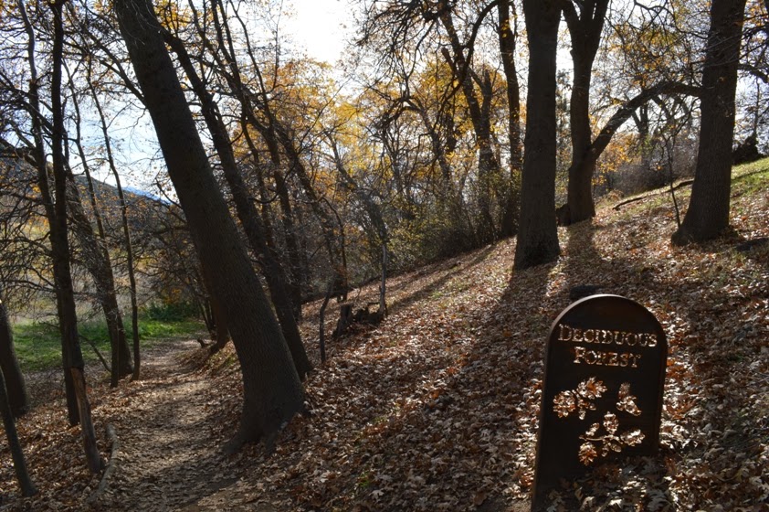
Next up were the two ponds, both picturesque, and lined by reeds, and by trees holding on to the end of autumn with all their might. At the upper pond, the Yucaipa Ridge was reflected in the glassy surface. On both, waterfowl swam upon and flew above the waters.
It's only about 1/4 mile from the trailhead to these two ponds. One could probably spend hours there, being still, and set with their camera to capture the unfolding of events here. However, I stayed only a few moments before continuing on my way. This meant backtracking my steps, now heading, I believe, to the southeast. The late morning sun was already hidden by the taller trees along this walk (albeit only partially, as most had dropped most of their leaves by now). This provided for some nice backlit pictures, which regular visitors to this blog may have discovered I just absolutely love.
The stream trail now descends along a broad old dirt road, with large oaks curving upon the way. About 1/3 mile down this way, the Chaparral trail splits off to the right, climbing a bit along the ridge here to provide a bird's eye view of Los Rios Rancho and the surrounding lands. It's not nearly as impressive from here as it would be from the trail to Preserve Point, which I would take later.
After the 1/3 mile or so detour up upon this hill, the Chaparral trail then drops back and rejoins the Stream Trail, not 100 yards further down from where you left. So this detour adds a bit of distance and altitude gain to an otherwise short jaunt.
I followed the Stream trail to its end, in a picnic area. From there, direction trail signs point out that it is .9 miles back to the trailhead from where you now stand (I assume this is taking the Stream trail, though the Boardwalk trail is probably essentially the same distance). It also tells you it's 1 mile to Preservation Point (straight at the sign), or .6 miles to return to the trailhead by continuing the loop (left at the sign). That would make a direct hike from the trailhead to Preservation Point and back as 3.8 miles. Add in the detour for the ponds and the Chaparral Loop, and that's the basis for my estimate of 4.5 miles for the day.
I decided to head up to Preserve Point. This trail is somewhat steep, and not nearly as well-trod as the trails you leave behind. Unfortunately, I'm also in poorer shape than I was a few years ago, so this little one mile climb sure seemed to be twice that long.
If I understood the Wildlands Conservancy ranger I spoke to after the fact, you need to follow this trail up to the ridge (which has several false 'summits'), then head north, to a gate. On the otherside of the gate is a sign saying the place you came from is private property (Rileys Los Rios Rancho, I assume). That would seem to suggest that the land on the other side of the gate is either owned by someone else or is public property.
If you were to cross through the gate, there's a dirt road not far beyond. I believe that dirt road rounds its way towards a nearby high point. Actually getting to that high point would require going on private land, but it was noted by someone (not the ranger) that the high point is owned by a utility and not normally subject to enforcement. But, technically, going there would still be trespassing.
Well, since I was already pretty tired (sad, I know) from the short but strenuous climb, and I was actually thinking I must have gone far beyond Preservation Point (which is not signed on the ground), I turned around here.
In later speaking to the ranger, it seems this area next to the gate is Preservation Point.
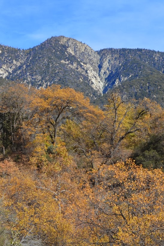
From there, and from the trail below, you've got some pretty impressive views. Far to the southeast is Mt. San Jacinto. More towards the south or southwest is Beaumont. Beyond Beaumont is a large reservoir, which would appear to be Lake Perris, which I identified by the large island in the reservoir.
The first photo of this post also came from near the climb up towards Preservation Point. I loved the rustic-looking farm houses and the pastures, orchards, and fields to the east-northeast.
It was a clear day, so the views through out the hike were outstand-ing. It was also a bit warm for the long sleeves I was wearing. This trail must be a killer in the summer.
I returned the way I came, retracing most of my footsteps, except I choose to take the Boardwalk trail on the return leg.
Great day for hiking.
The Wildlands Conservancy also manages Whitewater Preserve, where I have hiked before, and several other Preserves, where I have not been. Feeling so invigorated by my hike, I splurged and donated $20 for their coffee table book of the various preserves they manage.


this is a very thorough post and i love it thank you
ReplyDelete