Despite threatening weather earlier in the week, Saturday was clear enough to take a moderately long hike. I knew if the weather did cooperate, I was going to try heading out to the Middle Fork of Lytle Creek. I hiked this once before, in January of this year.

I wanted to verify my directions, so I decided to do this hike again.

You reach the trailhead by takng I-15 north to Sierra Highway. You exit there, and head west. Sierra Highway becomes Lytle Creek Road. Obtain your Wilderness Permit at the ranger station. Also, if you don't already have one, purchase your Adventure Pass there, too.
About 1.8 miles past the ranger station, Middle Fork Road is on your left. There's a sign saying it's three miles from there to the trailhead.

This time, I parked about 1/4 mile from the end of the pavement, where there's a large, flat parking area just down and to the left of the road.
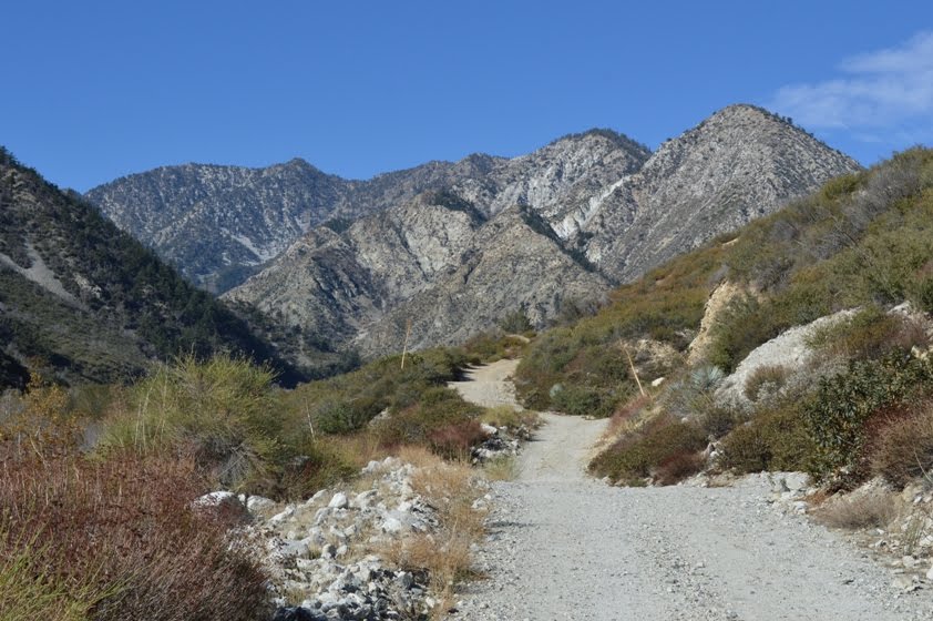
That meant I had a bit over 2 miles of walking along a dirt road each way, in addition to the 5.2 miles or so I would have had to the waterfall and back.

The start of this hike was warm. Although the temperature was probably in the 60s, it was in full sun, with little shade. That's the case for essentially the entire dirt road section of the trail. It's wide and on the north side of the canyon, so there's no escaping the sun. In this section, I wished I had worn shorts and a short-sleeved shirt.
I walked deliberately up the dirt road, which climbed consistently on up towards the trailhead. Most areas seemed like they would be passable for my car. Only two areas looked tricky (including the last stretch up to the official trailhead parking). If I took it slow and didn't mind knocking my alignment out of whack, I'm pretty sure I'd have made it okay. However, only high clearance pickup trucks and SUVs were in the trailhead lot both when I arrived and when I left.

There are only a few sections of this main section of trail where you need to pay careful attention. First, at the start of the trail, head off from the trailhead and resist the temptation to walk near the water way. Second, if at any point in the first mile, you find yourself rapidly descending towards the waterway, TURN AROUND. You missed a turn.
You may also take a few seconds when you reach a dry wash crossing in from the south. The trail is washed out for about fifteen yards by a wide path of rocks and sand. Scan the other side of the wash out and find your path on the other side.
Finally, when you reach "Third Crossing" (the first time on this hike where you will be crossing significant water, at least unless there's been a recent rain), you'll want to cross the stream, then begin heading downstream (east). You can either stick near the waterway, then turn north when you reach the fork coming in from your north, or head diagonally, to just west of what looks to me to be a limestone cliff. You would have seen this high and to your south as you were still on the main trail.

Some descriptions of the hike to these waterfalls would take you to the top of the highest of a series of falls. You'd need technical skills to make it down those upper falls to get to where you are standing now.
You will not need any technical skills to get to the base of the lowest of falls. But you might need to pick your way carefully. The rocks may be wet and slippery, particularly if the water is high. You might even find yourself needing to turn around, or else risk a significant fall into the water, or a willingness to walk through the pools that may be quite deep in spots.

I returned the way I came. Figure about nine miles and 2400 feet or so of elevation gain for the day. That was last Saturday. I sure wish I had done a hike today, but I got lazy. Should still be able to reach 80 for the year, though. It's not 100, but it's all I could manage, with my current work load.


Nice hike
ReplyDeleteLooks like a nice area!
ReplyDeleteIt is a nice area. Little far for an every day thing, but not bad for a weekend hike. Not nearly as crowded as the trails on the front range, either.
ReplyDeleteEnjoyed reading about this - after the holidays and weather permitting I hope to get out and hike more - this was helpful to read.
ReplyDelete