Hiked Friday, July 29. 2 miles.
After finishing the Alpine Pond hike, I headed over to the Rattlesnake Canyon trailhead. This one is just outside (north) of the boundary to the national monument.
My intent was to try something different for sunset. When I was here in the fall, I caught a sunset from along the trail to
Spectra Point. The next morning, I hiked to the Ramparts Overlook (It would appear I never blogged that hike!).
The sunset was undisputably amazing from that trail. But I did that, already. I looked at a map, and it looked like maybe I might get some nice views of the amphitheater rim, lit up by sunset, from this trail, too.
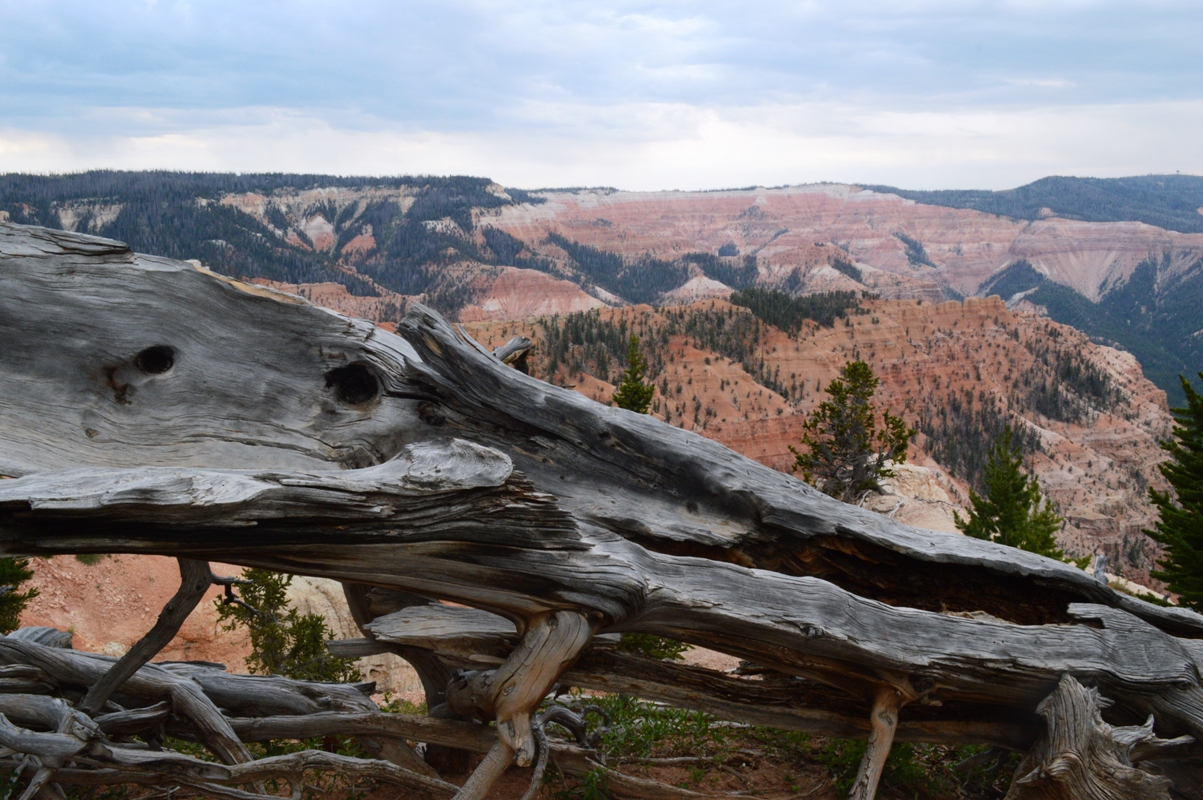
Alas, the clouds that began building ever when I was still down in Cedar City continued to build, and the sun was invisible as it set. So, no "rocks on fire," this evening.
Nonetheless, I knew this trail was supposed to give me a few views within the first mile down, back into the amphitheater. I thought it might be interesting, in its own right.
This turned out to be partially mistaken. The views were too close to the cliff, so you couldn't see a very large portion of the rim. You could look deep down into the "canyon." But, again, it was overcast, so the colors were somewhat muted.
The meadow of the upper trail segment was still pretty, however. Lots of wildflowers, here. Orange sneezeweed seemed to be the most common. There's also a shot of silvery penstemon, here.
Wildflower id's were using the Cedar Breaks National Monument wildflower app, which I mentioned in
my previous post.
There were also plenty of deer seen on this hike. I saw one or two on the way in. But, on the way out, I saw two clusters of 5 or so each, all within about 1/2 mile of the trailhead. But I was too lazy (and it was getting dark), so I took none with my dslr. And my phone camera is just too low of a resolution and too low of a focal length to produce a useful image of the deer.
I may one day try going further down Rattlesnake Canyon trail, at least to Stud Flat. But, from the map, it doesn't look like the view up will be very complete. Looks like you'd have to go further down, then cross back up Ashdown Creek to get a better view up at the Breaks, and that would require sloshing down the creek for several miles. That hike sounds very scenic, but probably too wet for my taste. But I would still like to try at least to Stud Flat. We'll see.
Still lots of catch up blogging to do. Not much recent hikes, so I'm getting to catch up some, although I'd like to get more hiking in, too. Looks like not much, until September, however.


No comments:
Post a Comment