Hiked Saturday, June 28. Not only am I well behind in the number of hikes I would like to have done by this time of the year, I'm also way behind in blogging what hikes I *have* done. This is my most recent, which leaves about six others still to be blogged.
The "Bristle-cone Trail" is usually referred to as the Bristle-cone Loop, but I didn't do the loop. The loop requires about .8 of a mile on pavement, and about two miles on a road-width grade that has no shade and little to offer versus the other part of the trail.
The Upper Bristlecone Trailhead is at the end of NV-156. To get here, you take U.S. 95 north from Las Vegas. About 30 miles northwest of the U.S. 95/I-15 Interchange ("The Spaghetti Bowl"), turn left at NV-156 (signed for the Las Vegas Ski Resort). Drive up this road until it deadends, just past the Las Vegas Ski and Snowboard Resort (about 17 miles).
There's a smallish parking area here. The trail-head is well-signed.
On your way here, you'd have passed the signed "Lower Bristlecone Trailhead, about .8 miles before. The trail from that point would be a road grade; during the Great Depression, the Works Progress Administration put men to work building a road through the mountains. When the War broke out, the project was shelved in favor of things with higher priorities and greater national security importance.
Note that there are no restroom facilities at either trailhead. There are some camp and picnic areas nearby, though, currently, those are closed. When they're open, I'd assume they'd at least have portapotties there, though I don't know for sure. This means you gotta go before you leave town, and/or be prepared for a walk in the woods.
From the upper trailhead, the trail runs along a low ridge, overlooking the base of the ski resort. Some of those runs look pretty steep!
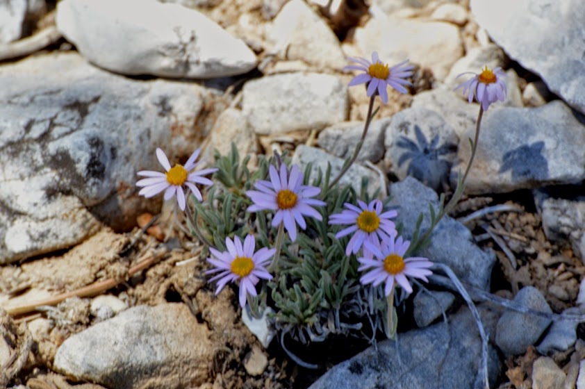
There's a fair amount of aspen here, which means in the fall, things should get pretty colorful. I guess in early spring, there must also be some runoff streams from all the snow on the high peaks. This year, by the end of June, however, there was snowmelt here. It was pretty dry, which is why I was really surprised when I saw some columbine blooming in the first ravine.
Also lots of a purple flower that didn't photograph well, small white, fragrant flowers, something that looked like very small aster, and a few other flowers.
On the return trip, along this last straight-away before getting back to the car, I saw a couple of swallowtail butterflies, mating. They moved fast and unpredictably, and I could not manage a decent focus on them, and definitely didn't have time to adjust my iso and shutterspeed. But I did wind up with an interesting picture, nonetheless. You'll know it when you see it.
Trail descrip-tions on-line also mentioned mountain bikes. Yes, they were there. They have no problem on the wide road that heads out of the lower trail-head, but the upper trail-head area is trickier for them.
They seemed nice enough, either way.
Descrip-tions online also mention that this trail is heavily used by all. When I started, at about 8am, I made it all the way from the upper trail-head to the junction with the Bonanza Trail. Probably saw no more than six bicyclists and a like number of hikers.
However, on the return trip, I must have seen twice that number of bicycles, and a crazy number of hikers. In particular, a "meet-up" was coming up the trail--must have been 30 or 35 hikers in that group alone. Add another 15 or so hikers in smaller groups, and that was a little much.
Well, in particular, the meet-up was a little much. Again, nothing against the individuals, but waiting at a narrow point in the trail for the 30-plus hikers to file past felt like waiting for a locomotive hauling a hundred boxcars to pass.
BTW, I guess I haven't mentioned why this is called the Bristlecone Loop. Yes, there are bristlecone pines, here. Lots of them. Most are healthy and green, and look nothing like you pictures bristlecone pines to look like.
But there is one ridge, maybe 1 1/2 miles from the upper trailhead, where a number of tree skeletons still stand, looking very much as you *do* expect them to look.
However, far more are healthy and alive, and you can contrast the two types, and wonder what sort of disaster it must have taken to kill those trees on the ridge.
Incidentally, there are interpretive signs at the trailhead that tell you how to identify bristlecone pines: Their needles are in bunches of five, and they grow off in all directions from the branch, giving a sort of bottle-clearer look to the branches.
A close-up of a living tree is below.
I hiked to the junction with the Bonanza Trail. The trail sign there said it was two miles back the way I came to the upper trail-head, or three miles forward to the lower trail-head. Those are approximate distances, I'm sure. The Forest Service says the full look is 6.2 miles.
I'm giving my distance covered roundtrip as four miles. It might have been a bit more, but that's what I'll go with. The remainder of the look forward didn't look that interesting, I didn't want to have to walk on pavement, and I had an engagement to make later that afternoon.


Wow, what a beautiful place. Looks like a great hike.
ReplyDeleteIt's a high-reward hike for such a short one, and one I may try to return to in the fall.
ReplyDelete