
Hiked Saturday, August 22. Approximately 12 miles total, out and back.
This new blogspot interface still has me confused; no idea why, but my pictures are again disaplying in smaller size, where you can click them and see them larger. I couldn't tell if this would happen as I wrote, but, after having "published," I can see the result. The text is not going where it was before, though. Weird!
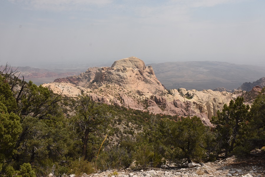
First shot is a panorama google made, automagically for me, by stitching together a couple of shots. Not sure when it decides to do this, but it's an interesting capability. It's near the end of the hike. That's the view from the saddle, where you'd decide whether to drop down and go forward, to Bridge Mountain (in front of you), or turn left, and go along the ridge line, to North Peak.

At the end of the pavement, the road continues as gravel, starting out smooth, then quickly becoming high clearance/4wd, only. This is Rocky Gap Road.

If you do have high clearance/4wd capability, you can drive up this road about 4.4 miles to the saddle, where the road would then descend, towards Lovell Canyon. There's a small, not entirely marked parking area there, on the left side of the road (if coming out of Red Rock) to park, and begin your hike.

 You start the hike at about 4,500 feet, so you'll be topping out at about 7,300 feet. Doesn't quite match up with the altitude they give, however.

Left side of the road is Rainbow Mountain Wilderness Area. Right side of the road is La Madre Mountains Wilderness Area.

From the saddle, it's a short 1 1/2 miles or so to North Peak, or six miles roundtrip to summit Bridge Mountain. But if you're walking, especially on a hot day, you'll be pretty beat just going the nearly five miles and 2,000 feet or so to get to the "trailhead."
Starting from Willow Springs trailhead, All Trails gives a total distance of 11.8 miles and 2667 net altitude.

The main point of this is that it's a relatively high-altitude hike for Red Rock. That makes it significantly cooler than most Red Rock hikes.

Most of the way on this one, you're hiking in juniper/pinyon pine forests.
You're also going along a couple of washes so where the washes cut along the road, you'll get some nice western redbud blooms in the spring, and some color in the fall (from the redbud, some desert willow, and wild grape).


Scattered clouds as my hike progressed. By the time I headed back, the increasing heat triggered the formation of cumulonimbus clouds, and even a few drizzles.
The picture below is just of some redbud seed pods.


No comments:
Post a Comment