There's a trail that goes around Convict Lake, and it's not particularly short, at a bit over 2.5 miles, because Convict is a pretty large lake. The other trail heads into the John Muir Wilderness from the far side of the lake.
Not long after you leave the parking lot near the outlet from Convict, there's this sign on the trailhead. If you click on the picture, you'll see a larger version, but the gist of the matter is that it says the bridge crossing Convict Creek, three miles ahead, is washed out, so plan accordingly.
So I was pretty sure I wasn't going to actually make it to Mildred Lake. I was pretty sure I'd stop at the bridge out, and turnaround. But I was open, depending on how I felt and how high the water was.
Well, it turns out, it's actually about four miles from the parking at Convict Lake to the bridge crossing, and by the time I got there, I was perfectly willing to call an eight mile out and back hike good enough for a day.
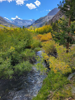
Despite being August and with the trail clear of snow, there were still some snow patches along the way, and their melt kept the water relatively high. But, unlike above Sabrina Lake, the slope of this creek and drainage meant far fewer stagnant pools, and basically no mosquitos. It was a more enjoyable hike, from that perspective, for sure.
On the other hand, with the faster drainage and dryer soil, there were far fewer wildflowers on this trail than above Sabrina.
The trail was well defined pretty much the entire way, up until just before the turnaround point, where use trails made the true trail less obvious. Still, once I got to the washout, there was no question that this was the place. Only the abutments remained. No sign of the actual bridge.
I was later informed that this was because it's not like the bridge got washed out this year. It's apparently been out for many years.
At the wash out, a side stream came in from the right, heading into the main stem. The bridge used to be just below that confluence.
The roar of the creeks was quite loud when standing near the water. And because I already knew (from my Alltrails recording) that I had gone four miles, I was ready to turnaround. However, in looking at my still shots, the water seems less powerful than it did in person.
Crossing would still require taking off my boots and splashing through swift water, but I think if I crossed the tributary, first, then either went further upstream or even crossed just above the confluence, the flow would not have been hazardous to cross. Yes, wet feet, and some time to dry my feet before lacing the boots back on, but not impassalbe, if I was committed. But I wasn't, because I didn't want to tire myself out too much, in the event of astronomy, later that night.
Spoiler alert -- It clouded out again that night, so I "saved" myself for nothing.
Returned the way I came. Passed only a few people who seemed prepared to continue past the water crossing. Almost everyone was on a day hike, and even then, it was a lot emptier than the trail around the lake.
Haven't been hiking much recently, for a variety of reasons. And not currently sure how many past hikes I still need to blog. So no more than maybe one more hike to post this year. So, Happy Holidays, and see you all in a few weeks!
Video from the crossing, here. Not sure if I uploaded it right. If not, I'll return tomorrow to fix that.


