Sunday, June 29, 2014

Hike 2014.035 -- Bristlecone Trail, Spring Mountains National Recreation Area, Humboldt-Toiyabe National Forest, NV

Hiked Saturday, June 28. Not only am I well behind in the number of hikes I would like to have done by this time of the year, I'm also way behind in blogging what hikes I *have* done. This is my most recent, which leaves about six others still to be blogged.

The "Bristle-cone Trail" is usually referred to as the Bristle-cone Loop, but I didn't do the loop. The loop requires about .8 of a mile on pavement, and about two miles on a road-width grade that has no shade and little to offer versus the other part of the trail.

The Upper Bristlecone Trailhead is at the end of NV-156. To get here, you take U.S. 95 north from Las Vegas. About 30 miles northwest of the U.S. 95/I-15 Interchange ("The Spaghetti Bowl"), turn left at NV-156 (signed for the Las Vegas Ski Resort). Drive up this road until it deadends, just past the Las Vegas Ski and Snowboard Resort (about 17 miles).

There's a smallish parking area here. The trail-head is well-signed.

On your way here, you'd have passed the signed "Lower Bristlecone Trailhead, about .8 miles before. The trail from that point would be a road grade; during the Great Depression, the Works Progress Administration put men to work building a road through the mountains. When the War broke out, the project was shelved in favor of things with higher priorities and greater national security importance.

Note that there are no restroom facilities at either trailhead. There are some camp and picnic areas nearby, though, currently, those are closed. When they're open, I'd assume they'd at least have portapotties there, though I don't know for sure. This means you gotta go before you leave town, and/or be prepared for a walk in the woods.

From the upper trailhead, the trail runs along a low ridge, overlooking the base of the ski resort. Some of those runs look pretty steep!

There's a fair amount of aspen here, which means in the fall, things should get pretty colorful. I guess in early spring, there must also be some runoff streams from all the snow on the high peaks. This year, by the end of June, however, there was snowmelt here. It was pretty dry, which is why I was really surprised when I saw some columbine blooming in the first ravine.

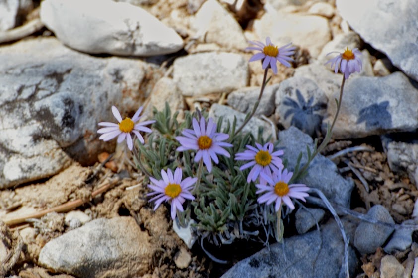
Also lots of a purple flower that didn't photograph well, small white, fragrant flowers, something that looked like very small aster, and a few other flowers.

On the return trip, along this last straight-away before getting back to the car, I saw a couple of swallowtail butterflies, mating. They moved fast and unpredictably, and I could not manage a decent focus on them, and definitely didn't have time to adjust my iso and shutterspeed. But I did wind up with an interesting picture, nonetheless. You'll know it when you see it.

Trail descrip-tions on-line also mentioned mountain bikes. Yes, they were there. They have no problem on the wide road that heads out of the lower trail-head, but the upper trail-head area is trickier for them.

They seemed nice enough, either way.

Descrip-tions online also mention that this trail is heavily used by all. When I started, at about 8am, I made it all the way from the upper trail-head to the junction with the Bonanza Trail. Probably saw no more than six bicyclists and a like number of hikers.

However, on the return trip, I must have seen twice that number of bicycles, and a crazy number of hikers. In particular, a "meet-up" was coming up the trail--must have been 30 or 35 hikers in that group alone. Add another 15 or so hikers in smaller groups, and that was a little much.

Well, in particular, the meet-up was a little much. Again, nothing against the individuals, but waiting at a narrow point in the trail for the 30-plus hikers to file past felt like waiting for a locomotive hauling a hundred boxcars to pass.

BTW, I guess I haven't mentioned why this is called the Bristlecone Loop. Yes, there are bristlecone pines, here. Lots of them. Most are healthy and green, and look nothing like you pictures bristlecone pines to look like.

But there is one ridge, maybe 1 1/2 miles from the upper trailhead, where a number of tree skeletons still stand, looking very much as you *do* expect them to look.

However, far more are healthy and alive, and you can contrast the two types, and wonder what sort of disaster it must have taken to kill those trees on the ridge.

Incidentally, there are interpretive signs at the trailhead that tell you how to identify bristlecone pines: Their needles are in bunches of five, and they grow off in all directions from the branch, giving a sort of bottle-clearer look to the branches.

A close-up of a living tree is below.

I hiked to the junction with the Bonanza Trail. The trail sign there said it was two miles back the way I came to the upper trail-head, or three miles forward to the lower trail-head. Those are approximate distances, I'm sure. The Forest Service says the full look is 6.2 miles.

I'm giving my distance covered roundtrip as four miles. It might have been a bit more, but that's what I'll go with. The remainder of the look forward didn't look that interesting, I didn't want to have to walk on pavement, and I had an engagement to make later that afternoon.

Sunday, June 15, 2014

Mojave Star Party, and a Non-Hike to Cow Cove Petroglyphs, Mojave National Preserve, CA

Not hiked on May 31, 2014. I don't usually post about hikes I don't go on, but this one requires an exception.

I had very high hopes for multiple hikes on this trip (Friday, May 30 - Sunday, June 1). I was driving out to Las Vegas on a Friday, driving down to Mojave Preserve on Saturday, then back home on Sunday. I was thinking two, maybe three hikes for the weekend. Instead, I got zero.

I did get some nice views of a very dark sky, however. That was for the bi-annual Mojave National Preserve star party. Twice a year, some friends of mine (and, most times, me, too) head out to the Mojave National Preserve with our telescopes, and we show lovers of wilderness something we can not show them from here in town: A really dark sky, and some of the wonders of the cosmos that you can only see from a really dark location.

The next star party's going to be on Saturday, November 1, 2014, in case you want to start planning your fall hikes already. :D

Well, so there I was, trying to plan some hikes for this long weekend, and I come across this site. It does not it is "difficult" for non-4wd, but that it is accessible by all vehicle classes. I spent some time looking at google maps satellite imagery to match the description up with actual photos of the route, and it looks pretty straightforward.
So, off I go: exit I-15 at Cima Road, south about 1/4 mile to Aiken Mine Road. Turned on the road. . . And in less than a mile, I was stuck in the sand. This was after several experiences that felt a lot like driving over ice: car's sliding, and turning the steering wheel has no effect on your direction of travel.

So I used my arms and hands to clear a path in the sand and got rolling forward, again.
After another 100 yards or so, I'm stuck again. And I'm not even at the part on the map that warns of deep sand. Practically the whole freaking road is deep sand.

So then I decide, well, better turn around, because I've got another six miles of road, and this isn't even the tough part. And I'll have to drive back on this, too.

Of course, as expected, turning around in deep sand is not easy. You're going perpendicular to the lines of travel (where previous tires have compressed the sand a bit). So I get stuck about four more times before finally getting back on to some tire tracks and making my way back to the pavement.
After I got back to the gas station on Cima road, I asked one of the workers there, "Hypothetically speaking, if I were to get stuck in the sand of Aiken Mine Road, how much would it have cost to get pulled out? Answer: Probably $500. So, my advice: Do NOT attempt reaching Cow Cove petroglyphs by passenger car via Aiken Mine Road. It's definitely for high-clearance and four wheel drive vehicles. If you ignore this advice, be sure to bring a shovel to dig yourself out (clearing a low path where your undercarriage doesn't drag along the sand as your wheels sink into the sand).

This was my experience in a Saturn L200. It's what I would consider to be a midsized car, with a fairly long wheel base and skinny tires. Driving something with a shorter wheelbase, slightly higher clearance, wider tires, and NO traction control MIGHT give you more success.

As for me, I'm planning to wait until fall, then just park my car near the start of Aiken Mine Road wand walking the 14 miles or so to the petroglyphs. This might also prove too difficult, since walking on sand means a lot of wasted energy. But, for me, it's either this or wait until I have four wheel drive.

Obviously the pictures on this post are all from the star party, and none are from my unsuccessful hike attempt. As I ssid, the star party went great. :D

Saturday, June 7, 2014

Hike 2014.029 -- Gabrielino Trail to Lower Sturtevant Canyon, Angeles National Forest

Hiked Wednes-day, June 4. Hmmm. I guess this would have been the 25th anniver-sary of the Tiananmen Square massacre.

I haven't been hiking that much recently. Even more so, I haven't had time to blog what few hikes I have been taking. As I write these words, this was the last one I took, although I may hike again before I actually get this posted. I have 3 or 4 other hikes that remain to be blogged.

This being a short and nearby hike for me, I've been here many times before. Most recently was back in March, when the water was slightly higher and I had my new telephoto lens to take some nice close-ups of the falling water.

I anticipated very low water, and had no other expectations about what else I might see. I just wanted to get myself a little walk in the woods, it having been far too long since my last hike. One thing I did decide to do was, rather than going to the base of the falls, I would stay on the lower Gabrielino Trail, which leaves the canyon just before Fiddler's Crossing, and heads just above the lip of Sturtevant Falls.

Along this trail, I had two pleasant floral surprises. The first was a single mariposa lily (first photo in this post), which I encountered a bit before reaching the lip of the falls. It was right adjacent to the trail, and it was a little hard to get a good angle on the bud.

This was the first mariposa lily I had seen on this side of the San Gabriel Mountains so far this year. Of course, admittedly, I have not been doing much hiking this year.

My second surprise was the two Humboldt lilies, which I found just above the lip of the falls, overlooking a deep alcove where a falls above "the" Sturtevant Falls. Hadn't seen any of these in at least a year.

Humboldt lilies are large and showy, and look so dramatic that it's hard to believe they're not part of someone's garden. Yet, while rare compared to many other wildflowers, I have seen them on several other hikes in southern California, including Lewis Falls and Topanga State Park.

Those two flower finds made me even happier that I managed to drag myself out of the house this day to get a little bit of mountain trail under my feet.
The other flowers I saw were Spanish broom (this last photo), Indian Pink (a couple photos up, overlooking that same alcove where I saw the Humboldt lily), and a whole bunch of wild mustard and monkey flower (which I did not photograph).

While overlooking the falls, I saw a flyfisherman. I don't really approve of fishing places where the water is so low and going to get lower and warmer, since the native trout there are already living on the edge, and don't need the additional stress of being caught and released.

About four miles for the day. Not much, but it was still nice to get out in the mountains, if only for a few hours. Got back to my car and drove out the gate at 7:57pm, just three minutes before the gate is ostensibly looked. Numerous cars and day hikers remained behind me, so either they got locked in, or they knew when the gate would actually be locked.

Saturday, May 17, 2014

Hike 2014.022 -- Claremont Wilderness Park

Hiked March 30, 2014. One of my hikes from earlier in the year that I hadn't gotten around to blogging, yet. This one was new ground for me. I tried hiking here once before, but I think there was a fire closure order in effect at the time

The trailhead is at the north end of Mills Road. There's also another nearby parking area at the northeast corner of Mills and Mt. Baldy Road. I parked in that one because I didn't know any better. Parking there was $3 for most folks, but free if you are a Claremont resident with a resident sticker on your car. The upper lot is $3 for everyone. Seeing so many cars in the lower lot, I just assumed the upper lot was filled, so I parked there. I didn't figure out until later that the lower lot always has cars because that's where Claremont residents park.

Claremont Wilderness Park is a city park of 1640 acres, set just below the Angeles National Forest. The main hiking trail here is a five mile loop along Cobalt Canyon Motorway and Johnson Pasture Road. It also connects to other trails that could take you west, to Marshall Canyon, north, to Potato Mountain, or east, to Evey Canyon. It also links to a couple of other city trailheads.

My hike began with a bit of excite-ment, as I heard the screeches of raptors and saw a pair of red tailed hawks flying not too far away. They were flying back and forth towards each other, and occasionally linked talons during their dance in the sky. I attached my long telephoto lens and did the best I could. Unfortunately, this lens is manual focus, and the depth of field with this lens is very shallow. That makes it hard to get a really sharp focus even on things that aren't moving. With flying objects, it's darn near impossible. So I got a couple of decent but no really good shots.

Later, once on the actual trail, I came to a fork in the road. Either way was going to be a motorway type of trail: as wide as a two-lane road, and relatively shallowly graded. I'm not sure if I remember why, but I went to the right. The sign said, "Cobal Canyon." The other way said, "Burbank." That would be the trail or canyon; it does not lead to the city of Burbank!

Although I didn't know it at the time, there were mileage polls at one mile intervals. Going right gives you the advantage of a countdown, so you can tell how many miles remain in your hike. Going the other way would give a count-up, which is not helpful if you don't already know how long your trail might be. However, if you're reading this, you now know the trail is five miles long.

Based on the contour lines, going counter-clockwise (right at the first split) gives you a less steep climb overall, and ends with a steep decent at the end. That means, obviously, that if you go clockwise, your hike will start with the steep incline. Going either way leaves you with relatively little shade, especially once you climb out of the oak forest. So this is an early or late season or early day/late afternoon hike. If you're hiking in the heat, bring lots of water.

Being the first time on this trail, I had no good idea of what to expect. What I experienced was a surprisingly busy trail. Yeah, it was a weekend, of course. And it was never as busy as, say, going up Mt. Hollywood. It wasn't even as crowded as Azusa Peak used to be. But it's well-traveled by a mixture of hikers, walkers, joggers, and mountain bikers.

If it's clear, you'll have expansive views to the south. The Angeles is to your north, so you can't see very far that way. As noted, there is good access from these trails to several different destinations. On the other hand, parking permits (at the lower lot, at least) are for four hours. That might limit which destinations you would have time to reach and return.

On the day I hiked, there was a fair variety of small wild-flowers. The grass was also still green and the weather was perfect for hiking. Given the alternative destinations, I'll keep this trailhead in mind for future early or late season hikes.

At the time of this hike, I was still just getting some new use out of my 500mm Tamron catadiop-tric lens. It's what I used for the hawk pictures near the top of this post, and for most of the flower pictures (and the lizard picture) later in this post. It's really trick to use, but, if you do manage to get a good focus, the narrow depth of field makes for some decent quasi-macro shots. It also produces the "doughnut hole" boka (out-of-focus blur) if there are any point light sources in the background.

Got one decent shot of what I assume to be a western fence lizard. This one's got a bit of color mixed into his back, though.
The last two miles or so of this trail give you some nice, wide-open vistas. You're running with good clearance to the south, and nice foregrounds both north and south. The trail also backtracks under itself on occasion, so you can get shots like the one a few down.

There was also a fair stretch where you could see downtown Los Angeles. It was a little hazy on this day, and, of course, from way out here in Claremont, you're practically in San Bernardino County, so the look back towards downtown L.A. is a long one.

This being back at the end of March, the wildflowers peak here had probably not been reached. The little tiny purple flowers in the fifth and eleventh pictures were among the more common, and they were far from obvious to see. The morning glory were also visible, down near the start of the hike. Didn't see much else for most of the hike, though the fiddleneck became common on the switchbacks near the end.

The only other interesting surprise was the cassia. I knew that plant from (informally) studying the Sunset Western Gardens book, back when I was looking for low-water use plants. These guys are from Australia, so I was a little surprised to see them out here in a "wilderness" park. Of course, it was just off a dirt road, and not that far from the street. Likely, seeds hitched their way up here from someone's tires or shoes, and they had such a plant in their yard.

Ideally, people would only plant native or quasi-native plants (plants that either naturally occur where you are using them, or immediately-adjacent area) in their yard. Then, even if they "escape," at least they are plants that belong in the area, and are plants that local insects and animals can utilize for food.

After getting lots of shots of the cassia, I made my way down towards my car. Just about five miles for the loop. Not sure on the altitude gain, but my very rough guess would be about 500 feet. Not much shade, except in the lowest sections of the trail. No water. Porta-potties are available at the bottom of the trail, and at a couple of places along the way.

It's a nice hike if the weather is mild, though by no means is this "wilderness." Apparently, cities have determined that if there are no ball fields and picnic tables in a park, it's a "wilderness" park.

Tuesday, May 13, 2014

Hike 2014.026 -- Echo Mountain

Starting writing this post a week ago, but, just as I'm not finding much time for hiking, and I'm finding much time to blog.

This was my first hike in three weeks. That's probably the longest I've gone without an official hike (more than three miles, off-pavement) in four years.

In the interim, I did take a few short walks, either just around the block, or to the Huntington Gardens, or to Santa Anita Park. So I was not entirely sedentary. But I was way less active than I have been in the past. And, as past experience has taught me, a body at rest tends to stay at rest. It was tough to finally feel ready to hit the trail again.

As is almost always the case, once I finally get on the trail, I feel good. Nonetheless, because of the long layoff, I walked slower than normal.

I initially intended to hike to Henninger Flats. However, I had just barely started when I heard a Sheriff's Department announcement from a radio car: "The park closes today at 7pm). Did that mean they were going to lock the gate at 7pm? It's supposed to be locked at sunset, and there's usually a grace period, so I was thinking I'd have time (even leaving after 5:30pm) to get to Henninger and back. But the announcement spooked me, so I walked back to my car, and then drove west on Altadena Drive, over to Lake, then on up to the Echo Mountain trailhead.

Not a lot of density of flowers, but I photographed most of what I saw.

No pictures of some primrose near the start. But, other than that, pretty much everything I saw is here. First up was the phlox. Pretty and purple. I often wonder if these flowers were what the Start Trek people were thinking of when they named that character on ST: Voyager. Well not *really* often. But once in a while.

Then, a yellow flower I've seen and learned before, but could not find a name for this time around. Then some purple penstamon.
Next, some very orange-y monkey flower.

There were also plenty of wild mustard, though I don't photograph that very often. Don't want to reward the invasive!
As you gain altitude, the San Gabriel Mountains rise before you. I always love the color of the mountains when the sun gets low. The hikers to give perspective to the size was nice, too. Not by design, though: They just stopped at the point and left me no choice but to include them in my picture. Not complaining about that, though.

The next flowers on this parade of wildflowers after this mustard) are golden yarrow, desert poppies, black sage, and blue dicks.
After that, its mostly pictures of the "White City."

This trail is one I've walked probably more frequently than any other. It's also probably the first trail I ever hiked in the Angeles. It's a good length what a nice payoff at the end (the "White City").

Yet, despite these many return trips, I still see new things here. On this trip, I noticed what looks like a lot of restoration or conservation going on at the White City.

Walls that did not seem apparent in past trips have been cleared and partially re-stacked. Other rocks have been laid out to set off the man-made structures more obvious.

The best time to visit, in my opinion, is near sunset.

This trail looks to the south, but with good visibility to the west, as well. You can watch the sun a long time, and watch the long, warm colors of the setting sun affect the appearance of the walls of the old resort here on Echo Mountain. You can also watch the shadows of trees on those same walls. It's just an all-around great place to watch the sun set.

The other nice thing is, the trail is now very well improved and easy to walk, even in poor light.

That's not to say you can ignore where you put your feet. You still need to pay attention, of course.
However, with the clear trails, and the bright lights of the city below, if you can add a moon (which was there the evening I hiked), no flashlight is necessary, at least not until you're quite near the end, and the canopy blocks out those lights.

So, when I go, I typically try to start down pretty much as the sun sets, and can usually make it to the trialhead by the end of twilight.

Yet, wheat I have noticed is, even as I am heading down, others are heading up. Apparently, many people either spend the night, or at least some amount of time after dark up on this trail.

In total night (as opposed to twilight), flashlights might be helpful. My suspicion is, you'd only really need them at the end. But, being risk averse, I would tend to want to head down by sunset, to get off the mountain by the end of twilight.

Not much else to say. The hike was a success. I enjoy my time on the trail, although it really took some effort to get myself out of the house and on the trail for the first time in so long. Roughly five miles of hiking, and, as I recall, about 1200 feet of vertical gain. Perfect for a late weekend afternoon. Or even a weekday afternoon, if you can get up here early enough.