Hiked Thursday, July 2. Not my most recent hike, but a relatively recent one to one of the lesser known waterfalls in the Front Range of the San Gabriel Mountains. From the 210 (Foothill) Freeway, exit at Azusa and head north, through "old" Azusa, across the Gold Line tracks, and on into San Gabriel Canyon. Stay on the main road, and observe the mile markers. Long after you've passed the dams and the reservoirs and the East and West Fork junctions, continue just past Mile Marker 34.54.
There's a rusted, metallic Caltrans rock dispenser (you'll know it when you see it). Within 1/4 mile of this point, as you head straight into the "armpit" of a ravine, and you would then need to make a hairpin turn to the left, open your ears. Hopefully, you'll hear the sound of running water.
There's room for about three carefully parked cars at this turn, plus small turnouts on the downhill side, just past the turn, and a small "deadend" driveway on the uphill side.
From there, follow the trail up and around a cabin. Your trail generally stays above and to the right of the water, which is shrouded in thick undergrowth. (It used to be thicker, but a lot of that clutter has been cleared over the past four years).
Apparently, it's been just about four years since my first visit here. Because of the drought, the water's lower than it was on my previous trips. But it's still a nice waterfall.
The silt has also cleared, which makes it a lot easier to get to the base of the falls than it used to be.
The hike still requires some ducking under and balancing over, but it's a short 4/10ths of a mile each way, so it's still a quick and easy hike. But, because of the lack of parking and signage, it's relatively lightly visited. I only saw one other person on this trip.
The falls themselves are in a nice little alcove. The past four years of running water have helped clear the alcove a bit, and make it easier to approach the base of the falls without getting your feet wet (at least in July--might be harder to do during an actual spring melt).
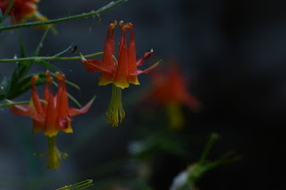
In the alcove, there have always been lots of columbine in bloom. This trip was no exception.
I've also always seen one lily plant on the approach. I used to assume it was a Humboldt lily, but it might actually be a leopard lily.
After this short little hike, I then planned to drive up to the end of Highway 39 and hike from there to the peak that's opposite Smith Mountain. I'd hiked to that peak both from Smith Saddle and from Highway 39 in the past. Unfortunately, the "Highway Closed" sign just past the turnout for Crystal Lake now prohibits, not merely cars, but also bikes and hikers, so you can no longer walk on the road to access the ridge.
So I retreated back to my car, then drove on up to Crystal Lake. I visited the lake (VERY low!), then checked to see if trail access had changed any since my last visit. I determined where I could park to access the trail to Windy Gap, then returned home. The next day, I headed on up to that trailhead for my 53rd hike of the year.
A Death Valley Spring | Funerals #5
-
After a spectacular hike up King Midas Canyon, I'd planned to camp
somewhere near the mouth of Monarch Wash - which I've visited the upper end
of in the pa...
9 hours ago


No comments:
Post a Comment