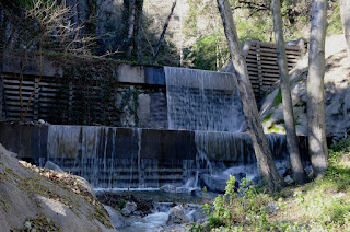
Hiked Friday, January 27. Four miles. This was two weeks ago last Friday. Took advantage of an off-work Friday to hike what is usually an unparkable trailhead on weekends. Water was much higher than my last few visits, but still not that high, by historical standards.
My waterfall shots are mostly longer exposures -- about f/16, ISO 100, and 1/4 of a second or so. That's why I get the soft, veil-like texture in the water. But this also makes the waterflow appear greater, because the water moves quite a bit during my exposures.
The trailhead is at Chantry Flat, which is at the top of Santa Anita Avenue. That's accessible right off the Foothill Freeway (I-210). Head north, through Sierra Madre, and on to the end of the road.
Parking requires an Adventure Pass or federal lands recreation pass. On weekends, the lot fills early. On Friday, I thought things would be easier, although the lot was basically at capacity when I got there (around 9am I think). I had to wait to park for a while because some dingus was digging around in his car for who knows what, and had his door blocking the only remaining spot in the lot.
To get to Sturtevant Falls, you head down to the east from the lots, down a paved road that is not usable by the public. At the bottom of the hill, Winter Creek comes in from the west. The last few times here, no water at all was coming down Winter Creek. This time, there was actual water, and one might actually want to use the wooden bridge to stay dry, and not just take the more direct route.
Water was also coming down Big Santa Anita Canyon quite swiftly, as well.
There are a couple of stream crossings on this hike. On the day I went, I had no problem keeping my socks dry. The water was actually lower than I expected, given how much recent rains had fallen. It was still pretty, of course. And the sound of falling water is always relaxing. Additionally, the crowds were pretty manageable.
Got some nice shots on my final approach, as well as at the base of the falls.
Too tired to take the route to the top of the falls, so I just headed back.
Roundtrip is about 4 miles. The final climb back up is a good climb, of course. Incidentally, at the first major turn to the right (heading down from the top) is a concrete spillway. If water is running high, there'd be water crossing the road here. If you look up that canyon, you'll see a small waterfall 100 yards or so off that way, too. But, again, I was too tired to want to make that detour, too. Just headed back to my car.
No hikes since, due to various conflicting demands and medical conditions. May try to squeeze a hike in next weekend, tough it's looking pretty busy, family-wise.
Rain is in the forecast for Friday and probably Saturday. I may try to hike on Sunday, visiting some waterfalls, again.
A Cold Morning on Chloride Cliffs | Funerals #3
-
I inched toward the edge of the cliff under cover of darkness. My
super-bright, bumper-mounted Diode Dynamics SS5 lights cut multi-mile-long
daggers into t...
2 days ago


No comments:
Post a Comment