First did this hike back in 2016. Hadn't necessarily planned to hike it again, but it became one of those, "I have time for a modest hike today, and don't want to have to hassle with the shuttle bus in Zion Canyon" sort of day.
The two longer hikes I'd like to take from up this way are Hop Canyon towards Kolob Arch, and the West Rim Trail. Those would be all day hikes. This one, by contrast, is only about 4.5 miles roundtrip if you just go to the overlook, or a bit longer if you decide to tackle one of the "gates."
From Utah Highway 9, take Kolob Terrace Road north. Alternatively, if coming from the west, you can take Pocketville Road north, through a residential area, and it will intersect into Kolob Terrace Road. Both are in the town of Virgin, Utah. From there, you head north about 12.5 miles, through some very scenic country with several other trailheads along the way. The last major signed trailhead would be for Hop Valley, although the Connector Trail (between the Hop Valley trailhead and the Wildcat Canyon Trail) crosses Kolob Terrace Road. There's a modest parking area at this trailhead, with a vault toilet but no running water. I've had no trouble finding room the two times I've been here, but it could just be a timing thing.
This trail initially heads south, out of the parking area, before turning east. Within the first 3/4 of a mile, the Connector trail comes in from the right, then the Wildcat trail shoots off and down, to the northeast. At that latter split, the Northgate Peaks trail veers to the south, staying above the rim. It's mostly level, and a mixture of grasslands and dwarf forest pretty much the whole way to the primary overlook.
That's where the "official" trail ends, at which point you could turnaround and retrace your steps back to the trailhead. Alternatively, you can take unofficial routes up the massive rocky protrustions on either side of the overlook. After you've turned around, the one on your right (east) is pretty straightforward, and does not require giving up much altitude before you scramble up the "gate." The one on the west would both require giving up more altitude, and have a much steeper and less protected approach.
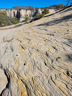
The last time, I just walked back to the trailhead. This time, shortly after turning around, I noticed the path heading towards the east Northgate, and decided to explore. After a brief descent through a forested patch, I came out at the base of the stone dome. It was a good scramble up, but entirely non-technical, and not exposed. From the top of that gate, you've got a wonderful view the drainages for Left and Right forks of North Creek. Lots of exposed cliffs, some stained pink, others bleached white.
Once back down off the dome and on the main trail, it is again mostly flat and straightforward, back to the parking area.
I'd still like to hike Hop Valley and the West Rim trails, and possibly also the Connector trail. I looked up into Hop Valley years ago, when I hiked down in LeVerkin Canyon, and I've looked down it, from the Hop Valley Trailhead. It would be long, with cow patties and sand, but straightforward. The West Rim trail, I haven't decided how far I should go from either the top or the bottom, but it's something for a later trip to southeastern Utah.


No comments:
Post a Comment