Tuesday, January 18, 2011

Hike 2011.005 -- Chantry Flats

Hiked Tuesday, January 18. I ended up hiking somewhat further than intended. When I left the house, I was just planning to walk the paved/dirt road that heads up from the upper parking lot. That would be about five miles or so. Once I got there, I figured I couldn't resist seeing Sturtevant Falls. So then, the plan was to hike there and back (about four miles). But once I got to the falls, I couldn't resist walking further. Also, my desire to avoid retracing my steps forced me to take a long, round-about way to get back home.

Chantry Flats is located at the end of Santa Anita Avenue. From the 210 freeway, you'd exit at Santa Anita and drive north. You'll drive right by the race track as you head through Arcadia. After entering Sierra Madre, Santa Anita soon becomes a one-lane road. Make your way through the residential neighborhood, and you'll come to a gate. If you arrive at the gate betweeen 6am and 8pm, the gate should be open. From there, you have a bit of mountain driving. Just keep going straight until you reach the parking lot. Ideally, you've already got your Adventure Pass. If not, you can either hope the ranger station (near the third tier of parking) is open, or hope to find a spot in the grocery store, where they often have an "honor system" five dollar charge to park. Of course, if you arrive on a weekend or holiday, you probably won't find parking anywhere.

The shortest way to Sturtevant Falls is to walk down the paved (but gated) road near where Santa Anita enters the parking lot. After about 7/10ths of a mile, the pavement ends, as does your descent. At this point, there's a bridge that carries you across Winter Creek. The Lower Winter Creek Trail begins here, and you'd get on that by making a left turn, here.

To get to Sturtevant Falls, however, turn right after you cross the bridge. There are pit toilets at this junction, by the way, and if you're heading to the falls, this is probably your last chance to use something other than a tree to relieve yourself. The trail after the bridge is still broad and easy to follow. The rivers remains on your right and there's a hill on your left. On either side, you'll soon pass numerous cabins. After about another 1/2 mile, you may notice a pair of trails heading off to your left. This is the Gabrielino Trail. You may wish to check those trails out, later. On my way in, I ignored them, and continued heading straight.

At Fiddler's Crossing, I crossed the water. I'm not sure if they call this Sturtevant Creek or Santa Anita Creek, but it's the main water in Santa Anita Canyon. From there, it's another 3/10ths of a mile to the base of Sturtevant Falls. If there's been recent rain, the falls run loud and misty. If it's late summer and dry, the water slows to a quiet trickle. Today, the water was running nicely.

After about ten minutes of enjoying the sight and sounds of a waterfall, I then backtracked the 3/10ths of a mile back to the Gabrielino Trail. The one that bears to the right after the split is for hikers, only, and takes you to the top of Sturtevant Falls. The one that bears to the left is open to hikers or horses. I'm not sure if I ever took that route. Both meet up again after .9 miles. The Gabrielino Trail gives you a nice, bird's eye view of the falls. It also keeps you close to the creek, and lets you see the numerous cascades above Sturtevant Falls. After that, the trail continues to follow Sturtevant Creek. When in doubt, just keep going up the main stem of the creek, and you'll be on the right track.

Two-and-a-half miles after leaving the Sturtevant trail, the Gabrielino Trail takes you Spruce Grove, a hike-in campground. There appear to be pit toilets here, although I've never tried them. You'll also have passed the Cascade picnic area, which appears to consist of a bench. There are emergency call boxes at both locations.

Three-tenths of a mile after Spruce Grove, you pass a junction. This is a little after you've passed the entrance to Camp Sturevant, where you would have crossed over the creek rather than continuing straightin into the private camp. At the junction mentioned above, a sharp left turn here would keep you on the Gabrielino Trail as it goes from there towards the West Fork of the San Gabriel River. It would also give you access to the Rim Trail approach to Mt. Wilson. Unfortunately, this section of trail has been closed for over a year. Instead, you need to go on the Sturtevant Trail.

One-eighth of a mile after starting on this trail, you reach another junction. A left turn here would, after three miles, take you to the top of Mt. Wilson. Of course, getting all the way up there and back would require either a longer day or an earlier start. Instead, I turned left, on to the Mt. Zion Trail. It's roughly 1 1/4 mile from there to the top of Mt. Zion. Unfortunatley, by now, my camera battery was dead. Also, the view from Mt. Zion wasn't very interesting. It was hazy, so even the view up towards Mt. Harvard and the solar telescopes of Mt. Wilson was a little fuzzy. The view down into the San Gabriel Valley was even worse.

After spending about two minutes at the summit, I backed down to the main trail and continued to Hoagee Camp, then took the Upper Winter Creek Trail back to Chantry Flats.

So, total mileage for the day: 1.5 to Sturtevant Falls, about 3 miles from the Falls to the Mt. Zion Trail, 2.8 miles on the Mt. Zion trail (including the 1/10th of a mile from the trail to the summit and back), 2.1 miles on the Upper Winter Creek Trail to get back to the paved road, then another .2 mile or so to get to the car. That's about 8.6 miles, total. Hmmmm. It seemed like more. :D Santa Anita Canyon has been heavily modified. In addition to the cabins and the non-native plants that came with them (especially English Ivy and periwinkle, but also a lot of Himalayan blackberry), the flood control folks did some major work here in the 1960s and 1970s.

Thought I'd try uploading a video, again. It's of Sturtevant Falls:

Sunday, January 16, 2011

Hike 2011.004 -- From GMR, North on Monroe Truck Trail

Hiked Saturday, January 15.

Because I had another night of astronomy outreach yesterday (the third of the week for me), I had to keep my hike brief. I didn't leave home until after 11am, and wanted to get back by 3pm. This made it a perfect time to take a stroll that would continue a previous hike. I drove up Glendora Mountain Road and parked where Lower Monroe Truck Trail (2N16) intersects with Glendora Mountain Road. Last time, I walked about a 1/2 past the crossing. Today, I started at the crossing and figured to walk about three miles down the road, hoping to get some nice views of San Gabriel Reservoir.

This was the first time I remember driving this section of GMR. It's very windy and narrow, and, on Saturday mornings, it is practically overrun with bikes and motorcycles. You need to be particularly careful on the way up, because the bikes move slow, and you'll pass many. The motorcycles, by contrast, move fast, and they'll be passing you on the left. So between bicycles on your right, motorcycles on your left, on-coming traffic, and the narrow, winding road itself, there's a lot to pay attention to.

On the way down, by contrast, I think the bicycles can move about as fast as a car, so you won't pass many. Still need to pay attention to the road, the on-coming traffic, and the motorcycles, though.

I didn't measure the distance, precisely, but I think it was about eight miles of driving on GMR to get to my destination. It was a little bit after a road maintenance pull out. There's a large parking area on the south side of GMR, and a smaller parking area on the north side. Since I was heading north, I parked on that side.Several rock slides from recent rains make the road impassable to four-wheeled vehicles. I'm not sure what the rule is on two-wheeled motorized vehicles, but I did see some tire tracks that looked to be from two of them. There were also some mountain bike tracks, a few human footprints, and what I'm pretty sure were some bear tracks.

The start of the trail gives you views towards Mt. Baldy. After about 1/2 mile, you come around a bend and can see down towards where the East Fork of the San Gabriel River meets with the main stem. Once there, the sounds of motorcycles climbing GMR was replaced by the sound of gunfire from the Burro Canyon shooting range, which is near the confluence of the two river forks.

I could also see Follows Camp, down on the East Fork.

After an hour of walking along the dirt road, my time was nearing an end. At that point, I shot off along a ridge firebreak, trying to get a good look down to San Gabriel Reservoir. I could never get close to seeing the dam, nor could I see more than a small portion of the reservoir.

I then headed back up the firebreak, and continued along the firebreak after I crossed the road. This probably cut a mile of walking, but increased the degree of difficulty. All told, I figure I walked about five miles, and gave away then regained about 400 feet.

Along the road, I passed several small fenced areas that look like where people probably place bee hives during sagebrush flowering season. I also got a nice view of the gibbous moon, just rising above Mt. Baldy. The sky must have been very smog-free to let me see the moon while it was so close to the horizon.

Thursday, January 13, 2011

Hike 2011.003 -- Rubio Canyon

Hiked Thursday, January 13. Ironically, this was exactly one year after my first trip into Rubio Canyon. That's when I took the trailhead shot, above.

After going a week without hiking, and not knowing if I'll be able to get much hiking in next week, I wanted to take advantage of the nice weather we were having this week to get outdoors. I was initially thinking of heading back above Glendora. But I had to pick up my new glasses at my optometrist, which is up near Huntington and Garfield. The put me closer to Altadena, so that became my target. Besides, with the recent rains, I thought the falls might be running, again.

Rubio Canyon is well-hidden. If you don't know there's a trailhead there, you'd never find it. It's at the corner of Rubio Vista Drive and Pleasant Ridge Drive in Altadena. You probably want to google map to get all the turns in there. Dan Simpson's hiking page also has detailed directions, as well as pictures of some of the other falls in the canyon that I did not hike to.

When you get to where Pleasant Ridge (running east) curves southward and changes into Rubio Vista, you want to head for the single-story house that's on the outside of this curve. The house number is 1342. Just left of this house is the small public right-of-way that grants you access to Rubio Canyon.

It's been a number of months since my last trip here. In the interim, I notice that a number of slides have occurred. Most have been somewhat cleared, and someone is obviously cutting back on the vegetation regularly. That makes the first 1/2 mile or so of the trail very easy to follow.

After a little over 1/2 mile of relatively easy walking, you come to the stone and concrete foundation supports for what used to be a pavilion where passengers heading up to Echo Mountain and Mt. Lowe would board their trains.

The more distinct trail at this support winds sharply up and to your left. If you follow that, you'll follow the remnants of the rail bed all the way on up to Echo Mountain. It's very steep, and it makes little sense to take this route if you're interested in Echo Mountain, since there's a much easier route to there that starts at the north end of Lake Avenue.

To explore Rubio Canyon, navigate your way past the supports. You should see a brief but steep section of trail making its way down to the stream bed. If it's winter or spring, you should also see and hear water rushing down below.

Making your way down there may take a few seconds of scrambling. At least for me, it is not a walk-down. But it can probably be navigated by most people with double digit ages and average dexterity and balance

The rest of the easy part of the trail runs along the stream, repeatedly crossing it and sometimes going between two prongs of the streams. Unless the water is high, this section should also be passable while still staying dry. But you still should take some care. This area is often severely overgrown with vegetation, making the going tricky.

As it turned out, it seems someone (or many someones) has or have been aggressively cutting back the growth, so getting upstream was much easier today than in past trips here.

There's about 1/4 mile of this stream bed trail to follow. In several points, you'll use the PVC or old steel pipes to help make your way around the various obstacles in your path.

Your easy reward is a pair of small waterfalls, each 10-15 feet in height. Vegetation probably partially blocks your view of both.

As you enjoy your view of these waterfalls, you may notice a trail that makes its way to the right of these waterfalls, heading up a steep drainage. If you follow this trail about 150 yards up, a rather well-defined trail cuts sharply back to your left. That trail leads you to the top of the lower falls (Moss Grotto Falls) and to near the base of the second falls (Ribbon Rock Falls). I think there's also a short diversion from the ravine that would take you above Ribbon Rock.

But I'm not much for those earlier detours because you wind up pushing an awful lot of rock and gravel down when you make the short traverses. I didn't make that detour today, either.

Instead of turning on the first left, I used to continue up another 150 yards or so to where I ran into a large boulder that semi-blocked further passage up. However, in the months since my last trip up here, rock and mudslides, and running water, have all worked together to carve an easy route around this rock. The problem, I later discovered, is that there's still no easy way to get out of this ravine if you keep going up.

Instead, you should probably continue until you run into a large tree, which is growing smack in the middle of the ravine. Not sure what kind of tree it is, except that it's deciduous, and but it's not an oak, eucalyptus, sycamore, or willow. I've got a picture of the leaves from a similar tree further down, so if someone wants to identify it for me, I'd welcome the information.

Immediately after passing the tree, work your way back to the left, and a rather well-defined trail will again start off, sharply to your left, partially doubling back on itself. After about thirty yards of clarity, the trace is obscured by a rock or mud slide. (There's also a path that starts cutting up to the left before the tree).

As you start your double back, above and to the north of the ravine bottom where you were, your trail suddenly vanishes. Where the trail used to weave between deer grass and yucca, you now need to walk over loose gravel and dirt. It's not the sort of surface I like to cross because you can't help but push lots of dirt and rocks down the hill. I figure a few thousand crossings like this and the passage will become all but impossible to follow. But, at the moment, it's all you've got.

Because I didn't want to make this crossing, I initially continued up the ravine. And I went WAY up, hoping for a clear trail that would take me back to the overlook. After several hundred yards of this, I eventually neared the top of the ravine. Still no obvious and easy way, but I made one. Cut to the left, pushed under trees and brush, and eventually got a view to the north, and figured out the falls were still not going to be visible from where I went.

That's where I saw the tick on my shirt, and probably where I got the tick that bit me.

Seeing nothing promising in the way of a trail, I made my way back the way I came. While resting on a rock, eating a Cliff Bar and drinking my Gatorade, catching my breath and letting my legs rest up for this little tricky bit of scrambling, I became aware of an annoying (not quite painful) feeling coming from my right thigh. And that's where I discovered I had a tick embedded. Yuck.

Continued on down to where the trail headed off to the Thalehala overlook, made my way the 100 yards or so to the overlook, took lots of pictures, then headed back to my car.


Thalehaha Falls is the tall one, which has a well-eroded chute it falls down. My guess is it's 80 feet or so in height. It's unfortunate there's nothing near the falls to give some better perspective on its height. All I could do was try to cast a shadow, so if you look along the shadow line, just below the yucca that's right of the falls, you can see a little bump in the shadow. The skinny bump is my shadow. Because of the distance between the ridge on which I stood and the wall on which that shadow is cast, it's a very fuzzy shadow. That may or may not put the height in perspective.

Just below Thalehaha Falls is another waterfall, Roaring Rift Falls. That one's shorter than Thalehaha, but probably still a good 30 or 40 feet.

From the overlook to Thalehaha Falls, the trail continues from there to the east. You'd stick just south of the ridge line, and follow the trail to the ridge. I didn't go that way today, either. However, the one time I did, I discovered the trail was multiple and indistinct. There was no one way that people followed from there on up the canyon

It eventually leads you down a ravine, where you need the assistance of ropes tied to trees to make a very sloppy decent into the canyon above Thalehaha. From there, there was more sloppy water crossings, then a sloppy ascent out of one pit and into another, where yet another waterfall awaited you.

However, my one experience continuing forward did not make me feel like the reward was worth the effort. That's just me, though.

I'm not sure if I actually covered three linear miles, but I'm sure I exerted myself at least as much as a three mile linear walk, so I'm counting this as a hike.

Tick!

Today was my first encounter (that I know about) with a tick. If they've gotten me before, I never noticed them.

Hiked in Rubio Canyon. Won't have time to do the writeup until either late tonight or tomorrow.

I was doing some bushwacking, and at one point noticed one of them on my shirt. I think he was trying to stick his mouth through my shirt because it took a little bit of a flick to get him off. Or it could be he just had grippy feet.

A bit later, I noticed some discomfort on my right thigh. I raised the leg of my shorts a bit higher, and. . . YUCK!

My first reaction was to try to yank him out with my fingers. Didn't work.

My second reaction was to go to my doctor. Office was closed early today. Grrrrrr!

My third reaction was use the tweasers in my Swiss army knife (the only tweasers in the house) to remove him. Yank, yank, yank. No joy. Man, those guys have strong mouths!

So then I went on the Internet and read the collective wisdom of the planet. The consensus was to use a curved tweaser and apply several minutes of continuous pulling. No jerking. No twisting.

The Swiss army knife tweasers aren't exactly the best grasping tool, but I tried the Internet's advice. And after several slips, I finally succeeded in pulling him out. Tossed him in an empty prescription bottle. That's a picture of him from below, taken through the bottle. It's a little fuzzy because the bottle is not entirely transparent.

Anyway, at least I got the thing out of my leg. Hopefully, there will be no health impacts. I should probably see a doctor and take the tick in for identification purposes.

Wednesday, January 12, 2011

Hike 2011.002 -- Garcia Trail

Hiked Wed-nesday, January 12.

After my unsuc-cessful search drive by this trail last week, I went on Google Maps and found the error of my ways. The fire station is located right at the second traffic circle. That's why it's so easy to miss. If you're heading east bound from Azusa Avenue/San Gabriel Canyon Road, you should start looking for a parking spot right after you get out of the second traffic circle.

This whole section of Sierra Madre Avenue was realigned recently. That means when you get out of your car, you need to take some care walking along the edge of the road because the gutter is about one inch higher than the rest of the road.

From the 210 freeway, exit at Azusa. Head north about two miles, past the new Target and the area Azusa hopes one day to look like Old Town Monrovia. (Right now, most of the storefronts are empty). As you approach Sierra Madre Avenue, you'll notice Azusa Avenue splits Three lanes curve to the left, while one lane goes straight. Go straight, to the signal. That's Sierra Madre Avenue. Turn right, heading east for just over two miles. After the first traffic circle, you'll pass small side streets with silly names like "Lemon Swirl" and "Orange Blossom Way." When you pass "Azusa Veterans Way" and "Crape Myrtle," you're getting close to the second traffic circle.

As soon as you exit the traffic circle, start looking for a place to park.

The fire station is on the northeast side of the traffic circle. There's a small patch of old pavement that shows the earlier alignment of Sierra Madre Avenue. From either the small patch of pavement or by walking up the fire station driveway then looking for a trail on your left, you'll find the start of the trail.

The sign at the start of the trail says it's 1.2 miles and 1,100 feet to the top (of Azusa Peak). It doesn't take a math genius to figure out this is nearly 1,000 feet per mile, which means a slope approaching 20%. Yeah, that's steep.

There was a blue metal box with the Rotary symbol attached to the trailhead sign, but the box was empty.

When I parked this morning (around 9:30am), there were only a few cars near the traffic circle. But I passed at least five groups coming down the trail. That indicates a lot of the folks walking this trail are real locals, who walk straight from their home, apartment, or dorm. Also, because most are only doing the 1.2 miles, they're traveling light. I think I may have been the only person I saw today using a day pack.

Pretty much the entire trail has southern exposure, so I imagine this trail can get very uncomfortable in the summer. This morning, it was still in the 60s when I got started, and in the low 70s when I got back.

I noticed a LOT of bush sunflowers growing along the trail. They should be putting on quite a show, once it warms up a bit. However, as of today, there are only a few scattered sunflowers. There were a few cliff aster, as well.

About ten minutes up, I got my first semi-good look at the white "A" on the mountain. Ten or so minutes up and I got my first glimpse of the white cross at the top of Azusa Peak.

I kept a comfortable pace, looking to see what could be seen as I climbed. To the west, I could see the mouth of Fish Canyon, with the mining scars. Closer was the entry point for Roberts Canyon. Closer still was San Gabriel Canyon Road (CA-39), and the San Gabriel River.

Didn't time myself, but I would estimate it's just about a mile to the crest. There, you meet a dirt road, identified on my map as Glendora Ridge Motorway. Looking over the crest, you can see the San Gabriel River (today, still very brown with runoff) and CA-39 running along side the road. If you peak a little closer below, you can see the equestrian center that's just below the El Encanto building that houses the San Gabriel and Lower Los Angeles Rivers and Mountains Conservancy. There's also a Buddhist retreat tucked in down there.

From the crest, Glendora Ridge Motorway heads both directions, but the path to Azusa Peak is along the ridgeline, just to the right (south) of the road. It's an easy walk up from there.

At the peak is the previously-mentioned white cross. It's covered in graffiti. A mailbox-looking container on the side of the cross was empty.

Several ravens and at least one turkey vulture kept flying around me on the way up. Many smaller birds were also about, but I couldn't identify them.

From Azusa Peak, I could see Glendora Ridge Motorway, continuing to the east. It curved its way towards a taller peak, which of course I wanted to explore. The peak could be attained either by walking along a rather broad and grass-covered "ridge," or by following the road around the peak, circumnavigating about 3/4 of the peak before a faint use trail came at the peak from the south.

I took the longer route. In fact, I also went a little bit past the peak, to see if I could see Glendora Mountain Road without going too much further. Didn't have the time to go all the way down there, though.

A sign at the peak seemed to indicate an altitude of 3557. However, that does not seem to jibe from what I can see on my Tom Harrison hiking map. Also, Glendora Mountain, with an altitude of 3322, is located somewhat north of this point, and across the GMR from here. It also appears that it should be substantially higher than any where near where I was standing.

Nonetheless, from the 3557 peak, it's a nice perspective down on to Azusa. There are also good views to the west, south, and east. Vegetation on the north side of the peak largely obscures the view that way, however.

As I prepared to turn around, I noticed a first-quarter moon, rising to the east. It reminded me that I had an astronomy outreach event at a local elementary school tonight (and another one tomorrow). That's part of why I wanted to take a shortish hike today--didn't want to wear myself out too much.

Given the 2.4 miles roundtrip given for Azusa to Azusa Peak via the Garcia Trail, and the additional ~1 mile total distance to get around the 3557 foot peak, then climb the peak, then return back to the Garcia Trail, I figured I did about 3.5 miles total, and about 2,500 feet of net altitude gain (assuming the elevation number on the sign at the peak was accurate--I don't feel like it is actually 1,200 feet above Azusa Peak, however. But I don't have a GPS any more, so I don't have an independent source for altitude or for location).

Thursday, January 6, 2011

Hike 2011.001 -- Big Dalton Canyon to north of Glendora Mountain Road

Hiked Thursday, January 6. The year is almost a week old, but I finally managed to get in my first hike of the year.

I planned on taking a short hike today: Garcia Peak. But I didn't read the directions very carefully (I actually do that on purpose, because I like being surprised on my hikes and I don't want to know everything I'm going to see). Took the 210 freeway, exited on Azusa, headed north, and turned right on Sierra Madre. Then I was supposed to park next to the fire station.

Hey, how hard can it be to find a fire station? Harder than I expected, it turns out. I must have driven right by it. I got to enjoy the homes, surveyed lots, and empty space where Monrovia Nursery used to be.

Then I passed a sign welcoming me to Glendora. Even though I was 99.98% sure I had gone too far, I figured I'd keep driving, just to see what was out this way. Before I knew it, I passed a traffic light that said "Grand Ave."

"Heck, I'm almost at Big Dalton Canyon," I said to myself. So I figured I'd just head on to the Upper Mystic Canyon Trail, take that up to the Lower Monroe Truck Trail, and go on to Glendora Mountain Road. I wanted to do that hike months ago, but never got around to it. The 112th hike of last year finally got me back on the Lower Monroe Truck Trail, and renewed my interest.

The first three miles or so of this hike is the same as my previous Hike 13, and also covered part of my hike 112. However, unlike my Hike 13, I did not take the short detour to the summit of Peak 3397. Instead, I continued north, on the TT. When I reached GMR, I saw the Truck Trail continued on the other side of the road, so I continued an additional 1/2 mile before I decided it was time to head back.

Made it back to my car about 5:15, about 30 minutes after sunset.

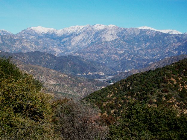
Not too has changed over the past week or so. The snow still covers Mt. Baldy and the surrounding high peaks. The ground is still wet, with mud and pooled water in places.

Some pictures from earlier today:

The backside of the gate, with Glendora Mountain Road beyond. Hopefully, Lindsay had the good sense to tell the yahoo who spray-painted this gate to go jump in a lake.

The view west from near the end of my hike. This should be looking over San Gabriel Canyon, with the main stem and north fork of the San Gabriel River somewhere down below.

Here's what was further to the north. I think a future hike will involve me driving up GMR and parking where Lower Monroe Truck Trail (2N16) crosses GMR. Then I'll just hike from there, north, all the way to where I can overlook San Gabriel Reservoir.

Taken somewhat earlier than the other cloud pictures, here, the sun is 90 minutes or so from setting. Rays stream through openings in the clouds. In the distance, the inversion layer is lit by one of those rays. In real life, it was a lot more spectacular than the camera could show.

Clouds at sunset always make a good show. Here's the sun is low, behind clouds, and about to set. The Pacific Ocean is lit up by the hidden sun.

Taken maybe ten minutes after the shot above, the sun (off-camera, far to the right) by now has dropped down to the horizon. Only the reddest of light makes it through the atmosphere. Those reddish rays give these dry grass stalks an eerie glow.

Taken moments after the shot above, a weak orange glow illuminates the hilltops nearby, and the snow-capped peaks, farther off (but higher up) in the distance.

Saturday, January 1, 2011

Hike 113: Water Canyon

My final hike of 2010 was on December 31, 2010. The trailhead was just north of Morris Dam. From the 210 freeway, exit at Azusa Ave (CA-39) and head north, into the canyon. At the mouth of the canyon, you pass the San Gabriel Canyon Gateway Center, on your right. Just two miles or so after the Discovery Center is the dam. The next wide spot on the right was across the highway from road 2N28, which Simpson says is named Silver Fish Road. On the Harrison map, the only indication on this road is that it leads into Water Canyon.

I wanted a relatively short hike for today, in the 3-5 mile range. But I had no real destination. To help keep it short, I traveled light--no water, no food. I probably shouldn't do that, because it limits your options. But I had to get back off the mountain pretty early and didn't want to be tempted into going too far.

Road 2N28 begins by heading north, slowly climbing, parallel to CA-39. About ten minutes up, there's your first good view of Morris Dam. There's a power line pole that holds the line in seemingly-arms reach, right in front of you.

If you go back to the road and just barely begin turning around the bend, you might notice a use trail that heads straight up the hill. Up there is a fire break. If you're wanting a short but steep hike, you can go up that way.

If you stay on 2N28, however, your route goes a bit further up stream before turning into Water Canyon. On this day, water was definitely flowing through Water Canyon. When the trail reaches the "end" of the canyon, things may get a little fuzzy. As far as I can tell, the correct route is to make a hairpin turn to your left. After about 100 feet, the road again becomes clear, doubling above and parallel to the route you just took in to the heart of Water Canyon. About 30-40 minutes after you stood at the Morris dam viewpoint on your route up, you'll find yourself much higher on that same ridge that was behind you when you ogled Morris Dam.

From the higher viewpoint, Morris Dam is no longer visible. The reservoir, however, is. On the 31st, the reservoir water was so muddy you could have almost plowed the water.

At this point, the road path becomes very indistinct. You can trace the road cut continuing along the side of the hill, but it is so overgrown that I turned around after only a few minutes. Instead, I went up the firebreak. As I said, it's the same firebreak that ends at the Morris Dam viewpoint, and continues on to a saddle, high above. For confirmation, just compared the picture at the top of this post (taken from the saddle) with the previous picture (taken where the road becomes indistinct and I started walking up the fire break).

The going here was so because of the steepness. Your legs can get scratched here very easily if you're not wearing long pants (I was not).

From the saddle top, you discover yourself in a grass-covered meadow. Views to the west (over Fish Canyon) to the north (to Silver Mountain), the the northeast (to Mt. Baldy), and to the east (over Morris Reservoir and the ridge that carries Glendora Ridge Road).

I walked south a bit from the saddle, to the first summit there. Further south was a slightly higher, greener summit. That would be summit 2843, which Simpson describes here. But I was too lazy to explore. I figured the view to the south in winter is going to be too glare-y, what with the low sun.

Time to head back. On the way back down to the saddle, I favored the west end, trying to see what I could that way. As a result, I overshot the ridge and fire break route back the way I came, so I had to go back up about five minutes.

From there, I headed down the ridge, intersecting 2N28 after about 20 minutes. Having enjoyed the view from higher up, I was pretty sure I could have continued along this ridge, past 2N28, to re-intersect with the road much further down the hill. It would have saved at least a mile (and probably 1.5 miles) each way. It would have been steeper, of course. But much shorter.

My estimated walking distance for the route I did take is between 6 and 7 miles, so I'll split the difference and say 6.5 miles roundtrip.