Saturday, August 20, 2011

Hike 2011.055 -- Canal Loop Trails, Land Between the Lakes NRA, KY

Hiked Saturday, August 20. Hiking trails in the Land Between the Lakes (LBL) are scattered among three primary centers. In addition to the North-South trail that goes from end to end, there are clusters of trails near Fort Henry (south end of the park), near the Nature Station (Hematite and Honker Lakes, near the middle of the park), and near the canal that links Lake Barkley with Kentucky Lake (at the north end of the park). Today, I hiked the last of these areas, up in the northern section of the LBL. The flyer for the Canal Loop Trails is here.

The Canal Loop Trails can be easily accessed either from the North Entrance Station or from the parking area for the Canal Overlook. Both are along "The Trace," which runs north/south through the park. If coming from I-24, look for KY-453 and take that south. Alternatively, from KY-80/U.S. 68, exit at "The Trace" and head north. The North Entrance Station is either about six miles south of I-24 or about 19 miles north of KY-80/U.S. 68.

Either because it was nice weather on a Saturday morning, or because of the relative proximity of the great megalopolis of Paducah to the Canal Loop, this trail was far busier than the others I have walked on so far. It's also open to mountain bikers, and most of the people I encountered were mountain bikers (not surprising, given the relative speed of bikes versus hikers). Most were relatively well trained (meaning, they hollered or made braking noises well in advance, and warned their friends behind them of a hiker ahead; also, I usually heard them before they saw me).

The Canal Loop trails are marked somewhat similar to what I saw at Fort Henry, with color-coded blazes and numbered or lettered signs. However, on this trail, the letters or numbers were not always at the junction. Also, at least one junction was very well-hidden.

On the linked map, you can trace my route today: From the North Entrance Station, I headed west, on the "D" trail, then north, towards the "11" main Canal Loop Trail. I intended to turn east at the "C" trail, but it was not marked. Instead, I continued north, crossed a narrow paved road that I later deduced to be Kentucky Lake Scenic Drive), climbed somewhat, and found myself at the base of a very tall radio tower that a turkey vulture was considering landing on.

Just a bit later, I reached the next junction. Turning left, I saw a "B" instead of the "C" that I expected, and stopped to ponder my next step. Although continuing along the "B" trail would only have added another 1.7 miles for the day, I was planning to make a return trip to walk the northern section of the Canal Loop (just as I plan to make return trips to the far western and eastern sections of the Fort Henry trails).

Instead, I backtracked .7 miles, and kept my eyes peeled for the "C" trail. I went back up a hill, passed the radio tower, crossed the road, and came to a couple of small bridges. Just after the bridges (on the south side), was a very faint but unmarked trail, which was really just a slight break in the foliage. I paused for a moment, contemplated my choices, then slipped through the narrow opening. Not 50 yards later, a short wooden crossing was there. Across a meadow (actually, the tree cut for a power line right of way), the trail continued, and I saw a few yellow blazes. This assured me that this was an actual trail and not just a use trail.

This "C" trail eventually crosses "The Trace" just south of where Kentucky Lake Scenic Drive merges with The Trace. The view down The Trace from here is peaceful, just as it is along pretty much the entire drive.

It still amazes me as I crossed The Trace and went from one section of trail to another, how different trail heads are here in Kentucky. The foliage is so thick that you could easily drive right by this section of road (as I had earlier this morning) and not even known that a hiking trail crossed right here.

I made a right at the next junction, and had a few peeks at Lake Barkley on this section of trail. Apparently, when the water is higher, a whole lot of floatsam makes its way into these pockets, and there was quite a bit of junk scattered around here: bits of styrofoam from coolers, empty bottles of water, juice, and motor oil, shoes, rubber balls, you name it. Don't know how much of this is from boaters and how much just gets washed or blown into the lakes from the shore.

After the turn, it was 1.8 miles (according to the map) back to the Entrance Station. There were a few nice views of Barkley Lake, but the best viewing spot was occupied by an RV with a generator: Right near the shore, overlooking a bay, and having several large boats bobbing near by.

Total mileage for the day (including the 1.4 mile unintended detour) was 6.6 miles. Despite the relatively short distance and near-lack of topography, the humidity just seems to sap my energy. Of course I could have gone somewhat longer, but I was feeling I had gone far enough as it was.

Few flower along the way. I guess it's high summer, now. I had previously seen some thistle like on this trail. It seems softer than the thistle back home. The small, datura-like flower, was new to me.

Monday, August 15, 2011

Hike 2011.054 -- Fort Henry Trails, Land Between the Lakes NRA, TN (Part 1)

Hiked Sunday, August 14. There's a network of trails collectively known as "Fort Henry Trails." They're all associated with the Fort Henry area, which was an important early Civil War battlefield. The Union victory there gave them control of the lower Tennessee and Cumberland Rivers, which were important transit ways for western and central Kentucky and Tennessee. Of course, Kentucky Lake and Lake Barkley did not exist at the time. This area was instead known as "Land Between the Rivers." In fact, Fort Henry, which used to overlook the Tennessee River, was submerged by the reservoir that pooled behind Kentucky Dam.

The trailhead for the Fort Henry trails is on a spur road off of Fort Henry Road. To get there from U.S. 79, take "The Trace" north from 79 (it is signed for access to Land Between the Lakes). At the south Welcome Center, turn left (away from the Welcome Center), to the west. Take the second right (the second paved road on the right), which will be signed towards Boswell Landing. When the road makes a sharp right towards Boswell Landing, you should see a dirt/gravel road signed for Fort Henry parking, more or less straight for your direction of travel. After about 200 yards, the road will reach a little loop at the end. There will also be the remains of roads heading in several directions near this loop, but I'm pretty sure those roads are for authorized vehicles only (although they are not signed that way--they're just kind of narrow and bumpy).

I parked in this end loop. There were no other cars when I parked, but 2 or 3 other cars when I left, so I know I parked legally.

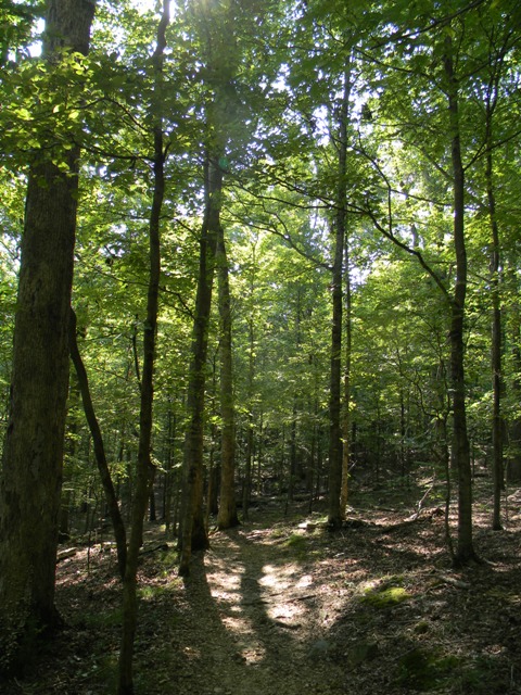
Although this was another "Land Between the Lakes" hike, I could not see any lakes on this hike. The forest cover is so thick that you can't see far in any direction. In fact, even though I could only rarely see any roads, I often heard the sound of trucks or motorcycles roaring quite nearby.

That's the main difference I've noticed in hiking here in the mid-South versus out West: Thick trees, and fewer expansive vistas.

Very pleasant day of hiking, even without the big open views. The high was in the low 80s and there was a nice breeze. The breeze wouldn't be so nice if I was trying to paddle a canoe out on one of the lakes, but it was wonderful up there in the hills.

Odd thing about these trails is that the signs are mostly coded. Trail inter-sections are numbered on the map, and numbered on the ground, so if you come to a junction with a big "2" on it, you have to look at your map to see that this is where you are. Then you often have to look at the color of the metal "blazes" hammered on to tree trunks to know which trail you're on.

On a few plastic trail markers, someone did Sharpy in a trail name. But most intersections lacked any indication of the trails. So, key factor number one if you hike this trail: Get a copy of the trail map!

Here's a link to the trail map that's available on the LBL website.

In reading the short trail descriptions, you'll see a color, followed by numbers after each trail name. That tells you which color blazes are on that trail, and which junction numbers the trail crosses.

To illustrate what you'll see, I've got a couple of pictures of forest with numbered junctions and/or colored blazes on trees for you to see.

Not much in the way of wildlife visible on these trails today. It did cross several mostly-dry creeks, where fish or tadpoles could sometimes be seen. One fuzzy shot of those fish is right here.

I also saw a few butterflies, ants, and some really weird things that I eventually learned were pods of Eastern tent caterpillars (I initially thought they were gypsy moth caterpillars). They were these large sacks, wrapped in silk. By large, I mean over a foot long. They were wrapped in a non-symetrical blob of silk, like a super-giant black widow might weave. You almost expected to see a giant spider in the trees above the sacks. Inside the sacks, you could see innumerable little caterpillars (1.5 inches long or so), occasionally wiggling or inching around in the sack.

Click on the picture above to enlarge it. Click it again to enlarge it even more.

In terms of my path today, I started out at the official trailhead, bore south and southeast (got my bearings from the sun) to get on the Telegraph Trail, heading east. Continued east to the Devil's Backbone trail, then headed south. (The picture below is from part of the Devil's Backbone--it was not nearly as amazing as the Devil's Backbone near Mt. Baldy!). Then east on the Artillery Trail, then east on the Piney Trail, then north on the Volunteer Trail, then the Telegraph Trail, west, back to my car.

Easy to follow that route if you have a map. It would be really easy to get lost without a map, however. As I said, most trails are not signed with names and directions, and with the thick tree coverage and lack of visible landmarks, one direction looks an awful lot like another.

Slightly over 7.2 miles for the day. Although that's short (and flat) by my previous standards of hiking, I've had a pretty long layoff of long, strenuous hikes. This one made me pretty tired, to the point where I got lazy and actually stumbled during a descent. Skinned my knee a little. And took a really long nap when I got home. Still, this did cap off a pretty busy period of hiking. Hoping to keep up a pace of 1-3 hikes a week for at least the summer and late fall period, when the sun sets late and I can squeeze in some hikes following afternoon classes.

Because of the large number of interconnected trails here, I anticipate probably 3-4 more visits, just to walk some of the other trails that I didn't do today.

Sunday, August 14, 2011

Hike 2011.053 -- Honker Lake, Land Between the Lakes NRA, KY

Hiked Friday, August 12. Three hikes in a row, although I'm pretty sure I'm too far behind to possibly manage 100 hikes for this year.

Drove out in the afternoon. From KY-80, take "The Trace" north about nine miles, then turn right, towards the Woodlands Wildlife Station. Since the gate on the last 1/4 mile or so of road to get to the Station is locked at 5pm, you need to park outside the gate if your hiking will keep you later than that.

Also, there seems to be a dearth of speed limit signs on the northbound side of the Trace, from US 80 on north. I did not remember seeing any speed limit signs going that way on either of my two trips to this area. However, a few signs on the southbound side to exist, so it is apparently 50mph though the entire Trace, except if it's posted otherwise. The road towards the Woodlands Wildlife Station seems to be 35mph or less, as posted.

Just 1/8 or so from the gate that is locked, there's a picnic bench area with a flush toilet and water fountain. It's adjacent to A short gravel road that takes you behind the restroom area, to where a sign on a chain indicates a "wildlife viewing area" is here.

On the other side of the chain is a sign, pointing to the right if you want to reach any of the hiking trails in the Woodlands area. Walking left here would take you to the North-South trail.

I walked right. You soon reach another gravel road, with a gate across it, announcing, "Authorized Personnel, Only." I'm pretty sure that applies to actually driving your car, however. Otherwise, the trail signs make no sense.

Less than five minutes down this gravel road, you'll notice a fifteen-foot cut in the grass coming in from the left. Immediately on the other side of the road from that cut is a trail that heads into the forest on your right. Although I did not know it at the time (but I did suspect it), this is the Honker Lake Trail. You could head in either direction from here, and be back where you started just 4.4 miles or so later.

Since there was no sign facing the access road I was on to tell me what this trail was, and because I didn't bother walking down the trail looking for a sign, I just continued more or less easterly along the road, eventually hitting other roads, and a sign for the Woodlands Trail. I walked on the Woodlands trail for a while before running into the Honker Trail. I know I walked the Honker Trail in a counter-clockwise direction, but I'm a little fuzzy in my recollection about which way I walked on the Woodland Walk.

Since I'm not exactly sure where on the map I ran into the Woodland Walk, I can't tell how long I walked on that before hitting the Honker Trail. My best guess is I must have walked somewhat over 1/2 mile from my car before hitting Honker Trail. Honker is supposed to be 4.3 miles, so I'm giving my mileage for the day at between 4.8 and 5.0 miles.

A .pdf of the flyer for the Honker Lake (August 12) and Hematite Lake and Center Furnance Trails is here.

The landscape around Honker was obviously very similar to that of Hematite Lake. The main differences are that Honker is much larger, and it's basically an extension of the massive Lake Barkley. It also has several islands and lots of wetlands that larger migratory birds seem to like. It gets its name (Honker Lake) from the Canada Geese that both reside there permanently and use it as a pit stop on their migrations. I also saw several grey herons (or perhaps the same one about three times?) and a large, white, egret-looking bird.

The heron was photo-graphed successful-ly (not with the best of surround-ings, but you can't help that), while the egret was tougher. Its white body provided too much of a contrast with the dark background. The shots that were more zoomed in all came out fuzzy.

Both were taken on the far end of the trail, near the causeway or dam that separates Honker Lake from Lake Barklay.

Perhaps in part due to the timing of my walk (starting about 5:30pm and ending near 8pm), the deer were out in force. I got more fuzzy pictures than anything else, and didn't even attempt to take pictures of several that I startled. But some practically posed for me, or at least stood and gave me a long stare.

In contrast to the Hematite trail, this one was well-signed, with posts that clearly pointed the direction and name of the trail choices you had, and with mileage markers to let you know how much further you had to go.

Saturday, August 13, 2011

Hike 2011.052 -- Central Park, Murray, KY

Short hike on Thursday, August 11, through Murray's Central Park. Much of it is developed as a typical city park, with ball fields, manicured lawns, picnic tables, slides, etc. Other parts are less modified, and the forest can be quite thick in places.

Set inside this park is an 18-hole Frisbee golf course. Holes range in length from about 85 yards on up to 150 yards, with 20-100 yard walks between holes and the next tee. Some are mostly in the open, mowed grass area, while others would require tosses between thick stands of trees. I walked the 18 hole course and also wandered around enough that I hope to have managed three miles of walking.

Here's a picture of a squirrel. Not that big a deal, except squirrels in KY are hard to photograph. They're too used to being hunted, I think. Well, except these city park squirrels, where no hunting is allowed and they probably get plenty of handouts from the locals.

Hike 2011.051 -- Eaton Canyon Falls

Hiked Wednesday, August 10. I squeezed in a quick, short-notice trip back home at the start of the week. Many side stories involved on the timing, but the short version is I had some time, I was already going to be in Memphis, so I burned 50K frequent flyer miles to get a last few days at home before the school year starts. I burned another 50K miles just a week earlier, to get my wife to visit, so many years of accumulation in the Delta Skymiles program have been almost wiped out in just a few weeks. At least I could use them, though--not like the useless USAirways Dividend Miles Program, which have proven impossible to efficiently utilize over the past few years--black out dates, extremely limited seat availability, including on their partner airlines, etc. Totally useless. If given a choice, don't sign up for USAirways. Seems like everyone else has program rules that are easier to actually redeem your miles on.

Because it had been another week without hiking, I kept it close and short. That's how Eaton Canyon got picked.

The wash is now reduced to a thin trickle where the trail crosses it. It's amazing to think that there were days in February or March when the water was absolutely uncrossable there.

Water still flows somewhat heavier under the toll road bridge, however. It still sounds like a river, although obviously the crossings are easy. Good thing, since I was just wearing my high tops.

For a weekday afternoon, the trail was about what I would have expected. When I got to the waterfall, I think there were only 3-4 other people in sight, however. There were also two trash bags, overflowing with trash, at the viewing area. I don't understand why people can't just carry out what they carried in, but at least several someones decided to bring bags, and probably filled them with trash.

I've written this hike up many times in the past, but for any newbies: I started at the Eaton Canyon Nature Center, which is on the east side of Altadena Blvd, just north of New York Avenue. From the 210 freeway, you can exit at Altadena Blvd and head north a couple of miles.

The nature center lot is large, but does fill up quickly on weekends.

From the nature center, walk north, through to the end of the parking lot. Then continue past the gate along the dirt. A few hundred yards after the gate, the trail drops down a bit and crosses the wash, heading slightly to your right as it does. Once on the other side, continue north, making a left when you reach the main north-south trail.

This section of trail is wide and mostly flat. Occasionally, mature oaks provide some shade. Other times, you're exposed, and walking over a sandy trail.

When you reach the bridge that crosses the wash, go under the bridge. A hundred yards or so after the undercrossing, the trail makes the first of several crossings of Eaton Canyon Wash. Now, it's pretty straightforward, though it will require some balance to keep your feet dry.

Just keep heading upstream, on either side of the river, until you reach the waterfall. It's about 1/2 mile from the bridge.

On the return leg of this hike, I got to see another one of those little rabbits that live near the visitor center. I also got a picturesque view of a rising gibbous moon, which I can rarely resist photographing.

Resist the urge to scramble up either canyon wall. It's dangerous to you if you fall, and dangerous to people in the canyon if you knock any rocks down while you're hiking up there.

Shot some video of the falls. For mid-August, it definitely is running strong.

Friday, August 5, 2011

Eaton Canyon Tragedy

One of the interesting thing about blogger (blogspot) is that it provides you with some feedback on where traffic coming to your site originated, and which posts have been viewed recently.

I was mystified as to why I got a small number of hits coming from an laweekly blog, so I tracked it back and figured it out. On the story they posted about a fatal fall at Eaton Canyon last on Sunday, they used a picture I had of the waterfall in the story (properly credited, of course).

Since nearly all of my posts are just hike reports, I was debating as to if I would post blog about the fall (as well as the extraordinary number of fatalities this year in Yosemite). I guess the link pushed me to post about the Eaton Canyon fatality.

I've been to Eaton Canyon many, many times, but I'ver never tried to get to this second waterfall. Apparently, it's frequently visited, but it sounds more precarious than getting to the falls in Rubio Canyon, Switzers', or the other local waterfalls I've been to. Or it could just be that the volume of hikers is much greater. Regardless, I'm pretty scared of heights (or, more properly, I'm pretty scared of falling), so if I did make my way towards that second falls and it got hairy, I'd turn around.

That's actually one of the advantages of hiking alone. Peer pressure can be a tremendous influence, both for good or bad. Sort of like the thing your mother probably used to say ("If everyone else was jumping off a cliff, would you also jump off a cliff?"), if you're in a group and everyone else is walking in front of you, it's easy to dismiss your qualms about falling as irrational. Obviously, around Eaton Canyon, they're not. Don't be afraid to turn around. Don't let the sight of other people going somewhere cause you to ignore your own reservations. If you choose to hike off-trail or where large drops are a threat, stay absolutely focused on the task at hand. Consider your route up carefully, and know that it's usually harder to climb back down than it is to climb up. Stay alert, and focus on the task at hand. Don't be afraid to turn around (yes, I know I wrote that one already: I'm just reiterating). And always remember that it's unlikely that anything you're going to see in Eaton Canyon is worth risking your life to see.

Tuesday, August 2, 2011

Hike 2011.050 -- Hematite Lake, Land Between the Lakes National Recreation Area

Hiked Sunday, July 31. First hike in the LBL, which I imagine I will become quite familiar with over the coming months.

My first foray into Land Between the Lakes was only partially successful. I should probably splurge for the expensive "recreation map" pf the area, because the trails and trailheads do not appear to be very well signed. I walked around Hematite Lake without once seeing a sign saying that this was, in fact the Hematite Lake trail. Also, this trail should have more or less intersected with the trail that goes around Honker Lake /Bay, but the likely junction was not signed in any way.

Land Between the Lakes National Recreation Area lies between Kentucky and Barkley Lakes. The former lies behind Kentucky Dam, on the Tennessee River. The latter lies behind Barkley Dam, on the Cumberland River. Both lakes generally stretch north to south, and Kentucky Highway 80 more or less bisects the area from east to west. Within the Land Between the Lakes, "The Trace" is a two-lane road that runs north to south, between I-24 and US 79.

To get to Hematite Lake, I took KY-80 to The Trace, then took The Trace north about 6.8 miles, to Mulberry Flat Road. It was signed as going to Energy Lake. There weren't any signs for Hematite Lake there.

[Edit--The KY-80 bridge across Kentucky Lake was taken out by a renegade NASA barge a few months ago, so accessing LBL from the west requires a detour to either north or south side of the LBL. (Update -- The bridge has long since been replaced, so ignore. But I'm leaving it here for historical reference)]

I headed east on Mulberry Flat Road for 4.1 miles, to Silver Trail road. There, a sign indicated 1 mile to the left to Hematite Lake.

I initially wanted to take the Honker Lake trail, but saw no signs pointing the way. I think perhaps I needed to follow the sign to The Nature Station, and park there, or outside of that gate. Failing that, I settled on Hematite Lake. I actually walked some around an historic furnace area, but, for simplicity's sake, I'll just describe the Hematite Lake segment.

This trail starts on the far southeast end of Hematite Lake. A trail map is linked here.

The lake gets its name from the former town (since relocated) and the presence of hematite in the soil. The high iron content made the site an important forge location "back in the day."

On the east end, a low earthen impound dam with an earthen and concrete spillway at the southeast end hold back Hematite Lake. Concrete steps allow crossing of the spillway even if the water is flowing, or if the soil here is sodden. If you were to walk the trail in a clockwise direction, you'd cross here, then walk across the clearly mowed top of the dam.


I actually walked the trail in a counter-clockwise direction. In that direction, the lake starts out shallow and weed-choked, but deeper, open water is visible just fifty yards or so out.

However, the trail soon heads a bit away from the lake shore. Here, the tree canopy is thick. This makes it a relatively cool hike to take when the temperatures are high, but it also obscures your view for much of the way. About a half-mile in, a short spur trail takes you towards the lake, again. However, from the viewing area at the end of the spur, trees still largely obscure the view.

There's also a short detour around a wetlands area near the northwest end of the lake. It adds maybe 1/5 of a mile to the hike (hard to say).

Once you get to the west end of the lake, the trail spends some time on a boardwalk. This is obviously a wetlands area, and often saturated with water. Water lilies grow thick in this sheltered area. Some were in flower as I walked by.

Atop the boardwalk, I saw the muddy footprints of a raccoon.

A bridge carried you over a section of lake near what is presumably the inflow for the lake. Another spur trail (seemed to be 1/5 mile each way, at least) headed out to a point. This provided a better view of the water lilies. You could also look back and see the bridge. It wasn't quite Giverny, but it was nice.

Once back on the trail, the boardwalk continues until you are ready to start heading back east. Then, it's more walking under a forest canopy. You also pass an old pier. One could walk on it, but it looked pretty rickety to me.

Finally, after about a mile of more or less straight walking to the west, you reach the earthen dam and make the final northward jaunt back to the trailhead.