Sunday, October 4, 2020

Oak Glen Preserve, Yupaipa, CA

Hiked Saturday, September 26, 2020.  The Oak Glen Preserve and adjoining Riley's at Los Rios Rancho has been a regular getaway for me for about as many years as I've kept this blog.  I love their apple selection, their apple pies, and the trails of the Preserve, not necessarily in that order.  So it was a shock over the weekend to learn that the farm shop and bakery burned over the weekend (early on the morning of Friday, October 2, 2020).
I had hiked there less than a week earlier.  First visit in a while, because of the combination of Coronavirus, brushfires, and so forth.  In fact, the El Dorado fire had threatened the entire community of Oak Glen just last month, and the Apple Fire similarly affected them in August.  So, finally, last weekend, I took advantage of a long-awaited break in the smoke of local fires to visit.  Arrived a little after 9am, when the shop used to open, bought some apples and a pie, put them in an ice chest, then headed into the Preserve.
Walked around the lower ("Red Wing") pond, up around the upper (Duck) pond, made my way down the canyon, then headed up to Preservation Point.  Walking those trails is somewhere around 4 miles.  That's relatively short, but, as is often the case, I only had a little time there before having to head back.  It worked out fine.
On my way in, I noticed that the big dirt parking area down in Yucaipa (for a hiking/mountain biking trail I've still never been on) was appropriated as a staging area for fire fighters.  The El Dorado Fire was now well away from Oak Glen, but still burned.
In walking around the Preserve, I saw fire damage in the wildlands in three directions.  The hills immediately north of Oak Glen, once tree-covered, were now bare.  Also, to the south and east, the hills were burned to quite close to the  farm areas.  The photo above is looking over Riley's Farm, across the road from the Preserve and further along the loop from Los Rios Rancho.  Obvious burn scar there, probably from the Apple Fire.
The photo above was looking south, from the Preservation Point trail.
This one is looking from the top of the Preservation Point trail, along the boundary fence, looking to the northeast.
Looking towards Mount San Jacinto.
And, finally, looking north, over the farm and shop area of Los Rios Rancho.  The parking lot is visible near the bottom right.  The buildings that burned were adjacent to that lot.  Barren hills, to the north.

The brush fires were sad enough, but losing the shops, after they had to close twice for those brush fires made this a really tough year for the Riley Family.  

As the linked-story notes, they are operating a limited set of services off of their farm lands, to the north of Oak Glen Road.  I wish them luck in rebuilding. There's a gofundme mentioned in that article, as well.

Sunday, September 27, 2020

Around Mission Hills Trailhead, Sloan Canyon National Conservation Area, NV

 Hiked Friday, September 18, and Saturday, September 19, 2020.

The summer heat has peaked in the Las Vegas Valley, so rather than dealing with 115 or so as a high, it's only in the low hundreds.  Makes it a little easier to start a hike in the afternoon.  So I drove up from the Los Angeles area, unpacked, and hit the trail around 5pm on Friday, hiked for about 90 minutes, then returned, the next morning, for more

The Mission Hills trailhead is located at 295 W Mission Drive, in Henderson.  It is easily accessed from U.S. 93/U.S. 95/I-11 (Yes, it's all those things; Waze takes a really long time to say that all, as you're driving!). If coming from the Las Vegas Valley, take Exit 20, Horizon Drive, then turn right at the top of the off-ramp.  Two lanes turn right.  If you're in the left of those two lanes, swing over to the far left turn lane; if in the right off ramp lane, you should be able to go into the second left turn lane, but keep an eye to be sure the person in the left lane goes where they're supposed to go.

Then turn left at the light, which is not more than fifty yards from your offramp.  After the left, you'll be going more or less south, on Horizon Ridge Parkway.  After about a 1/2 mile, the light will be Mission Drive.  Make a right there, and head to the end of the road, another 1/2 mile or so.  Parking will be on your left.

Incidentally, the offramp you just got off on is called a "diverging diamond interchange."  On the way to the trailhead, it'll be pretty normal.  The return drive will be a little trickier.

A nice overview map of the geography of Sloan Canyon and the trails is here.  As you can see, the Mission Hills Trailhead is at the northeast corner of the conservation area.

There are multiple trails starting off here.  Oh, there's also a flush toilet here, and a trailhead map, but it pretty much just shows the McCullough Hills Trail.

I had hiked on the McCullough Hills Trails once before, from the other end.  So, long-term, I'm going to want to hike this trail going this way, to meet up with where I got from the other end.  It's supposed to be eight miles each way, and I think I went more than half way from the other side, so it'll be an easy eight miles or less, to finish the trail.  But that's in the future.

For the Friday evening hike, I mainly followed the Trail 601 signs, and wanted to get far enough to look out into the undeveloped portions of the national conservation area.

The Bobcat and El Dorado fires were still burning (and are still burning, now, btw), and the smoke and ash were visible in the sky.  The sun shined a pinkish color, and the color of the McCullough Hills, around me, were also more pinkish than normal.

So were the cactus.  The color became more prominent as the sun set.

The hills to my southeast were intriguing.  It looked like there might be steep, direct routes up to their tops.  I thought I might try to reach them, the next day.

However, those apparent trails were less obvious the next day. So, instead, although I did approach those steep mountains and explored one of the "coves" at the base of the hills, 

Friday night, I probably only walked about three miles, out and back.  Enough to get a good stretch, though.

The next day, I started out along the 601 trail, again.  It parallels the McCullough Hills trail, and intersects it on a couple of occasions.  But other parts, it runs alone, sometimes along powerline right of ways, and other times up wide and sandy washes.  It was slower going than I had hoped.

Eventually, I did take a use route that took me up along a ridgeline a ways.  I passed a rock-outlined heart, along the way.

But the trail did not go all the way to the top of the mountains, as I had hoped.  I ended up going back down the way I came, then headed into the "cove." A sign outside a gate said the area was closed to camping, hunting, or shooting, but did not appear to prohibit entry.  So I climbed over the gate and walked to the end of the dirt road.  Again, several use trails did go up some ways on those hills, but the trail was steep and it did not appear obvious that I could safely ascend them to the top, so I backed back out, and returned to trail 601.

Along one washy section, I eventually determined I had lost 601.  I decided to "shortcut" back to that trail.  In retrospect, it may not have been a shortcut.  Took 601, past several additional trail junctions (most with names rather than numbers, and on wood signs rather than the woven plastic or metal "stakes" of the regular BLM trail markers).  Eventually re-intersected with the McCullough Hills trail.  Since that one seemed likely to be more direct, wider, and less hilly than 601, I followed that back the last 2 1/2 miles or so.

Got back to my car feeling pretty tired, but happy for the chance to get some walking in.

I'm thinking I passed or was passed by fewer than ten people (a number of them on mountain bikes).  I kept my mask on the whole time (except when drinking), on the idea that it might also help with the particulate pollution.  Some hikers similarly masked up, while other hikers and mountain bikers did not.  Few enough encounters that I felt safe, either way.  As noted at the start, while cooler than a few weeks previous, it was still pretty hot.

Hiked about three miles on Friday afternoon, and at or near 9 miles on Saturday.  Hard to be sure, as I did not start my All Trails "recording" to measure the land covered until after I reached my "Heart Mountain summit."  It was 7.2 miles of recording travel, and I'm guessing about 1.5 miles to reach that summit.

Oh, I forgot to wrap up the "double diamond interchange."  On your return, the interchange is right after you've made a right, from Horizon Ridge Parkway.  Traffic will probably back up there.  On a double diamond interchange, right after the light, you need to cross over from the right side of the road to the left.  That means you'll then have an uncontrolled entry on to US 93/US 95/I-11 North, on your left.  The crossover may disorient you, so pay attention. Otherwise, as noted, you'll go head-on into approaching traffic!

If you did not turn on to the northbound freeway, you'd then have to crossover, back to the right side of the road, on the other side of the freeway. As noted, potentially confusing, if you haven't driven on one, before.

Friday, September 11, 2020

Willow Springs Trailhead to North Peak, Red Rock Canyon National Conservation Area, NV


Hiked Saturday, August 22.  Approximately 12 miles total, out and back.

This new blogspot interface still has me confused; no idea why, but my pictures are again disaplying in smaller size, where you can click them and see them larger.  I couldn't tell if this would happen as I wrote, but, after having "published," I can see the result. The text is not going where it was before, though.  Weird!

First shot is a panorama google made, automagically for me, by stitching together a couple of shots.  Not sure when it decides to do this, but it's an interesting capability.  It's near the end of the hike. That's the view from the saddle, where you'd decide whether to drop down and go forward, to Bridge Mountain (in front of you), or turn left, and go along the ridge line, to North Peak.
The trailhead is at the Willow Springs picnic area.  It's about seven miles along the Red Rock Canyon National Conservation Area scenic drive.  Turn off the main road at the sign, indicating Willow Springs.  Multiple trailheads, here.

At the end of the pavement, the road continues as gravel, starting out smooth, then quickly becoming high clearance/4wd, only.  This is Rocky Gap Road.
Left side of the road is Rainbow Mountain Wilderness Area.  Right side of the road is La Madre Mountains Wilderness Area.

If you do have high clearance/4wd capability, you can drive up this road about 4.4 miles to the saddle, where the road would then descend, towards Lovell Canyon.  There's a small, not entirely marked parking area there, on the left side of the road (if coming out of Red Rock) to park, and begin your hike.
From the saddle, it's a short 1 1/2 miles or so to North Peak, or six miles roundtrip to summit Bridge Mountain.  But if you're walking, especially on a hot day, you'll be pretty beat just going the nearly five miles and 2,000 feet or so to get to the "trailhead."

Starting from Willow Springs trailhead, All Trails gives a total distance of 11.8 miles and 2667 net altitude.

You start the hike at about 4,500 feet, so you'll be topping out at about 7,300 feet.  Doesn't quite match up with the altitude they give, however.

The main point of this is that it's a relatively high-altitude hike for Red Rock.  That makes it significantly cooler than most Red Rock hikes.

Most of the way on this one, you're hiking in juniper/pinyon pine forests.  

You're also going along a couple of washes so where the washes cut along the road, you'll get some nice western redbud blooms in the spring, and some color in the fall (from the redbud, some desert willow, and wild grape).
Poking above the trees, lots of impressive rocky outcroppings.  And, of course, the La Madre Mountains tower to your west.
The unpaved road climbs persistently higher, giving you nice views in all directions.
Scattered clouds as my hike progressed.  By the time I headed back, the increasing heat triggered the formation of cumulonimbus clouds, and even a few drizzles.

The picture below is just of some redbud seed pods.
More views of the La Madre Mountains, below.
There's one recurring area of at least some water on the way up.  Neat little flowers along the bank.  A couple of columbine, mixed in.

There were also some impressive Ponderosa pine, tucked in near where the water emerged.  Later, when looking out towards Bridge Mountain, I saw a few pockets with Ponderosa Pine scattered below me, and on Bridge Mountain, itself.
Just a few more columbine in my little pocket of watered growth.
I'm not 100 percent sure, but I'm saying the yellow flowers near the watery area was goldenrod.
This is along the mostly-level run, a brief resprite from the climbing, before making the final bit up to the saddle that overlooks Bridge Mountain.
Thunderclouds were building.
Nice old rocks, and the clouds, again.
Mormon tea, on the approach to that last saddle.
Rocky Gap road is out of this shot, to the right.
Wider view, looking over to Bridge Mountain.
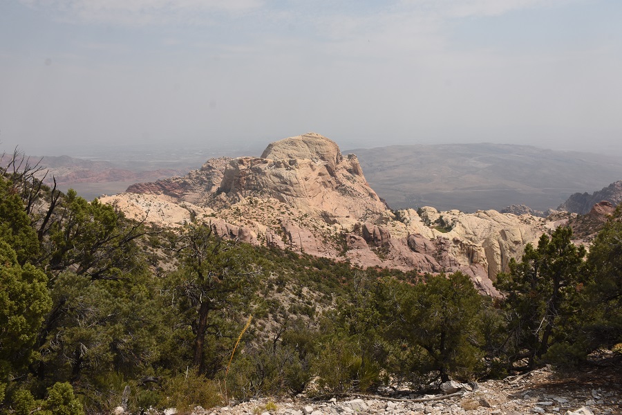
Moderate zoom on to Bridge Mountain.  The nature bridge appears small, almost dead center.  The opening is 30-40 feet across.  Never made it up there, because the approach is pretty exposed, with a highly likelihood of a fatal end, should you slip.  It's so tiring just to get to the start of that climb that I never managed to psyche myself up for those last few pitches up.
Interesting how the soil just "ends," and the ground cover almost completely stops as you approach the edge of the escarpment.
Pocket of water, with greenery and a few Ponderosa pine, among the exposed sandstone.
This was my most challenging hike in a while.  Decent length, significant climb, very high temperatures, at least at the start.  I was hoping this would be the first of many hikes, but wildfires have closed California national forests, and the current (September 11) air quality would keep me from wanting to hike for now, anyway.  Still have one or two more older hikes to blog, though.


Monday, August 24, 2020

Middle Oak Creek Trail, Red Rock Canyon National Conservation Area, NV

Note:  I still don't have a hang on this new editing interface.  Landscape-oriented shots are getting truncated in the blog view.  If you click on the photos, they exhibit in full.


Hiked Friday, July 24.  This was last month, which seems a lot longer than that.  My original plan was just to scout the area out, take a short hike, figure the angles, then come back that night and try to get some Comet Neowise shots, above the Red Rock Escarpment.  Criminals, however, had other plans.


I parked at the Middle Oak Creek trailhead.  Pulled out my phone to run the planetarium software, then slowly walked along the trail.  Looking back, I noticed a dark sedan parked next to mine.  Oddly, no one came out of the car to join me on the trail.

I gave some though to taking a telephoto lens shot back at the car, to try to catch a license plate and a person, "just in case."  I've done that, on occassion.  But that seemed paranoid.  Instead, I continued, walking just about a mile and a half out, then back, just far enough to decide where some possible angles and foregrounds could be framed when I came back to photograph NEOWISE.


I came across some broken dishes, with writing on the plates.  I assume it's a cleansing thing.  Then, it was back to my car.

When I got there, I discovered my front passenger side window was broken.  Oddly, what they took were my two reusable grocery bags worth of "stuff."

I had just driven up from southern California, so one bag was full of snacks, but also my maintenance medication for diabetes and cholesterol.  I also had some pills to help with lactose digestion and some non-preservative eye drops.  Also in the bag, was a Swiss army knife, three wildlife calendars, and assorted other stuff.  Oh, yeah, my Pilot-Flying J, vacuum-insulated, refillable mug. But mainly, it was food.  That's my road trip bag.


In the other bag were mostly sugar-free and low-sugar sports drink.  That's for hiking, which I hoped to do a lot of, that weekend. Except I also tossed one my ultrawide angle zoom lenses in there, since I knew I wouldn't need it for my short walk, and didn't want to carry the extra weight.  My camera body and a few other lenses were with me.

Also, they took my bifocals.  Yes, my bifocals  I assume they thought the case contained some sort of pricey sunglasses.  But, no.  Prescription bifocals.

That kind of ruined my weekend.  Spent most of the next day getting my window replaced (Charleston Auto Glass, located, perplexingly, at Sahara and Lamb.  They were cheap, and could get me fixed on that Saturday.  Other places were more expensive, and would not be able to get me fixed up until well into the next week.  So they get a free plug, here. 😀


I also had to get an "emergency" supply of my maintenance medications -- Many hours at CVS and on the phone with them and my home pharmacy.

This meant no hiking for me, and no last chance to see Comet NEOWISE against a relatively dark sky and interesting foreground. With my bifocals gone, all I had were the prescription sunglasses I was wearing on my hike, which don't work, for astronomy!

Moral of the story:  Don't leave ANYTHING in your car, not even food!

Good news is, they got the guys.  They're part of a regular crew, that was also breaking into cars in Griffith Park.  I know, small world.

At any rate, eventually I'll get my camera lens back.  Probably won't get anything else.  The bifocals, especially.  Dang!

No serious harm, however, the criminals got caught, so that's something.


Tuesday, August 11, 2020

Eaton Canyon Falls from Altadena Crest Trail (Tanoble Access)

Well, I got something on Blogger, telling me they were changing the layout.  I ignored it as long as I could, but now they are mandating the new interface.  No me gusta.

I hadn't been up to Eaton Canyon in quite a while  Normally it's a winter or spring visit, when the water is high.  This year, right about when I was thinking of kicking my hiking into high gear, COVID-19 came along. Initially, when the early, "hard" lockdown came out, I figured, sure, I'll wait it out.  But it continued, and the lockdown softened.

Last week, my sister asked about hiking to Eaton Falls, so I did some investigating.  I wondered if the controlled access at the nature center also applied if you came in from Pinecrest Drive.  I had heard that Pinecrest access up to Henninger Flats was open, for example.  So I drove on up to Pinecrest Drive after work on Wednesday, August 5.  Pinecrest (and the other non-nature center access, off of Altadena Drive) were closed, with a sign saying "indefinitely."


So I went with Plan B, which was the Altadena Crest Trail.  Hadn't been on this trail in a while, either.  Figured I'd come in from Tanoble Drive, and walk east, to the terminus, when the Altadena Crest Trail hits the Old Mount Wilson Toll Road.  Looks like I've done this trail before.  Well, I've probably done it more than once, but that particular trip is the first one that comes up on my blog.

This route is a hilly route, so it's a pretty good workout, as you walk the urban-forest interface.  It's 1.25 miles from the Tanoble Access to the Toll Road, so 2.5 miles roundtrip.


You spend the entire distance overlooking Altadena and the rest of the San Gabriel Valley.  DTLA was also visible, as were a couple of inversion layers.
When you approach Eaton Canyon, you overlook both the lower Toll Road, that would continue up to Henninger, then on to Mount Wilson, and the County trail that goes back to the nature center.

Crossing the bridge and looping to the right and under puts you into Eaton Canyon.  Head on up the Canyon for a bit less than a mile.  The falls were fine.  And the route was blessedly empty.  Clearly, not everyone was getting there the way I got there, but apparently few were  outright breaking the rule on access from Altadena Drive, and access from the nature center was already cutoff.  Only saw about eight people on my hike, this day.