 Hiked Monday, February 14. About five miles roundtrip.
I started this hike off of Glendora Mountain Road. From the 210 Freeway, take Grand Avenue exit and head north. Today, between construction and traffic, this segment was annoyingly slow. (Google Maps suggests I should be getting off at Lone Hill Avenue, but I've never tried that way).
 After exiting on Grand and heading north, passing Route 66, Foothill Blvd, and several other lights, Grand reaches a stop light at Sierra Madre Avenue. That's about 2 1/2 miles north of the 210. Make a right at Sierra Madre. It's another 2 1/2 miles east until you reach Glendora Mountain Road. Along the way, you will have passed AND NOT TURNED at Glendora Avenue). Glendora Mountain Road (GMR) is about 50 yards or so before Sierra Madre Avenue deadends into Mountain Lane, but there is no stop sign on Sierra Madre when you reach GMR.
Turn left on GMR ahd head north. You'll pass Big Dalton Canyon Road, which offers several hiking alternatives for another day. Shortly after that, you'll also pass the road-side parking area for the Poop Out Trail. Another 1/2 mile or so and you'll pass the parking area for Lower Monroe Truck Trail. After that hairpin turn and a number of other winding parts you'll pass the end of the Colby Trail. (I still haven't come across the START of that trail, but I suppose I could easily find it if I wanted to).
 Shortly after you pass mile marker 9.77 (the mileage numbers gets smaller as you head up GMR), you'll find a parking area on your right and a gated dirt road on your left. Park on the right, and hang your Adventure Pass on your car's rear view mirror.
There were no signs indicating the name of this road. It should take you to the southwest, so if you start out heading to the north, you're on the wrong road.
 There were a number of live oak lining this road. After about 1/4 mile, there was a nice peek-over, back towards GMR and my car. After that, most of the other views for the first mile or so are back to the north, over San Gabriel and Morris dams and reservoirs. Later, there are nice views to the west (towards Mt. Wilson) and south, over Glendora, Azusa, etc.
It's also nearly all on a wide dirt road, although there was an eroded point near the start with about an eight-foot gap. The entire path is still passable by horse, foot, or bicycle, but no longer by motor vehicle. I suppose they'll fix that in the spring, though.
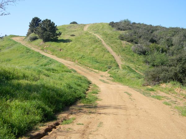 At several places, use paths diverge from the dirt road to give you the option of walking or riding over summits. Today, I stayed on the main road, just trying to get past where I got to on my walk from the other side (the Garcia Trail), from last month.
It being the winter growing season, annual grasses were thick and green. A few annual flowers were popping up, too.
 My best guess is that I took this road about 2 1/2 miles, until I passed the high point I stopped at a few weeks ago. I initially planned to go all the way to Azusa Peak, but standing on the road and seeing the several hundred feet of altitude I would have to give away to get there deterred me. Besides, I was supposed to get back early. My wife and I celebrated a Valentine's Day lunch at Zen Buffet. Yeah, it's more fun for me than for her, but at least I didn't forget!
 Not sure when I'll be able to get my next hike in. I have other plans tomorrow, plus I need to get my last bit of studying in for a civil service exam on Wednesday morning. The first day of docent training is also tomorrow, so I'm not sure if I can still squeeze this in. I also have another job application that's due on Thursday, and a few more due in March I should probably get started on. Might not be able to go hiking again for another week.


No comments:
Post a Comment