Hiked Monday, September 7. 5 miles. But the five miles is the whole distance I walked. If I had only walked up and down Moist Canyon, it would probably be about two miles.
I had to do a lot of driving on Sunday and Monday, and REALLY needed to take a walk on Monday afternoon. so, as the afternoon grew late and my options grew short, I settled on a walk around Eaton Canyon. Wasn't sure exactly where I'd hike, except that I hoped to get some decent mileage in.
I parked on Altadena Drive, because I wasn't sure where I was going, which meant I wasn't sure when I'd get back. The lot at the nature center gets locked around sunset, so I opted to play it save.
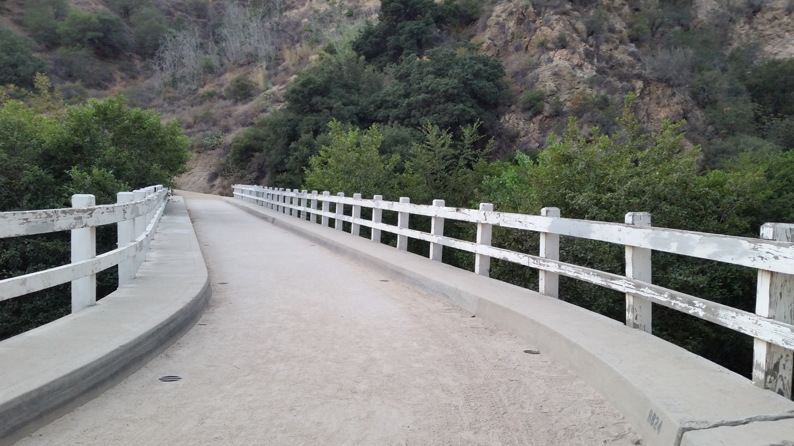
First, I just walked down canyon, and followed a trail until it first took me across the wash and up to the Pasadena Police Training center, then backed down the trail and to the New York Avenue bridge that crosses Eaton Canyon. Then I walked back up, past the nature center, and took the main trail.
This, again, took me over the wash. Once there, I headed down the canyon, again. After about 1/4 mile, I came across a sign for "Moist Canyon." This was a new one for me, so I decided to head up that canyon.
It actually went on for somewhat further than I expected. In parts, it was relatively shallow, but at others, it climbed quite steeply. At my turnaround point, it was so steep that I figured it would have been one step up and two steps back the rest of the way.
This canyon was pretty typical of a lot of the local foothills. Crumbly, dry, and with lots of oak trees along the ridge. it was not, however, moist, at all. It must be in the winter and spring, however, since it's a narrow canyon that winds back and forth on itself as I climbed, then descended.
The oak trees cut beautiful silhouettes against the setting sun.
The total walk in and back out seemed longer than the walk from the mouth of Eaton Canyon to the falls, so I'm figuring I went between 1/2 and 3/4 of a mile each way.
Once back in the main canyon, I headed upstream, to the bridge that crosses the mouth of Eaton Canyon's narrows. This was just to give myself a decent walk. Along the way, the high tension powerlines glowed orange from the setting sun, and stood out brightly against the shadowed mountains, beyond.
It's about 1 3/4 miles from the nature center to this bridge. Figure about 3/4 mile from the wash crossing to where I turned around in Moist Canyon, and another 1/4 from the parking area to the New York Avenue bridge. So somewhere around five miles, total.
By the time I got back to the nature center, the sky had already turned dark. A sign for an after hours meeting at the nature center was up, but I saw no evidence of an actual meeting going on. I was curious to see what group it might have been, and was disappointed not to see anyone.
Busy couple of weeks, so I haven't had time to blog. Not much time for hiking, either. I'm slightly behind where I wanted to be to achieve my 100 hikes for the year, but it's still not an unreasonable target, if I can get a few good weekends of hiking in, soon.


This comment has been removed by the author.
ReplyDeleteI've never meet a moist canyon that I didn't like.
ReplyDeleteHello, so i hiked up the Moist Canyon trail a couple days ago and was curious what happened at the very top and whether it is possible to even hike to the top (wherever that may be) and perhaps exit another way once there. After walking a fair distance in scrub and following the small (dry) creek bed, i finally reached a point where the trail became sandwiched between narrow canyon walls. As i went up, it got steeper and more crumbly until i was reduced to scrambling on all fours. At that point, i could see the canyon rim almost within reach. There was a "smooth" chute area ahead of me made up of very fine pebbles with some larger scree along the left side. Then the trail seemed to make a sharp left turn and there was no way to know what it did beyond that point (must be very close to the top though). While i might have managed to make my way up the larger scree on the left side to that turn, a glance downward indicated that any false move or slippage of the scree could easily cause me to cascade down the canyon with unpleasant results (perhaps if i was younger i would have attempted it). So, i turned back at that point and gingerly made my way back down until i could again walk upright. But i am curious as to how close i was to the top and if there is indeed some sort of trail at the top (or if it is simply a deathtrap). But i did, on my way up, see other travelers footprints so don't know if they go that way or veer off before the actual canyon to some other destination. BTW, i didn't see any police training center or shooting range.
ReplyDeleteOne of the things I am able to read are the "Op Log" posts from the LASD. You'd be shocked how often they need to deploy their rescue helicopter to save hikers who have either fallen or get "stuck" on the cliffs around Eaton Canyon. Most of these do not make it into the newspapers, unless the person actually dies (as opposed to "just" getting injured, or safely hoisted out of the canyon). In any event, yeah, I would not try to cross-country up the cliffs around here. The soil is so crumbly that you can't trust that your foot or handhold will be able to support your weight. Glad you made it back down OK!
DeleteThe shooting range was pretty far down-canyon from Moist Canyon, as I recall. It's off of Eaton Canyon.
Delete