Wednesday, January 13, 2021

Juniper Flats Backcountry Board to Fan Canyon Overlook, Joshua Tree National Park, CA

Hiked Sunday, November 9, 2020. One of several hikes from last year that I hadn't gotten around to blogging. This one was inspired just by looking at my Trails Illustrated map for Joshua Tree National Park. Saw a trail indicated on the map that I had never walked on before, and decided to do it.

According to the map, this would be about 5.1 miles, out and back, starting at the Juniper Flats backcountry board, and ending at an overlook into Fan Canyon. I was assuming a decent view into the Coachella Valley would be had.

From the West Entrance to Joshua Tree, turn right at Keys View Road, and proceed about one mile. The parking area is on the right.

There is no toilet at this backcountry board.

From the backcountry board parking area, there is a well-defined, no-longer open jeep trail that heads straight on out. Or, there's the actual trail, which starts at the other end of the parking lot, and heads east, before bending to the west.

Because the old road was more obvious, and easier to maintain social distance, I took the old jeep trail.

The trail is somewhat sandy in spots, but relatively level. By contrast, the trail, from what I could see, would be firmer, but required a slight gain in altitude. Couldn't actually see it, since I was below the trail's altitude, so I'm not sure how far away it went from the road. But I was satisfied with the scenery of my road route, and walked that way.

There are relatively few trail splits along the way, and each split I had to choose also had a sign. Some of the signs had a map. I also had my Trails Illustrated map, and the All Trails app on my phone. Having a backup, in addition to the signage, just provides a bit of redundancy, to reduce possible "Am I still on the right path?" anxiety.

Because, I spent the night in Yucca Valley, I got a reasonably early start. It was windy and cold. No snow flurries, like the previous night, but I was happy to discover I had Kleenix in my backpack, because my nose ran pretty continuously on the way up, due to the cold.

The turn on to the Stubbe Springs Loop, towards the Fan Canyon overlook, was the less obvious of the options at that junction. Yes, there's a sign, there, but it's a narrow trail compared to the jeep trail I was on.

You zig-zag among the Joshua tree, climb a bit, then head up above a wash, with large, grass-covered, previously-burnt juniper/pinyon pine forest.
The last junction, for the .3 mile segment to the Fan Canyon Overlook, is out of a sandy wash. It's signed, although one of the two signs there was laying down on this day. Without signage, it would also be less obvious.

Slight incline out of the wash, and on to the edge of the Coachella Valley. There is no signed "end of trail," so you just get to the edge, and then decide if you want to go a bit left or right to look for a better view.

The canyon view is somewhat obstructed by various outcroppings, and the clouds that had not yet broken left the view grey. Still, not a bad end to the trail.
On the return trip, I just followed by route in. Had I instead completed the Stubbe Springs loop, that would have added two miles to my hike, and ten miles seemed enough for the day. Indeed, as I trudged along the sandy trail, I was feeling pretty tired, and was glad not to have gone the long way.

The clouds finally broke on the way back, and I warmed up, some.

The drive home was a slow one. I had forgotten that Sunday night drives back from the 10 almost always backed up until at least the truck scales, and sometimes until the 10/60 split. I filed away this information, and determined that future weekend trips, I'd limit myself to a shorter hike on Sunday, to beat the traffic back into town.

Monday, January 4, 2021

Warren Peak, Joshua Tree National Park, CA

Another quick post. Hiked this on Saturday, November 7. Late start from the LA area, but that was partially because of the forecast of possible thunderstorms and flash flooding until 1pm, so I had arrange to get there after the threat was past. Hiked here once before, during my first 100 hike year. But, because I'm an idiot, I did not review my writeup and see that I should have parked at the visitor center rather than at the actual trailhead.
Started out brisk, and stayed that way past sunset. Pretty decent flurries for the first 30 or 40 minutes, and I found some snowflakes still hanging on as I got to the peak. Nice sunset. About 2 2/3 miles each way. Well signed, though you should pay attention as you walk. The "WP" signs point the way. Because of the cold and the late start, I passed numerous people coming the other way near the start, but had most of the hike to myself. No problem social distancing.

Tuesday, December 29, 2020

Heart Rock, Joshua Tree National Park, CA

Hiked Saturday, December 5. Spent the night in the Super 8 in Yucca Valley. Although Joshua Tree is close enough that I can drive back home if I want to, if I stay overnight, I can usually manage two days of hiking for one long drive. Also, there was a Wyndham promotion where I needed to fit in a second stay to earn bonus points worth another free stay, next year. I also wanted to squeeze in another trip because I was pretty sure a new "Safer at Home" order was coming, which would eliminate the possibility of overnight stays in Joshua Tree for the foreseeable future.
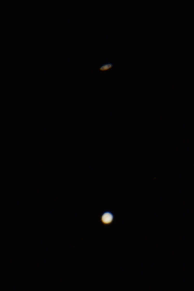
Finally, I wanted to get a chance to practice shooting magnified views of Jupiter and Saturn, in anticipation of the conjunction, coming up a few weeks after this trip. Unfortunately, very little went as planned for this trip. I left home late, and then there was an extensive line of cars to enter the park, and a lack of parking near one of my hiking choices. So I figured I'd just do the short search for Heart Rock.
I parked at the Twin Tanks trailhead. That's the trailhead for both Arch Rock and one of several access points for the California Riding and Hiking Trail. I had hiked to Arch Rock many, many times, both in daylight and at night. But I didn't learn until later that Heart Rock was so close by. By the descriptions I read, it sounded like I could just not make the turn to the arch, head up the hill, and I'd find Heart Rock. And that's pretty much what I did.
Took some pictues there, then headed back to the parking lot, as it got darker. Once there, I realized that I forgot my tripod for my telescope mount, so I didn't get a chance to practice on Jupiter and Saturn. But I ran into this guy named "Sunny," who leant me a spare camera tripod, so I shot some wide angle, untracked sky shots. The shot one up is centered on the Andromeda Galaxy. I ended up practicing with my telescope at home in the weeks that followed, and got decent (but not good) shots of the conjunction on the 19th, 20th and 21st of December. No hiking for that, but I have taken a number of other hikes in the past few weeks. Will try to blog those hikes in the days to come.

Friday, November 6, 2020

Fire Canyon Trailhead, Valley of Fire State Park, NV

Hiked Saturday, October 3. Catching up on hikes. This was over a month ago, obviously. This was the day after my Northshore Summit hike and astronomy visit to Redstone, and the same days as, but after, the short hike to the arch I could see from Redstone, From Redstone, I continued on Northshore Drive, and on into Valley of Fire State Park. I made a short stop near Elephant Rock (no photos posted, here), then proceeded up Mouse's Tank Road (a spur that leaves the main road that passes through the park, starting at the visitor center and ending at White Domes). I ended up parking at the Fire Canyon/Silica Dome overlook.

There's a vault toilet there, and a fairly large parking area. Behind the vault toilet was a dirt road, with a gate, that headed down into the big wide open. This seemed as good a place as any to go hiking.

An Alltrails recording is posted here. Apparently, I walked about four miles, total. I decended downward along this broad road. It eventually reached a wash, which bisected the road. Across the erosion cut, the trail both continued more or less in the same direction (but not as obvious), and also on a hard right heading south. I went straight.

It was a pretty warm day, and I was losing altitude as I walked, so I was cognizent not to overexert myself. Took a nice leisure pace along the trail. Eventually, I approached a huge sandstone outcropping. At the south end of this outcropping was what looked like a baby elephant (not to be confused with Elephant Rock, out on the main highway through Valley of Fire).

The baby elephant arch (pictured at the start of this post) was at the south end of this outcropping (see photo below). On my return trip, I detoured over to see that arch, up close. In the meantime, I continued parallel to the outcropping, where the trail began a bit of an incline. From the high point, I looked forward and backward, and saw nothing within a short distance that looked more interesting that what I was already near. So I turned around and started back.
As noted above, I detoured to the arch, took many pictures, then continued retracing my steps. While off-trail, I did also do my best to either walk on rock or on sand, to avoid possible damage to desert soils.

When I got back to the trail split (about 1/3 of a mile from the trailhead), I decided to explore to the south, a bit.

This area is apparently called "Silica Domes." It's mostly sandstone, with lots of crossbedding, and areas with differently-hued layers, within. There was a small arch atop one of these sandstone "dunes."

From the other side, the arch glowed a beautiful reddish hue, with lots of detailed layers. However, some idiot carved his name into the base, so no photo of that, here.

This area isn't quite as impressive as "The Wave," or even "Fire Wave," but it's the same idea: interspersed, multi-colored layers of curving sandstone. It was a good detour.
Made my way back to the main trail, then back to my car. The Alltrails "recording" says I went a little over four miles, and the net altitude change was about 200 feet from highest point to lowest point, but obviously with some up and downs, especially when walking on sandstone.
Never walked this area, before, so I enjoyed seeing some different, and dramatic landscapes.

Unlike many of the more popular areas, where cars were thick, and presumably trails were more crowded, I saw maybe one other person on this trail during my two hours or so of walking the trail and wandering the rocky outcroppings. Easy to remain socially distant.

Only place I saw more people than that was near the trailhead, and even that was pretty empty.

There's a short use trail from the parking area to an overlook near the lot. That's where the guy in the picture above is standing, maybe 100 yards from the parking area. He just ran down from the lot, took a few pictures then ran back to his car.

Thursday, October 29, 2020

Redstone and Northshore Summit, Lake Mead National Recreation Area, NV

Hiked October 2 and 3, 2020. Friday, October 2, I drove up from the Los Angeles area. The goal was to get to Redstone, a trailhead in Lake Mead National Recreation Area, NV. I had to meet up with a colleague of my wife, to try to figure out why he was having trouble viewing through his telescope.

I got there with plenty of time to spare, and so ate dinner and spent some time walking around the area.

I had been there before, but apparently never made a blog post about it. This was years ago.

The third and fourth pictures in this post were from that evening. We then "did some astronomy," although I still wore a KN95 mask, because I'm cautious. First telescope viewing in a while. But no pictures of that. Probably less than 1/4 mile of wandering, and a little scrambling, on a couple of large sandstone outcroppings. I also observed what seemed like a fair-sized arch, off to the west.
The next day (Saturday, October 3), on my way to Valley of Fire State Park (a blog post, yet to come), I again drove along Northshore Road, and stopped at Redstone to walk to that arch I had seen, the day before.

There was no trail there, so I tried to take a minimum impact route, staying in sandy wash bottoms and walking on sandstone, when possible. Made it to the arch, and scrambled up to the arch.

The first shot was from the other side of the arch, shooting back from where I came.

The second shot was looking up, either before or after I climbed the arch.

The arch was maybe six feet across and less than that tall. Smaller than it appeared, from a distance. Maybe a mile or mile and a half, roundtrip. I didn't use my Alltrails thing to measure my distance or trace my actual route.

The shot from the top (and a few other shots) were with my cell phone. The scramble to the arch was short, but awkward enough that I didn't want to have to carry the extra weight or bulk, so I just headed up with my cell phone.

Before getting to Redstone on Friday, I stopped at the Northshore Summit trailhead, because I was early, and wanted to get some steps in.

I had hiked this trail once before. However, apparently, it was the same trip as my last visit to Redstone, and it didn't get blogged, either. Weird!

Alltrails gives the distance for this hike as about 1.2 miles, out and back. So, even combined, my three hikes and scrambles may not have been long enough to qualify as a regular hike.

Also while checking out Alltrails, I saw they indicated another hike, continuing from the Northshore Peak trail, called "Bowl of Fire." That trail is not signed by the NPS, and the trail is not necessarily obvious. Hard to tell in the desert, sometimes, because old paths can be persistent. In any event, if given more time, apparently, I could have continued for quite some distance, or taken an alternate route, further away from the highway.

At any rate, these were hikes from the start of the month.

As noted above, I also visited Valley of Fire State Park on that weekend. First time back there in quite some time. But I still need to blog that.

I also need to write-upa couple of visits to the Huntington. And I anticipate another hike or two this weekend, as well.

On an unrelated note, my struggles with blogspot layout continues. I had to manually insert the html for paragraph breaks. Used to be that happened automatically. More weirdness!

Sunday, October 18, 2020

Trail 601 and McCullough Hills Trail, Sloan Canyon National Conservation Area, NV

Hiked Saturday, October 10. Hiked the day before the Spring Mountains hike I previously blogged, but I wanted to get the fall foliage shots out before they became obsolete. Sort of intentionally waited until late afternoon, because that's when you get the good light. In fact, didn't get back to the car until it was pretty dark. Had to use my headlamp, for the first time in a while.
This hike started at the Mission Hills trailhead, the same trailhead as my September 18 and September 19 hikes. That's at the west end of Mission Hills Drive, in Henderson.
My actual goal was to get to the second shelter, since I had once hiked past that shelter, coming from the other side. I thought I had seen on the map that the shelter was just past the four mile point. But I went past the four mile marker, then past a marker for the high point on the trail (3120 feet), and did not reach that shelter. Couldn't see it from that point, either, but it could not have been too much further.
That's just by comparing the view of the distant water tanks I could see from the high point, and are in one of the shots from my linked previous hike, from the other side. Sun was setting fast, however. And, with the 4 1/2 miles or so to get back to my car, well, that'll take an hour twenty minutes or so, and that's going to be pretty dark. Which it was!
As I was curving up the last climb towards the high point on the trail, I saw a mountain biker, paused higher up on the trail. I just assumed he was resting, but when he passed me on the way down, he pointed out the huge herd of desert bighorn. Took some distance shots, while they were in the shade.
They stayed in the shade as I looped on to the high point, thinking I would reach the shelter, soon. But, not seeing it, I turned around, there. As I made my way towards to sheep, again, they made their way across the trail, heading higher. Conveniently, this brought them out of the shade, and into the warm setting sunlight. Got some decent shots of the sheep.
That's the mountain biker, the small speck in the next shot. There are some nice viewscapes on these trails Obviously, I never got more than about 4 1/2 miles or so from suburbia. But there are several places on this trail where the homes are hidden, and all you see are the rolling hills and the desert landscape. Yet, for what ever reason, at least when I have hiked here, it's been relatively empty.
I don't recall my exact person count on this hike, but it may have been just 2 or 3 mountain bikers. Even if it was double that, for a 9 mile hike, that's not a lot of traffic. Yeah, it's summer, but the temperatures were in the low hundreds for a high. For someone semi-aclimatated to desert temperatures, this wasn't bad.
The desert bighorn were a pleasant surprise. I guess I know they're out there, and I know I can get a close look at them down at Hemenway Park, in Boulder City. But I prefer to see them in a more natural setting.
Also, although I have seen desert bighorn on numerous occasions, this has got to be the biggest single herd I've seen, with the exception of Hemenway Park.
Still several hikes to blog. The week before this hike, I did some hiking around Valley of Fire State Park. There was also a local trip, to the Huntington. Also, a bit of hiking in Lake Mead National Recreation Area. So, lots of stuff still to blog.
No hikes this last week, though. We'll see about next week.

Wednesday, October 14, 2020

Spring Mountains National Recreation Area, NV (Trail Canyon and Vicinity)

It's been a decent hiking month for me, so far. I've been able to hike some each of the last three weekends, so there are quite a bit of hikes I need to blog, still. This is my most recent hike, but it has some time value, so I'm blogging it, first. Spring Mountains National Recreation Area is generically referred to by the locals as just "Mount Charleston." Mount Charleston is the highest peak in the area, at just under 12,000 feet, but there are plenty of other high peaks nearby. (Funny, I was going to put a link in to my blog entry from when I summited that peak, but it turns out I hiked that long before I started this blog! Tough climb, too. Oh, well.).
Hiked this area on Sunday, October 11. From Downtown Las Vegas, you take U.S. 95 north, through Summerlin, past the Beltway, and on towards Reno. Then exit at NV-157 and head west. The last times I drove up this way, U.S. 95 was a divided, but not limited-access, and you had to pull over into a left turn lane to cross over to NV-157. Now, however, it's a regular, three-lanes in each direction freeway, with a regular off-ramp on your right. There's a diverging diamond interchange underneath the freeway, however, so you do need to pay a little attention as you exit, then go under the freeway, towards Mount Charleston.
The off-ramp is labeled as Exit 96, Kyle Canyon Road. That exit is about 16 miles north of the "Spaghetti Bowl." From the exit, it's about 21 miles on NV-157 to Trail Canyon trailhead. That'll be on your right, just a little after the fire station. From NV-157, I followed a sign to turn right, and drove the tenth of a mile or so to the parking area for Trail Canyon. Even at about 4pm, the lot was still mostly full.
Just before I got there, and right after I passed the fire station, I noticed a splash of color, on my left. There was a bit of a ravine on the left side of the road. Tall mountain peaks were further that way, and the sun, while still hours from officially setting, was about to be blocked by those high peaks. If I waited, those aspen would be in shadow. So I turned around, found a place to park, and walked along the ravine, past the fire station. Walked within 1/2 mile of that area for well over half an hour, just clicking at the trees. Lost the light before that. Then headed up canyon again, and decided to try Trail Canyon.
Most of the pictures here were from that hike. Probably went about a mile and a half up the trail. Not far, because of my late start and slow pace, as I kept stopping for pictures. Most were taken around a spot with a nice overview of a ravine, towards and outcropping, and a high ridge, beyond. Colorful trees on the intermediate ridge, and also colorful trees behind me. Because of my short little hike, there weren't many open vistas, so it was mostly just individual trees, or a couple of trees, lined up, providing the color. Still, I enjoyed the hint of a Rocky Mountain fall, even not in the Rocky Mountains.
Most recent years, I feel as though I've headed to Cedar Breaks for fall, around Columbus Day, or, as is more common, Indigenous People's Day. However, in reviewing my hiking blog, I don't see a lot of color until I go back to 2015. This was Cedar Breaks, and this was Kolob Terrace Road. I have more recent hikes, but not a lot of color. I do recall that last year up there seemed pretty un-colorful.
Not sure if I'll try to make it up to the Spring Mountains again this weekend. The trail seemed pretty crowded, even with my late start. That's not my confort zone, right now. May try to hit some of the lower altitude areas of Zion then, or maybe a few weeks after? Not sure. I really want to try to hit the east slope of the Sierra. I've been wanting to do that for several years, but that just hasn't worked out. Lots of fires and stuff to deter a trip there, and, now, both fires and COVID.
Funny thing about this last hike was that I've hiked in the Spring Mountains, before, and, on one of those hikes, I remember walking through a thick stand of aspen, and thinking, "I should come back here in the fall." But I don't recall which hike that was! Another weird thing about this post is that I've managed, without knowing how, to return the post to the format I used to prefer. I don't get it. Oh, third weird thing was as I started driving down and came to the fire station, the outline of wildlife crossing the highway made me slow down. I assumed "deer," but when I got closer, the outline looked very feline, with a long, skinny tail. I'm pretty sure that was a mountain lion. That would mean weird guy on the mountain bike I saw making dog noises as he rode almost make sense, to alert the cougars and bear that you're not prey. But, more likely, no, the weird guy was just a weird guy.