 Hiked Tuesday, May 18. 6.5 miles.
Today's hike was from the Powder Canyon trailhead in the Puente Hills Landfill Native Habitat Preservation Authority (PHLNHPA) land near Schabarum Park in La Habra Heights. To get to the trailhead, I took the Pomona Freeway (CA-60) to the Fullerton Road exit, took Fullerton Road south about 3 miles (approximate). Just after the signal at Pathfinder Road (where the Schabarum trail extension crosses Fullerton Road), you need to make a right turn at the next corner to stay on Fullerton Road (if you go straight, the road turns into Harbor).
You pass the familiar green trailhead sign adjacent to Fullerton Road within 1/4 mile of turning. That trailhead (Black Walnut trail) has limited street-adjacent parking. However, if you go on another 1/10th of a mile, there's a dirt road on your right, again adorned by the a Native Habitat Preservation Authority trailhead sign. Turn right on the dirt road and follow it about 1/4 mile to a relatively large parking area. There's an oval equestrian warm-up ring right near the parking area, as well as a portapotty and a wooden sign with a map of the area.
Printing out a copy of the map is a good idea, because, with the exception of some areas of the Schabarum trail, trail junctions are mostly unsigned. Maps for all of the PHLNHPA are available at this address: http://www.habitatauthority.org/trailaccess.shtml
If you have the map, you can trace my route by following this trail route summary: I took the Powder Canyon trail west, turned left on to the Purple Sage trail to the end, came back on the Schabarum trail, skirted Schabarum Park, walked past the Schabarum Park equestrian area, headed south back down Powder Canyon, then hung a sharp left to return via the Black Walnut trail. I connected back to the Powder Canyon trail using the Nogales trail. Mileage on the PHLNHPA for this route would be 6.24 miles. However, I made two wrong turns along the way, so my total distance covered was approxmiately 6.5 miles for the day.
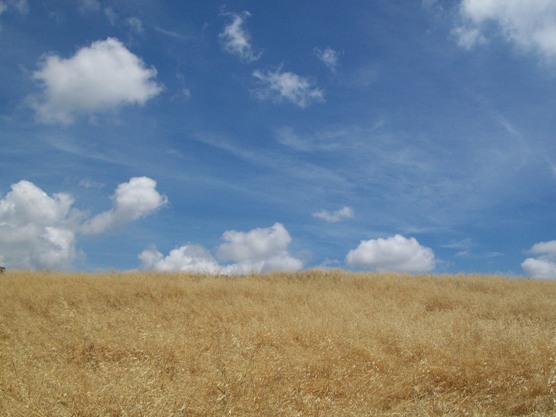 The seasonal grasses have aleady dried out, as illustrated by this picture from the hills to the east of Schabarum Park. However, many seasonal bushes and herbs are still in bloom. I came across several new-to-me flowers in bloom that I will need to identify.
 I think these five-petaled, purple and white flowers were my first new species of the day. They were growing in Powder Canyon, right near the start of the trail.
 Not much further along were a large number of these plants, with tall stalks peppered with yellow flowers.
 Other plants I have seen before, even if I don't know all of their names. One I did recognize was the devil's trumpet, which I had seen on my hike in Arroyo San Miguel. Shortly after passing the plants above, the Powder Canyon trail goes under a canopy of black walnut and oak trees. That's the picture at the top of this post.
Not long after going under the trees, the trail begins to climb. I passed the unsigned junction for the Black Walnut trail (on the right), then another unsigned junction for a short dirt road that goes (also to the right) to the base of an electrical transmission tower on a hill. Next came the unsigned junction for the Purple Sage trail, which required a sharp left turn. After I came around a bend, I could see a water tank, which confirmed I was on the right track (because the trail map showed a water tank near the trail).
 Right after I saw the water tower, I also saw a couple of large purple sage bushes, which further confirmed I was on the right track.
After passing the water tank, the trail continues to the west.
 Fields of yellow mustard grew on either side of the road as I approached a cluster of radio antennas on a hilltop. I consulted the map several times at this spot, to be sure I stayed on the correct side of the hill as I passed the hill both as I went west, on the Purple Sage trail, and again when I came back east along the Schabarum trail.
 Monkey flower grew thick in several spots, but especially as I made it past the towers a second time, along the Schabarum trail.
 I also passed a mixture of purple "flag" flowers and a yellow globe flower of unknown species. The purple flowers have been blooming in the Puente Hills for several months. The yellow flowers (arranged in a globe at the top of a small plant) were new to me.
Other sites I passed along the way:
 Another field of mustard.
 A skinny little garter snake. I've seen several the past few weeks, but they are usually just a striped blur as they cross the trail and disappear into the grass. This guy was all stretched out straight on the trail, and appeared to have some difficulty gaining traction to get out of my path, so I was able to get a few pictures of him. Probably about 18 inches long, but only about 1 inch in diameter when he was stretched out, far skinnier than the rattlers I have seen.
 I've seen these guys before, too. They may be some sort of datura, but I'm not sure.
After today, I have walked nearly all of the official trails in the Puente Hills Landfill Native Habitat Preservation Authority. There are only a few trails from the Hacienda trailhead I need to cover. The next time there's a cool day, I'll probably do them. On warmer days, I think I've waited long enough that I should be able to do most of the trails in the Mt. Baldy area, although actually reaching the summits may still be a few weeks off.


hello i was interested in the first pic you have posted of the covering of trees. please email me where the location is i have a photoshoot coming up and want to use location. lifeasithappensphotography@gmail.com
ReplyDeleteThank you
Can't be entirely sure, since it's been over a year since I was there. However, if my notes on the hike write-up are correct, it should be near the beginning of the hike mentioned above. On my hard drive, after my pictures of the equestrian circle, the pictures of the tree boughs were next in the file.
ReplyDeleteOddly, the tree looks like a black walnut to me, so you'd think they would be on the Black Walnut trail.
Either way, it's my recollection that this was somewhat near the Powder Canyon trailhead and definitely NOT in Schabarum Park.
Might be a good idea to walk out there prior to your shoot to confirm the location of the tree bough. Print out the trail map I linked in the original post so you can stay on the right trails.
Good luck!
that first pic is the initial part of powder canyon trail, past the parking lot/map area.
ReplyDelete