
Hiked Monday, July 25. July 25 was a long day. I woke up in Albuquerque, hiked around Petroglyph National Monument, then drove all the way to Oklahoma City. Didn't get there until around 11pm local time. And it was still not far enough to easily reach my final destination the next night.

From Albuquerque, Petroglyph National Monument is just to the northwest. Off of I-40, several portions of the national monument (including the visitor center) are located off of exit #154 (Unser Blvd). Head north 3 miles to Western Trail, then turn left into the visitor center.
On the way to the visitor center, you pass the Rinconada trailhead, which is about a mile south of the VC. After my quick visit to the VC to get oriented and pick up some materials, I headed back to Rincondada for a short hike.
This trailhead, like seemingly all of the ones in the monument, are open during daylight hours, only. That's to discourage vandalism.

From the parking area, the trail heads into a broad canyon, with lava rocks pretty much covering the hills around the canyon. On those lava rocks were carved many historic petroglyphs, and many more recent scribblings. Not being trained, I can't necessarily tell one from the other. For example, on this picture, the face looks suspiciously like Mr. Bill, to me.
I suspect most are not visible from the trail, but you're not supposed to walk on the lava rocks. From the trail, the visibility of petroglyphs depends on the angle the light strikes the rock. The same rock can appear barren or covered in markings, depending on the angle of the sun. Most rocks appear bare.
One thing I saw a LOT of on my hike was millipedes. They were everywhere. Not sure if the rain the previous night is what brought them out, or if they're always that way.

Other wildlife I saw were mostly lizards. I also saw a road runner, which was probably eating the lizards. He's right in the middle of this picture, though his plumage definitely helps him blend in to the rocks and grass!
Ironically, not five minutes after I saw a roadrunner, I saw a drawing that looked like a roadrunner. I like to think that there's some strange spiritual connection between the person who carved the roadrunner, hundreds of years ago, and the roadrunners that still live in this canyon. Of course, it could be it's a non-ancient scribbling, and the drawing is of this actual roadrunner. :D

This loop has an official distance of 2.2 miles.
After I finished this loop, I headed to the Volcanoes section, which you would access by taking exit 149 north off of I-40 and driving about five miles north on Paseo del Volcan. Although the map shows the road as unpaved, it is actually paved until it reaches a small parking lot. It's on your right, shortly after you pass a sign for a shooting range (pointing to the left). A small parking lot and vault toilets are at the trailhead.
During your drive towards the parking lot, you'll see the three volcanoes that this area is named for, off and to your right. They actually stand out better from a distance, when you are looking up, than they do when you're closer to their level and to the west.

Looking west from your parking lot, the trail begins heading straight towards the southern-most volcano. Meanwhile, once you start on your trail and look to the north, here's what the other two volcanoes look like:

Nonethe-less, even from here, it is clear that the, the northern-most volcano is the tallest. My plan was to take the 2 mile loop that goes around the southern two cones, then climb up the third one. It's distance is about two miles. That means total mileage for the NM monuments was 4.2 miles.

From the west side of any of the three volcanoes (or even from the saddle between them), you have a view overlooking Albuquerque, with the Sandia Mountains in the background. Here, we're looking towards that saddle, with the Sandia Mountains in the background and some hikers on the saddle, heading north.
Meanwhile, as you approach the northern volcano, here's what you'll see:

And from the top of that volcano, here's the view looking back to the south:

Although the picture somewhat flattens depth, it accurate presents that the two southern volcanoes practically disappear once you climb up the third one.
 Hiked Monday, July 25. July 25 was a long day. I woke up in Albuquerque, hiked around Petroglyph National Monument, then drove all the way to Oklahoma City. Didn't get there until around 11pm local time. And it was still not far enough to easily reach my final destination the next night.
 From Albuquerque, Petroglyph National Monument is just to the northwest. Off of I-40, several portions of the national monument (including the visitor center) are located off of exit #154 (Unser Blvd). Head north 3 miles to Western Trail, then turn left into the visitor center.
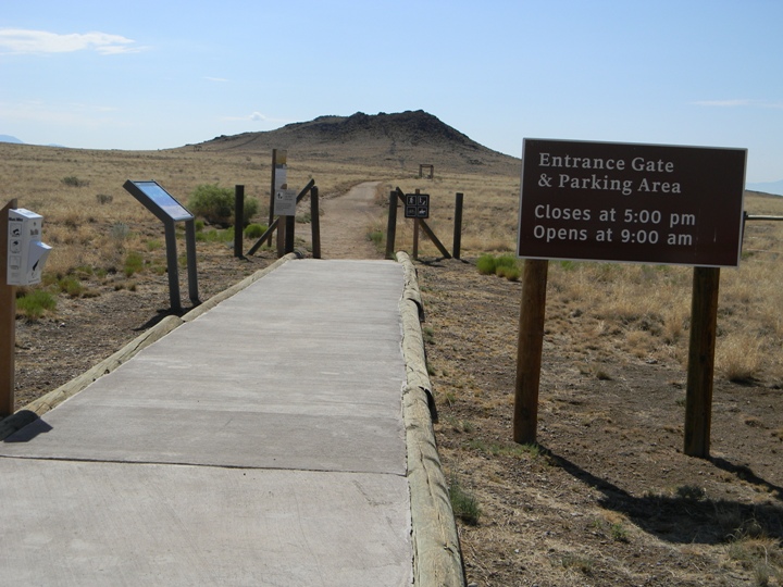
On the way to the visitor center, you pass the Rinconada trailhead, which is about a mile south of the VC. After my quick visit to the VC to get oriented and pick up some materials, I headed back to Rincondada for a short hike.
This trailhead, like seemingly all of the ones in the monument, are open during daylight hours, only. That's to discourage vandalism.
From Albuquerque, Petroglyph National Monument is just to the northwest. Off of I-40, several portions of the national monument (including the visitor center) are located off of exit #154 (Unser Blvd). Head north 3 miles to Western Trail, then turn left into the visitor center.
On the way to the visitor center, you pass the Rinconada trailhead, which is about a mile south of the VC. After my quick visit to the VC to get oriented and pick up some materials, I headed back to Rincondada for a short hike.
This trailhead, like seemingly all of the ones in the monument, are open during daylight hours, only. That's to discourage vandalism.
 From the parking area, the trail heads into a broad canyon, with lava rocks pretty much covering the hills around the canyon. On those lava rocks were carved many historic petroglyphs, and many more recent scribblings. Not being trained, I can't necessarily tell one from the other. For example, on this picture, the face looks suspiciously like Mr. Bill, to me.
I suspect most are not visible from the trail, but you're not supposed to walk on the lava rocks. From the trail, the visibility of petroglyphs depends on the angle the light strikes the rock. The same rock can appear barren or covered in markings, depending on the angle of the sun. Most rocks appear bare.
One thing I saw a LOT of on my hike was millipedes. They were everywhere. Not sure if the rain the previous night is what brought them out, or if they're always that way.
From the parking area, the trail heads into a broad canyon, with lava rocks pretty much covering the hills around the canyon. On those lava rocks were carved many historic petroglyphs, and many more recent scribblings. Not being trained, I can't necessarily tell one from the other. For example, on this picture, the face looks suspiciously like Mr. Bill, to me.
I suspect most are not visible from the trail, but you're not supposed to walk on the lava rocks. From the trail, the visibility of petroglyphs depends on the angle the light strikes the rock. The same rock can appear barren or covered in markings, depending on the angle of the sun. Most rocks appear bare.
One thing I saw a LOT of on my hike was millipedes. They were everywhere. Not sure if the rain the previous night is what brought them out, or if they're always that way.
 Other wildlife I saw were mostly lizards. I also saw a road runner, which was probably eating the lizards. He's right in the middle of this picture, though his plumage definitely helps him blend in to the rocks and grass!
Ironically, not five minutes after I saw a roadrunner, I saw a drawing that looked like a roadrunner. I like to think that there's some strange spiritual connection between the person who carved the roadrunner, hundreds of years ago, and the roadrunners that still live in this canyon. Of course, it could be it's a non-ancient scribbling, and the drawing is of this actual roadrunner. :D
Other wildlife I saw were mostly lizards. I also saw a road runner, which was probably eating the lizards. He's right in the middle of this picture, though his plumage definitely helps him blend in to the rocks and grass!
Ironically, not five minutes after I saw a roadrunner, I saw a drawing that looked like a roadrunner. I like to think that there's some strange spiritual connection between the person who carved the roadrunner, hundreds of years ago, and the roadrunners that still live in this canyon. Of course, it could be it's a non-ancient scribbling, and the drawing is of this actual roadrunner. :D
 This loop has an official distance of 2.2 miles.
After I finished this loop, I headed to the Volcanoes section, which you would access by taking exit 149 north off of I-40 and driving about five miles north on Paseo del Volcan. Although the map shows the road as unpaved, it is actually paved until it reaches a small parking lot. It's on your right, shortly after you pass a sign for a shooting range (pointing to the left). A small parking lot and vault toilets are at the trailhead.
During your drive towards the parking lot, you'll see the three volcanoes that this area is named for, off and to your right. They actually stand out better from a distance, when you are looking up, than they do when you're closer to their level and to the west.
This loop has an official distance of 2.2 miles.
After I finished this loop, I headed to the Volcanoes section, which you would access by taking exit 149 north off of I-40 and driving about five miles north on Paseo del Volcan. Although the map shows the road as unpaved, it is actually paved until it reaches a small parking lot. It's on your right, shortly after you pass a sign for a shooting range (pointing to the left). A small parking lot and vault toilets are at the trailhead.
During your drive towards the parking lot, you'll see the three volcanoes that this area is named for, off and to your right. They actually stand out better from a distance, when you are looking up, than they do when you're closer to their level and to the west.
 Looking west from your parking lot, the trail begins heading straight towards the southern-most volcano. Meanwhile, once you start on your trail and look to the north, here's what the other two volcanoes look like:
 Nonethe-less, even from here, it is clear that the, the northern-most volcano is the tallest. My plan was to take the 2 mile loop that goes around the southern two cones, then climb up the third one. It's distance is about two miles. That means total mileage for the NM monuments was 4.2 miles.
 From the west side of any of the three volcanoes (or even from the saddle between them), you have a view overlooking Albuquerque, with the Sandia Mountains in the background. Here, we're looking towards that saddle, with the Sandia Mountains in the background and some hikers on the saddle, heading north.
Meanwhile, as you approach the northern volcano, here's what you'll see:
From the west side of any of the three volcanoes (or even from the saddle between them), you have a view overlooking Albuquerque, with the Sandia Mountains in the background. Here, we're looking towards that saddle, with the Sandia Mountains in the background and some hikers on the saddle, heading north.
Meanwhile, as you approach the northern volcano, here's what you'll see: And from the top of that volcano, here's the view looking back to the south:
 Although the picture somewhat flattens depth, it accurate presents that the two southern volcanoes practically disappear once you climb up the third one.


Skyhiker, I stopped here when I moved to LA from the east coast a few years ago. I too, couldn't distinguish between modern and ancient petroglyphs. It was kind of obnoxious how many people carved their names or whatever into the rocks, sometimes over the top of other pictures. Mr Bill looked like it might have been done since I visited in 2008!
ReplyDeleteWhen you get on the I-40 eastbound in Barstow, there's a sign that says something like, "Charlotte, NC: 2,190 miles" (I don't remember the actual miles). And I have a recollection of your being from NC originally. That would explain the I-40 trip. That means you also saw the Cadillac Ranch, though you probably weren't old enough to remember the Springsteen song that's always playing in my head when I say the words, "Cadillac Ranch." :D
ReplyDelete